MyTopo
Satterwhite North Carolina US Topo Map
Couldn't load pickup availability
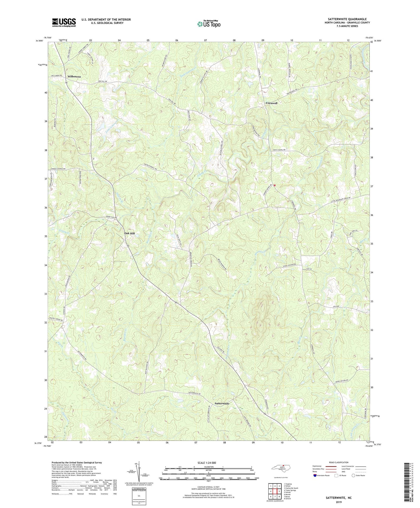
2022 topographic map quadrangle Satterwhite in the state of North Carolina. Scale: 1:24000. Based on the newly updated USGS 7.5' US Topo map series, this map is in the following counties: Granville. The map contains contour data, water features, and other items you are used to seeing on USGS maps, but also has updated roads and other features. This is the next generation of topographic maps. Printed on high-quality waterproof paper with UV fade-resistant inks.
Quads adjacent to this one:
West: Triple Springs
Northwest: Virgilina
North: Nelson
Northeast: Clarksville South
East: Stovall
Southeast: Oxford
South: Berea
Southwest: Moriah
This map covers the same area as the classic USGS quad with code o36078d6.
Contains the following named places: Bearskin Creek, Cornwall, Cornwall Volunteer Fire Department, Granville County Emergency Medical Services Station 7, Grassy Creek Church, Greenwood School, Gregory Lake, Gregory Lake Dam, Joe Tolers School, Mount Moriah Church, Mountain Creek, Mountain Creek Church, Mountain Creek School, New Cornith Church, North Granville School, Oak Hill, Oak Hill School, Saint Matthews Church, Saint Stephens Church, Satterwhite, Smyrna Branch, Smyrna Branch School, Toler-Oak Hill School, Township of Oak Hill, Whetstone Church, Wilbourns