MyTopo
Kittrell North Carolina US Topo Map
Couldn't load pickup availability
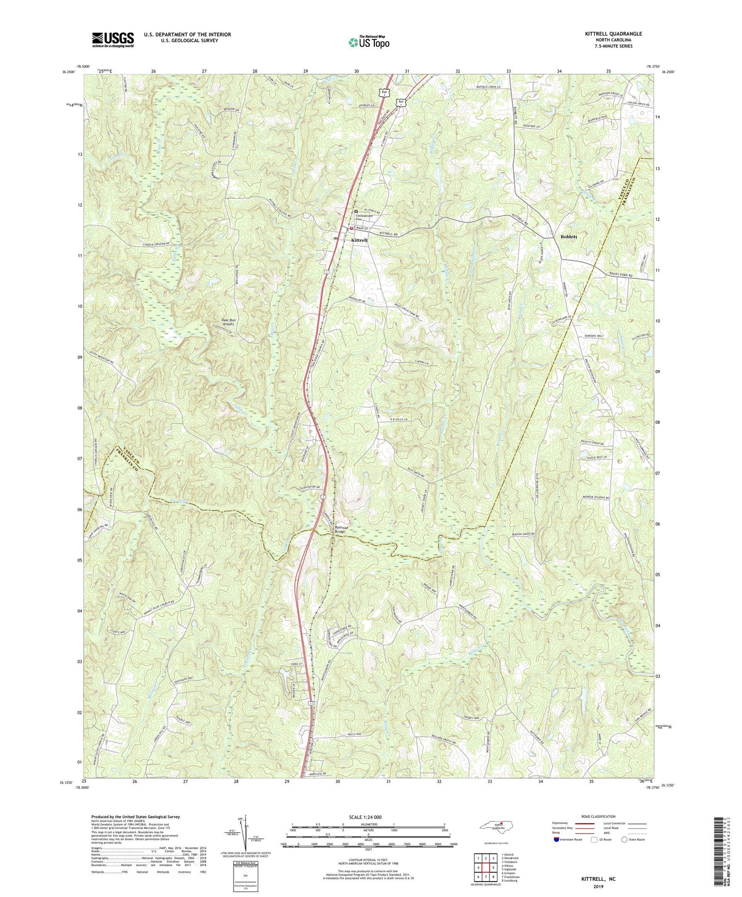
2022 topographic map quadrangle Kittrell in the state of North Carolina. Scale: 1:24000. Based on the newly updated USGS 7.5' US Topo map series, this map is in the following counties: Vance, Franklin, Granville. The map contains contour data, water features, and other items you are used to seeing on USGS maps, but also has updated roads and other features. This is the next generation of topographic maps. Printed on high-quality waterproof paper with UV fade-resistant inks.
Quads adjacent to this one:
West: Wilton
Northwest: Oxford
North: Henderson
Northeast: Vicksboro
East: Ingleside
Southeast: Louisburg
South: Franklinton
Southwest: Grissom
This map covers the same area as the classic USGS quad with code o36078b4.
Contains the following named places: Billys Creek, Bobbitt, Buffalo Creek, Concord Church, Confederate Cemetery, Crudup House, Deer Run Airport, Epping Forrest, Ford Creek, Guptons Lake, Guptons Lake Dam, Kings Creek, Kittrell, Kittrell Junior College, Kittrell Post Office, Kittrell Volunteer Fire Department, Little Buffalo Creek, Long Creek, Lynnbrook Estates, McGee Creek, Meadowlark Airport, Middle Creek, Mill Creek, Mount Olive Church, Oak Ridge Church, Plank Chapel, Railroad Bridge, Ruin Creek, Saint James Episcopal Church, Saint Marys Church, Shiloh Church, Tabbs Creek, Taylors Creek, Town of Kittrell, Township of Kittrell, Union Chapel, Vance High School, ZIP Codes: 27525, 27544