MyTopo
Waynesville North Carolina US Topo Map
Couldn't load pickup availability
Also explore the Waynesville Forest Service Topo of this same quad for updated USFS data
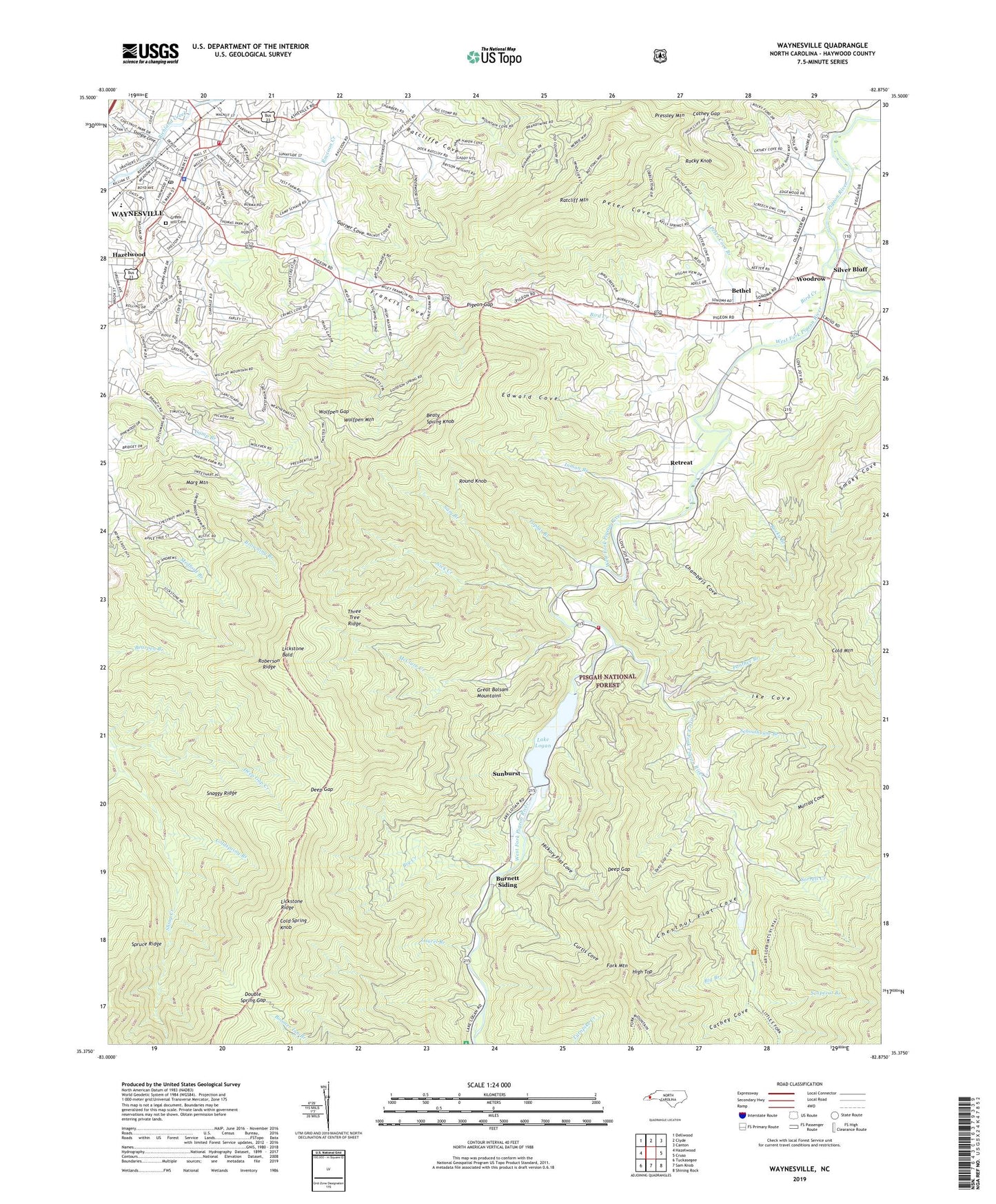
2022 topographic map quadrangle Waynesville in the state of North Carolina. Scale: 1:24000. Based on the newly updated USGS 7.5' US Topo map series, this map is in the following counties: Haywood. The map contains contour data, water features, and other items you are used to seeing on USGS maps, but also has updated roads and other features. This is the next generation of topographic maps. Printed on high-quality waterproof paper with UV fade-resistant inks.
Quads adjacent to this one:
West: Hazelwood
Northwest: Dellwood
North: Clyde
Northeast: Canton
East: Cruso
Southeast: Shining Rock
South: Sam Knob
Southwest: Tuckasegee
This map covers the same area as the classic USGS quad with code o35082d8.
Contains the following named places: Beaty Spring Knob, Bethel, Bethel Elementary School, Bethel High School, Big Branch, Big Creek, Big Ridge Mine, Bird Creek, Burnett Siding, Burnetts Siding Baptist Church, Camp Daniel Boone Dam, Camp Daniel Boone Lake, Cathey Cove, Cathey Gap, Cecil, Cecil School, Central Elementary School, Chambers Cove, Cherry Cove Creek, Chestnut Flat Cove, Cold Spring Knob, Coldspring Branch, Curtis Cove, Daniel Boone Camp, Deep Creek, Deep Gap, Deep Gap Cove, Deep Gap Creek, Double Spring Gap, East Fork Pigeon River, Edward Cove, Elizabeth Chapel, Francis Cove, Francis Cove Church, Garner Cove, Green Hill Cemetery, Haywood County Farm, Haywood County Rescue Squad, Hazelwood Elementary School, Hickory Flat Cove, High Top, Ike Cove, Inman Branch, Inman Church, Lake Logan, Lake Logan Cecil Volunteer Fire Department, Lake Logan Dam, Laurel Branch, Laurel Grove Church, Lavinia, Lickstone Bald, Little East Fork Pigeon River, Marg Mountain, McClure Creek, Medford Branch, Murray Cove, Nick Creek, Panther Branch, Peter Cove, Peter Cove Branch, Pigeon Gap, Poplar Branch, Queen Creek, Ratcliff Cove Baptist Church, Ratcliff Mountain, Ratcliffe Cove, Retreat, Riverside Baptist Church, Roberson Ridge, Rocky Branch, Rocky Knob, Round Knob, Sam Branch, Scapecat Branch, Schoolhouse Branch, Shingle Cove, Shiny Creek, Silver Bluff, Snaggy Ridge, Sonoma, Sorrell Creek, Sunburst, Three Tree Ridge, Town of Waynesville, Township of Pigeon, Waynesville, Waynesville Fire Department Station 1, Waynesville Golf and Country Club, Waynesville Junior High School, Waynesville Plaza, Waynesville Police Department, Waynesville Post Office, Waynesville Reservoir, West Fork Pigeon River, Wolfpen Gap, Wolfpen Mountain, Woodrow, ZIP Code: 28786