MyTopo
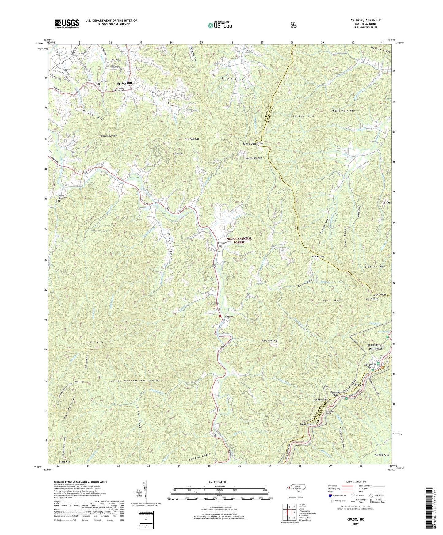
Cruso North Carolina US Topo Map
Couldn't load pickup availability
Also explore the Cruso Forest Service Topo of this same quad for updated USFS data
2022 topographic map quadrangle Cruso in the state of North Carolina. Scale: 1:24000. Based on the newly updated USGS 7.5' US Topo map series, this map is in the following counties: Haywood, Buncombe, Transylvania. The map contains contour data, water features, and other items you are used to seeing on USGS maps, but also has updated roads and other features. This is the next generation of topographic maps. Printed on high-quality waterproof paper with UV fade-resistant inks.
Quads adjacent to this one:
West: Waynesville
Northwest: Clyde
North: Canton
Northeast: Enka
East: Dunsmore Mountain
Southeast: Pisgah Forest
South: Shining Rock
Southwest: Sam Knob
This map covers the same area as the classic USGS quad with code o35082d7.
Contains the following named places: Anderson Creek, Bee Branch, Beech Knob, Bens Cove, Bens Ridge, Big Bald, Brooks Cove, Brooks Gap, Buck Spring, Buck Spring Trail, Burnett Cove, Burnett Creek, Burnett Grove Church, Camp Hope, Chinquapin Branch, Cold Creek, Cold Mountain, Crawford Creek, Cruso, Cruso Volunteer Fire Department, Deep Gap, Dix Creek, Dutch Cove, East Fork Baptist Church, East Fork Gap, Flat Laurel Gap, Fork Mountain, Frying Pan Tunnel, Fryingpan Gap, Fryingpan Mountain, Fryingpan Mountain Lookout, Gwyn Cemetery, Harley Branch, Henderson Branch, Henson Cove, Hungry Creek, Johns Cove, Lenoir Creek, Long Branch, Longs Cemetery, Longs Chapel, Meadow Grove Church, Mount Pisgah, Mount Pisgah Recreation Site, Mount Zion Cemetery, Mount Zion Missionary Baptist Church, Piney Field Top, Pisgah Creek, Pisgah Game Lands, Poison Cove, Poison Cove Branch, Poison Cove Top, Reed Cove, Reed Creek, Ripshin Mountain, Rocky Face Mountain, Sams Branch, Saw Branch, Shining Rock, Shining Rock Wilderness, Smoky Cove, Spring Hill, Spring Hill Baptist Church, Spring Hill Cemetery, Spring Hill School, Spring Mountain, Springdale, Springdale School, Stairs Mountain, Sugar Top, The Narrows, Thompson Ridge, Township of East Fork, Twelve O'Clock Top, Ugly Creek, White Rock Branch, White Rock Mountain, WLOS-FM (Asheville), WLOS-TV (Asheville), WUNF-TV (Asheville), ZIP Code: 28716