MyTopo
Cosmos Ohio US Topo Map
Couldn't load pickup availability
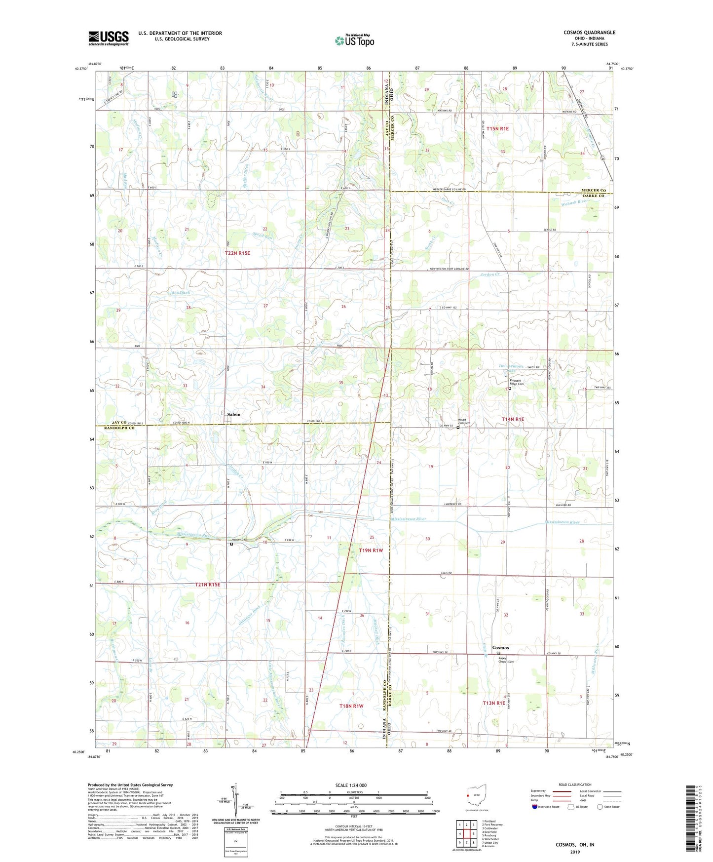
2023 topographic map quadrangle Cosmos in the states of Indiana, Ohio. Scale: 1:24000. Based on the newly updated USGS 7.5' US Topo map series, this map is in the following counties: Darke, Jay, Randolph, Mercer. The map contains contour data, water features, and other items you are used to seeing on USGS maps, but also has updated roads and other features. This is the next generation of topographic maps. Printed on high-quality waterproof paper with UV fade-resistant inks.
Quads adjacent to this one:
West: Deerfield
Northwest: Portland
North: Fort Recovery
Northeast: Coldwater
East: Rossburg
Southeast: Ansonia
South: Union City
Southwest: Winchester
This map covers the same area as the classic USGS quad with code o40084c7.
Contains the following named places: Bethel Church, Bray Ditch, Bucks Corner, Bunker Hill School, College Hill School, Cosmos, Cosmos Post Office, Cosmos School, Gettinger Ditch, Gray Branch, Henry Ditch, Hess Farm, Hoover Cemetery, Horney School, Jordon Creek, Kirgan Farms, Little Mississinewa River, Lows Branch, Mad Run, McLaughlin Ditch, Miracle Church, Mitchell Ditch, Mount Zion Cemetery, Mount Zion School, North Dayton, Oak Grove School, Peden Ditch, Pleasant Hill Church, Pleasant Hill Speedway, Pleasant Ridge Cemetery, Pleasant Ridge Church, Pleasant Valley Church, Raper Chapel, Raper Chapel Cemetery, Rhoades Ditch, Salem, Sheffer Ditch, Speed Run, Sugar Grove Church of Christ, Timmerman Farm, Tobin School, Township of Jackson, Township of Madison, Township of Mississinawa, Twin Willows Lake, Vogel Hog Farm