MyTopo
Canfield Ohio US Topo Map
Couldn't load pickup availability
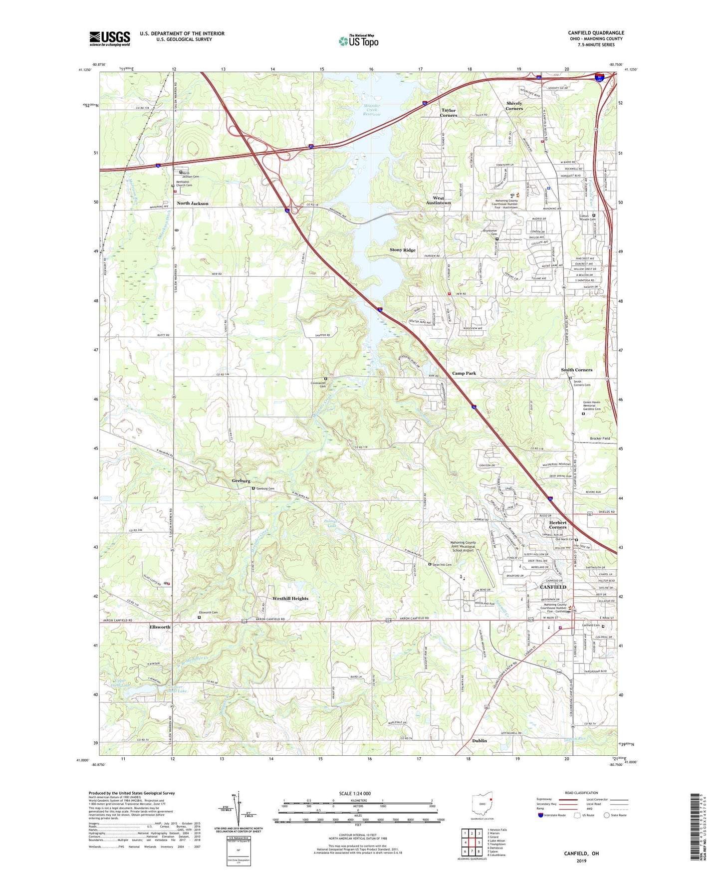
2023 topographic map quadrangle Canfield in the state of Ohio. Scale: 1:24000. Based on the newly updated USGS 7.5' US Topo map series, this map is in the following counties: Mahoning. The map contains contour data, water features, and other items you are used to seeing on USGS maps, but also has updated roads and other features. This is the next generation of topographic maps. Printed on high-quality waterproof paper with UV fade-resistant inks.
Quads adjacent to this one:
West: Lake Milton
Northwest: Newton Falls
North: Warren
Northeast: Girard
East: Youngstown
Southeast: Columbiana
South: Salem
Southwest: Damascus
This map covers the same area as the classic USGS quad with code o41080a7.
Contains the following named places: Austintown, Austintown Branch Library, Austintown Community Church, Austintown Fire Department Station 1, Austintown Fire Department Station 4, Austintown Middle School, Austintown Plaza Shopping Center, Austintown Post Office, Austintown Township Police Department, Briel Airport, Brocker Field, Brunsteter Cemetery, Camp Kiwatani, Camp Park, Campbell School, Canfield, Canfield Cemetery, Canfield Christian Church, Canfield High School, Canfield Memorial Building, Canfield Middle School, Canfield Police Department, Canfield Post Office, Canfield Presbyterian Church, Canfield United Methodist Church, Cardinal Joint Fire District Station 1, Chucks Greenhouses, City of Canfield, Cotton Private Cemetery, Covenanter Cemetery, Dean Hill Cemetery, Diehl Lake, Diehl Lake Dam, Dublin, Dublin School, Ellsworth, Ellsworth Cemetery, Ellsworth Elementary School, Ellsworth Fire Department Station 400, Ellsworth Post Office, First Freewill Baptist Church, First United Methodist Church of West Austintown, Geeburg, Geeburg Cemetery, Geeburg School, Girl Scout Camp, Green Haven Memorial Gardens Cemetery, Herbert Corners, Independent Church, Jackson Township Fire Department, Jackson-Milton Elementary School, Jackson-Milton High School, Lane Life Transport Paramedics, Leffingwell Country Club, Lipkey Corners, Lloyd Elementary School, Lord of Life Lutheran Church, Lower Diehl Lake, Mahoning County, Mahoning County Experimental Farm, Mahoning County Fairgrounds, Mahoning County Joint Vocational School Airport, Meander Creek Reservoir, Methodist Church Cemetery, Misner Corners, Mollica Airport, North Jackson, North Jackson Cemetery, North Jackson Ditch, North Jackson Post Office, North Jackson Station, Ohio State Highway Patrol - Canfield Patrol Post, Ohlton, Old North Baptist Church, Old North Cemetery, Palmyra Lake, Pellin Ambulance Service Station 1, Pellin Ambulance Service Station 2, Russell School, Saint Michael Catholic Church, Saint Pauls Monastery, Sawmill Creek, Shepard's Mobile Home Park, Shively Corners, Smith Corners, Smith Corners Cemetery, Smith Corners United Methodist Church, Stony Ridge, Taylor Corners, Township of Austintown, Township of Canfield, Township of Ellsworth, Township of Jackson, Turner Street School, Upper Diehl Lake, Village Square Shopping Center, West Austintown, West Austintown Post Office, West Branch Meander Creek, Westhill Heights, Wetzl Airport, Youngs School, Youngstown Executive Airport, ZIP Codes: 44406, 44451, 44515