MyTopo
Newton Falls Ohio US Topo Map
Couldn't load pickup availability
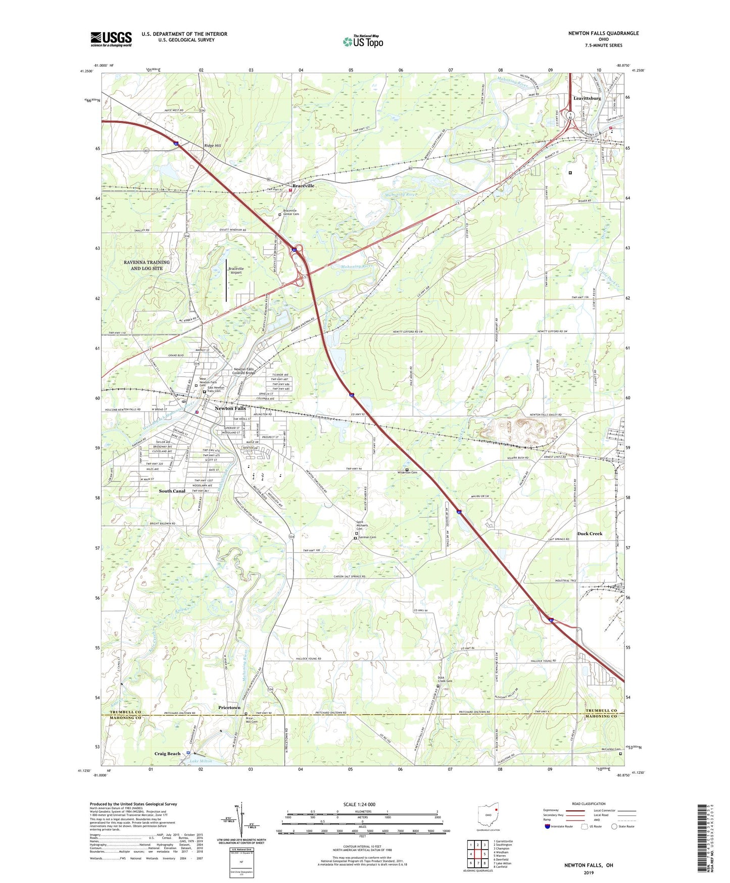
2023 topographic map quadrangle Newton Falls in the state of Ohio. Scale: 1:24000. Based on the newly updated USGS 7.5' US Topo map series, this map is in the following counties: Trumbull, Mahoning, Portage. The map contains contour data, water features, and other items you are used to seeing on USGS maps, but also has updated roads and other features. This is the next generation of topographic maps. Printed on high-quality waterproof paper with UV fade-resistant inks.
Quads adjacent to this one:
West: Windham
Northwest: Garrettsville
North: Southington
Northeast: Champion
East: Warren
Southeast: Canfield
South: Lake Milton
Southwest: Deerfield
This map covers the same area as the classic USGS quad with code o41080b8.
Contains the following named places: Arhaven Estates, Arlington Heights, Arlington Public School, Baileys Corners, Baldwin Corners, Blue Water Manor, Braceville, Braceville Airport, Braceville Center Cemetery, Braceville Post Office, Braceville Ridge, Braceville Township Fire Department, Center World, Craig Beach Police Department, Duck Creek, Duck Creek Cemetery, Duck Creek Post Office, East Newton Falls Cemetery, First Christian Church, First Congregational Church, First Methodist Episcopal Church, German Cemetery, Immanuel Missionary Church, Imperial Mobile Home Park, Kale Creek, Labrae High School, Labrae Middle School, Lawson Run, Leavittsburg, Leavittsburg Census Designated Place, Little Duck Creek, Maderite Heights, McCorkle Cemetery, Middle Elementary School, Milton Dam, Newton Falls, Newton Falls City Hall, Newton Falls Covered Bridge, Newton Falls Dam, Newton Falls High School, Newton Falls Joint Fire District Station 43, Newton Falls Junior High School, Newton Falls Police Department, Newton Falls Post Office, Newton Falls Reservoir, Newton Heights, Phalanx Station, Price Mill Cemetery, Pricetown, Pricetown United Methodist Church, Ridge Branch Campground, Ridge Hill, Riverview, Riverview Golf Course, Rose Park, Saint Josephs Catholic Church, Saint Marys Roman Catholic Church, Saint Michaels Cemetery, Saint Michaels Greek Catholic Church, South Canal, South Canal Census Designated Place, Tiger, Tiger Post Office, Township of Braceville, Township of Newton, Township of Warren, Trumbull Correctional Institution, Vaughn Elementary School, Village of Newton Falls, Warren Township Fire Department Station 47, West Branch Mahoning River, West Branch Park, West Newton Falls Cemetery, West River Park, West View, Wilderson Cemetery, ZIP Codes: 44430, 44444, 44481