MyTopo
Lake Milton Ohio US Topo Map
Couldn't load pickup availability
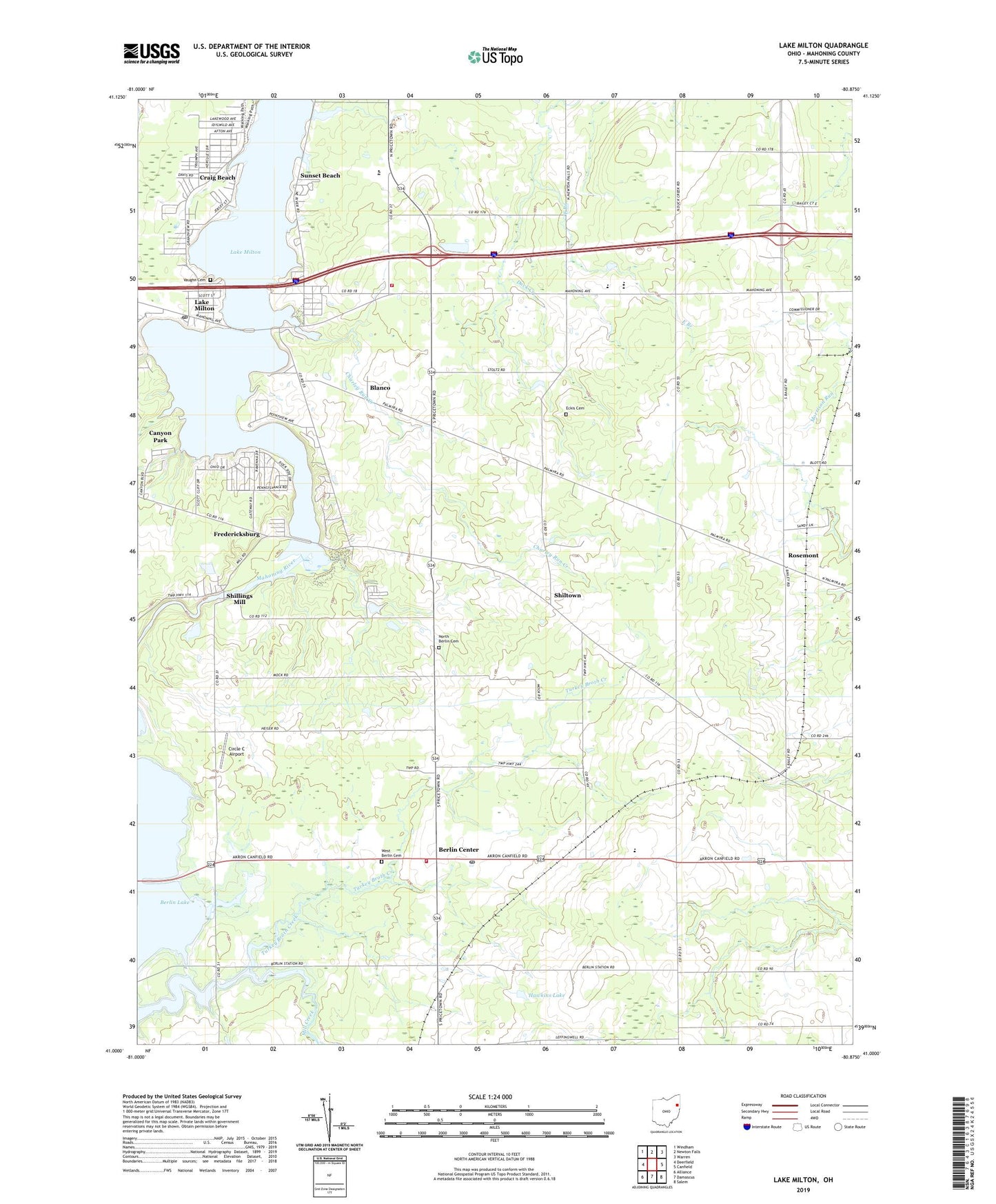
2023 topographic map quadrangle Lake Milton in the state of Ohio. Scale: 1:24000. Based on the newly updated USGS 7.5' US Topo map series, this map is in the following counties: Mahoning, Portage. The map contains contour data, water features, and other items you are used to seeing on USGS maps, but also has updated roads and other features. This is the next generation of topographic maps. Printed on high-quality waterproof paper with UV fade-resistant inks.
Quads adjacent to this one:
West: Deerfield
Northwest: Windham
North: Newton Falls
Northeast: Warren
East: Canfield
Southeast: Salem
South: Damascus
Southwest: Alliance
This map covers the same area as the classic USGS quad with code o41080a8.
Contains the following named places: Berlin Center, Berlin Center Post Office, Berlin Center Station, Berlin Township Fire Department, Blanco, Blanco Post Office, Canyon Park, Charley Run Creek, Circle C Airport, Craig Beach, Craig Beach Post Office, East Branch, Eckis Cemetery, Ellsworth Station, Fredericksburg, Hawkins Lake, Heiser Corners, Helsel Corners, Lake Milton, Lake Milton Census Designated Place, Lake Milton Elementary School, Lake Milton Mobile Home Park, Lake Milton Post Office, Lake Milton Rescue Squad, Lake Milton Temple, Mill Creek Recreation Area, Milton Township Volunteer Fire Department, Mount Moriah Lutheran Church, North Berlin Cemetery, Rosemont, Rosemont Post Office, Saint Catherines Church, Sandy Knoll Horse Farm, Schrader Corners, Shillings Mill, Shiltown, Smith Corners, Sunset Beach, Township of Berlin, Township of Milton, Turkey Broth Creek, Vaughn Cemetery, Village of Craig Beach, West Berlin Cemetery, Western Reserve High School, Western Reserve Middle School, Wolf Corners, ZIP Codes: 44401, 44429