MyTopo
Watertown Ohio US Topo Map
Couldn't load pickup availability
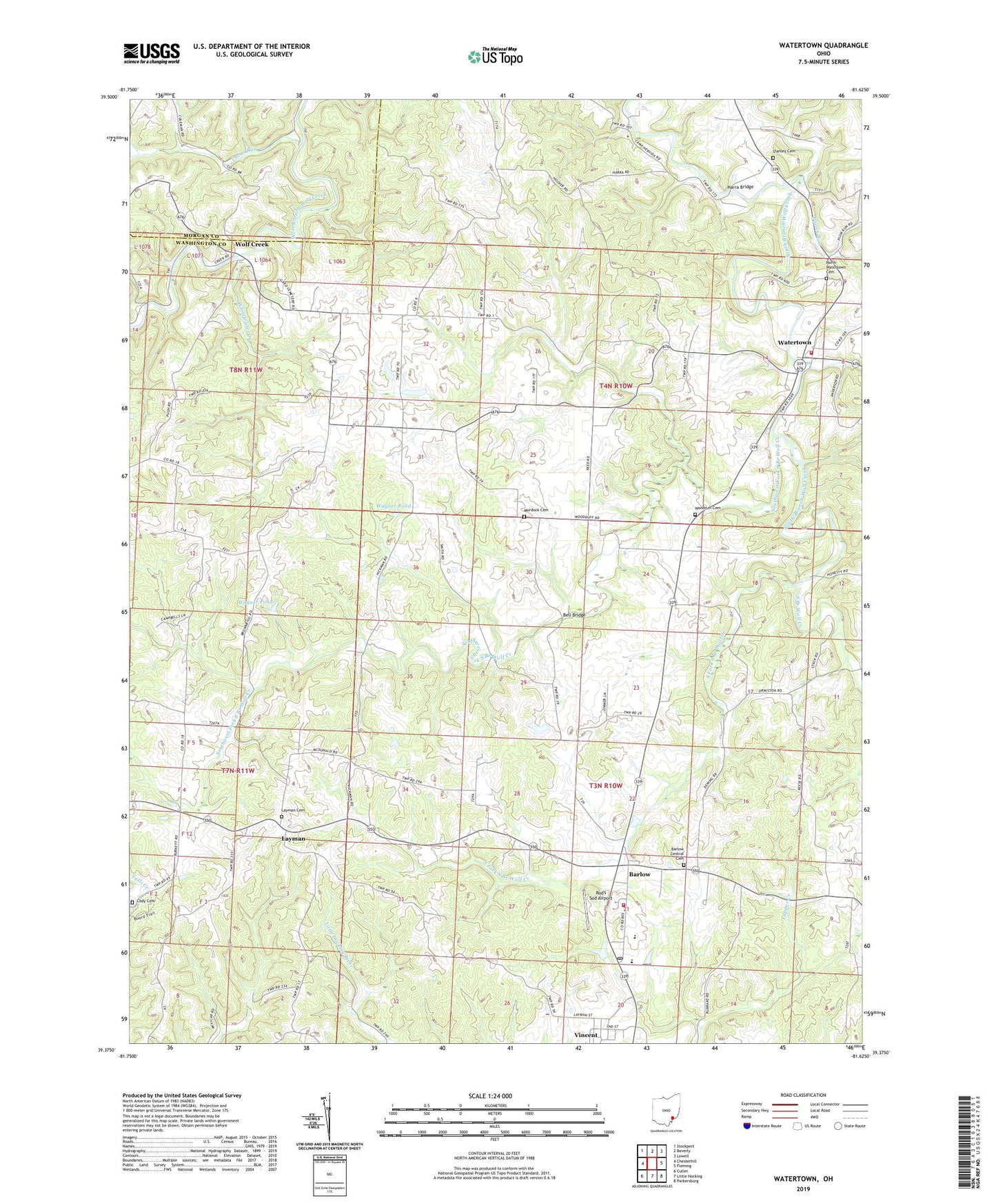
2023 topographic map quadrangle Watertown in the state of Ohio. Scale: 1:24000. Based on the newly updated USGS 7.5' US Topo map series, this map is in the following counties: Washington, Morgan. The map contains contour data, water features, and other items you are used to seeing on USGS maps, but also has updated roads and other features. This is the next generation of topographic maps. Printed on high-quality waterproof paper with UV fade-resistant inks.
Quads adjacent to this one:
West: Chesterhill
Northwest: Stockport
North: Beverly
Northeast: Lowell
East: Fleming
Southeast: Parkersburg
South: Little Hocking
Southwest: Cutler
This map covers the same area as the classic USGS quad with code o39081d6.
Contains the following named places: Barlow, Barlow Central Cemetery, Barlow Methodist Church, Barlow Volunteer Fire Department, Barlow-Vincent Elementary School, Bell Bridge, Browns Mill, Camp Hervida, Harra Bridge, Layman, Layman Cemetery, Lucas Run, Murdock Cemetery, North Watertown Cemetery, Painter Run, Palmer United Methodist Church, Plumb Run, Rod's Sod Airport, Saint Ambrose Church, South Fork South Branch Wolf Creek, Southwest Fork South Branch Wolf Creek, Stanley Cemetery, Sterling Acres, Township of Barlow, Township of Fairfield, Township of Palmer, Vincent, Vincent Post Office, Vincent United Methodist Church, Wagner Pond, Wagner Pond Dam, Warren Elementary School, Warren High School, Watertown, Watertown Elementary School, Watertown Historic District, Watertown Volunteer Fire Department, Whitewater Creek, Wolf Creek, Woodruff Cemetery, ZIP Codes: 45784, 45787