MyTopo
Fleming Ohio US Topo Map
Couldn't load pickup availability
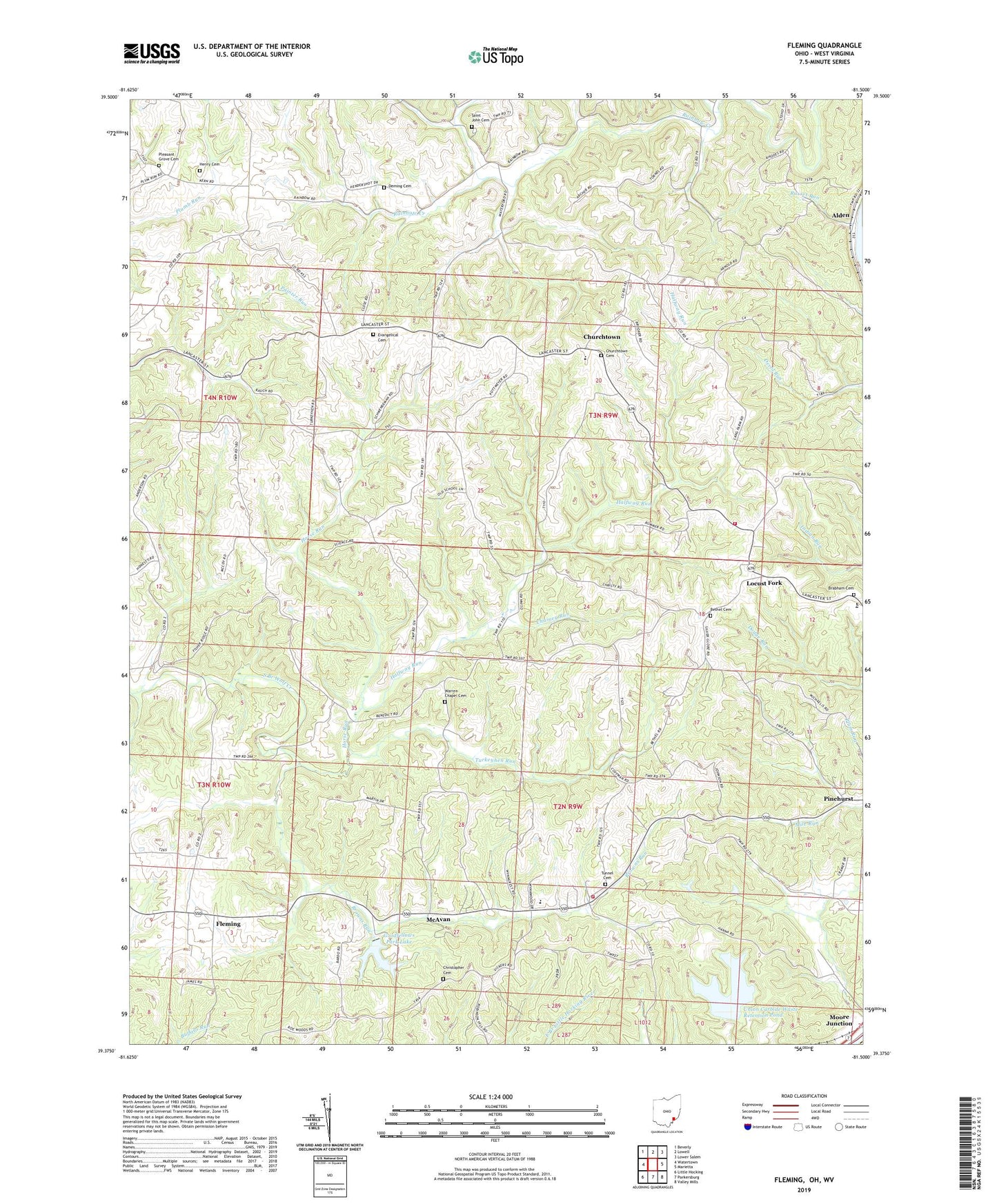
2023 topographic map quadrangle Fleming in the state of Ohio. Scale: 1:24000. Based on the newly updated USGS 7.5' US Topo map series, this map is in the following counties: Washington, Wood. The map contains contour data, water features, and other items you are used to seeing on USGS maps, but also has updated roads and other features. This is the next generation of topographic maps. Printed on high-quality waterproof paper with UV fade-resistant inks.
Quads adjacent to this one:
West: Watertown
Northwest: Beverly
North: Lowell
Northeast: Lower Salem
East: Marietta
Southeast: Valley Mills
South: Parkersburg
Southwest: Little Hocking
Contains the following named places: Alden, Bethel Cemetery, Bethel Church, Brabham Cemetery, Browns Run, Chainey Run, Christopher Cemetery, Churchtown, Churchtown Cemetery, Coffmans Farms, Deming Cemetery, Evangelical Cemetery, Evangelical Church, Fleming, Goodfellows Park, Goodfellows Park Lake, Goodfellows Park Lake Dam, Halfway Run, Henry Cemetery, Horse Run, Kern Greenhouse, Langs Buckeye Dairy Farm, Locust Fork, McAvan, Pleasant Grove Cemetery, Pleasant Grove Church, Russet Run, Saint John Cemetery, Township of Warren, Township of Watertown, Tunnel, Tunnel Cemetery, Tunnel United Methodist Church, Turkeyhen Run, Union Carbide Waste Retention Dam, Union Carbide Waste Retention Pond, Warren Chapel Cemetery, Warren Chapel Methodist Church, Warren Elementary School, Warren Township Volunteer Fire Department Station 1, Warren Township Volunteer Fire Department Station 2, ZIP Code: 45729