MyTopo
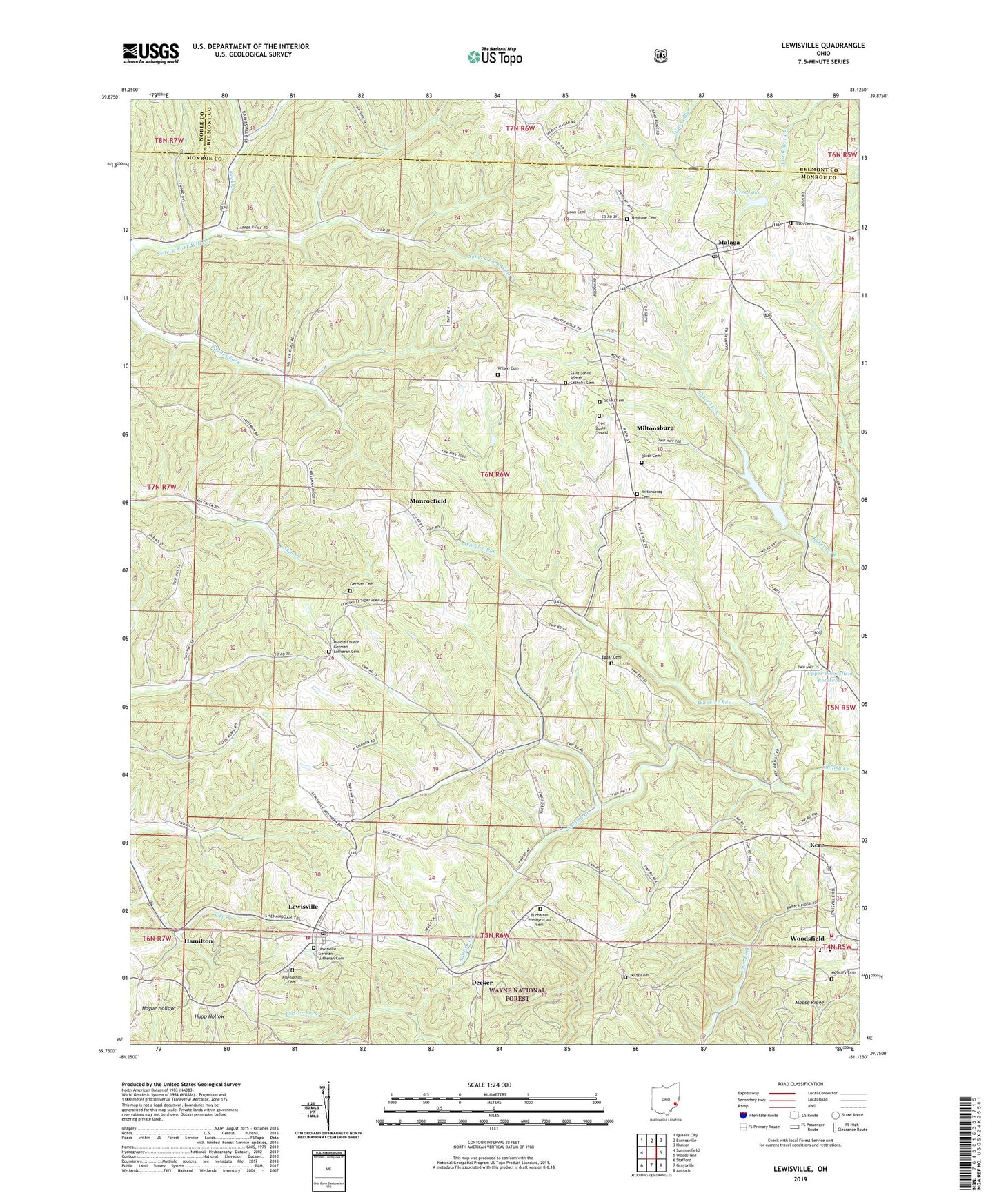
Lewisville Ohio US Topo Map
Couldn't load pickup availability
Also explore the Lewisville Forest Service Topo of this same quad for updated USFS data
2023 topographic map quadrangle Lewisville in the state of Ohio. Scale: 1:24000. Based on the newly updated USGS 7.5' US Topo map series, this map is in the following counties: Monroe, Belmont, Noble. The map contains contour data, water features, and other items you are used to seeing on USGS maps, but also has updated roads and other features. This is the next generation of topographic maps. Printed on high-quality waterproof paper with UV fade-resistant inks.
Quads adjacent to this one:
West: Summerfield
Northwest: Quaker City
North: Barnesville
Northeast: Hunter
East: Woodsfield
Southeast: Antioch
South: Graysville
Southwest: Stafford
This map covers the same area as the classic USGS quad with code o39081g2.
Contains the following named places: Block Cemetery, Buchanon Presbyterian Cemetery, Bush Cemetery, Bush Church, Decker, Eggar Cemetery, Free Burial Ground, Friendship Cemetery, German Cemetery, Hamilton, Jacobsburg, Kerr, Landefeld Dairy Farm, Lewisville, Lewisville Community Volunteer Fire Department, Lewisville Elementary School, Lewisville German Lutheran Cemetery, Lewisville Post Office, Malaga, Malaga Post Office, McGrary Cemetery, Middle Church German Lutheran Cemetery, Miltonsburg, Miltonsburg Cemetery, Monroe Lake, Monroe Lake Dam, Monroe Lake State Wildlife Area, Monroefield, Monroefield Post Office, Moose Ridge, Neptune Cemetery, Potts Cemetery, Rock Creek, Saint Johns Church, Saint Johns Roman Catholic Cemetery, Schell Cemetery, Sloan Cemetery, Stires Lake, Stires Lake Dam, Township of Malaga, Township of Summit, Village of Lewisville, Village of Miltonsburg, Wheeler Run, Wilson Cemetery, Woodsfield Heliport, Woodsfield Volunteer Fire Department, ZIP Code: 43754