MyTopo
Bally Mountain Oklahoma US Topo Map
Couldn't load pickup availability
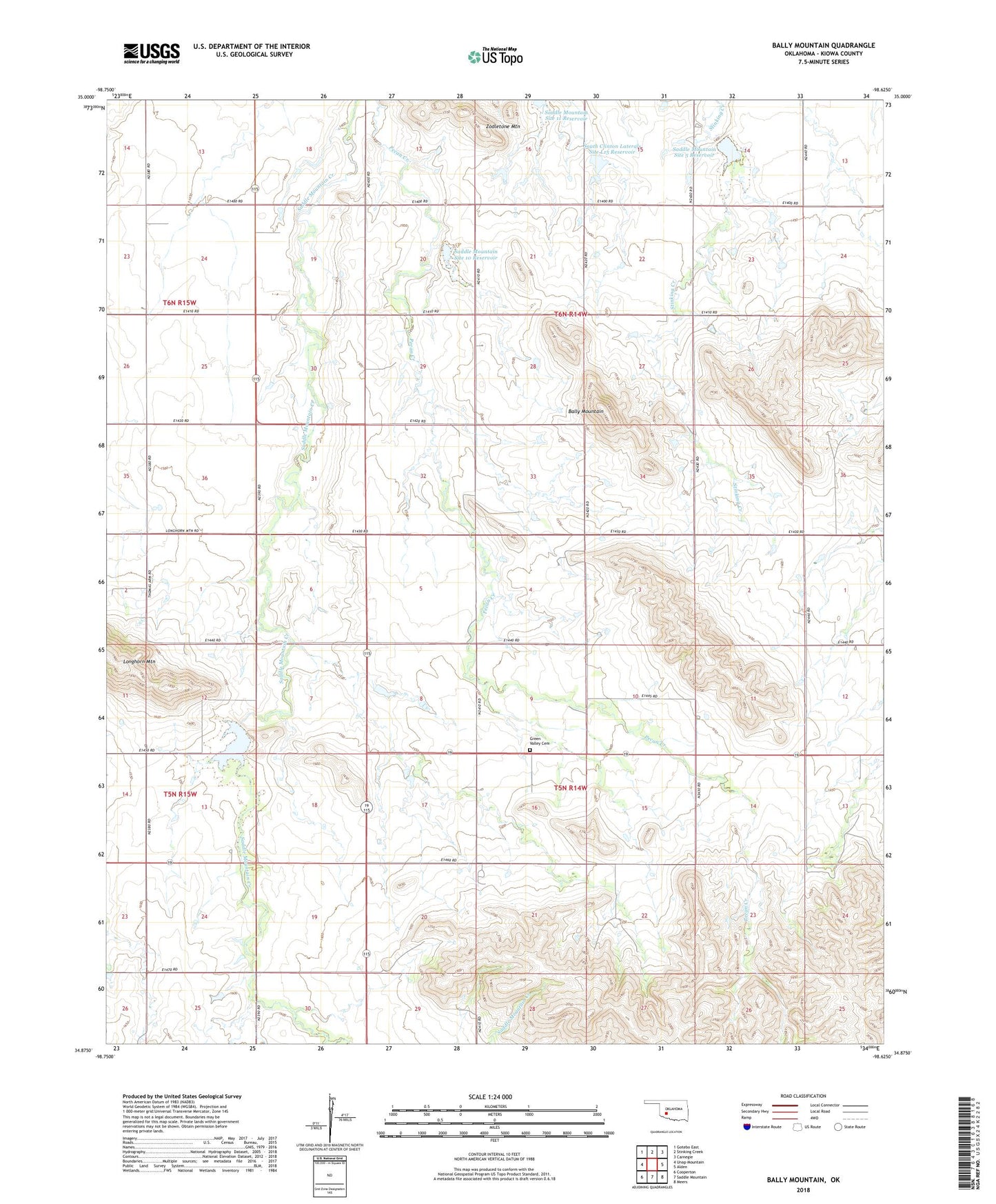
2022 topographic map quadrangle Bally Mountain in the state of Oklahoma. Scale: 1:24000. Based on the newly updated USGS 7.5' US Topo map series, this map is in the following counties: Kiowa. The map contains contour data, water features, and other items you are used to seeing on USGS maps, but also has updated roads and other features. This is the next generation of topographic maps. Printed on high-quality waterproof paper with UV fade-resistant inks.
Quads adjacent to this one:
West: Unap Mountain
Northwest: Gotebo East
North: Stinking Creek
Northeast: Carnegie
East: Alden
Southeast: Meers
South: Saddle Mountain
Southwest: Cooperton
This map covers the same area as the classic USGS quad with code o34098h6.
Contains the following named places: Bally Mountain, Ferrell Ranch Airport, Green Valley Cemetery, Longhorn Mountain, Saddle Mountain Site 10 Dam, Saddle Mountain Site 10 Reservoir, Saddle Mountain Site 11 Dam, Saddle Mountain Site 11 Reservoir, Saddle Mountain Site 4 Dam, Saddle Mountain Site 4 Reservoir, Saddle Mountain Site 5 Dam, Saddle Mountain Site 5 Reservoir, Saddle Mountain Site 6 Dam, Saddle Mountain Site 6 Reservoir, South Clinton Laterals Site L15 Reservoir, Township of Marshall, Zodletone Mountain