MyTopo
Boswell SW Oklahoma US Topo Map
Couldn't load pickup availability
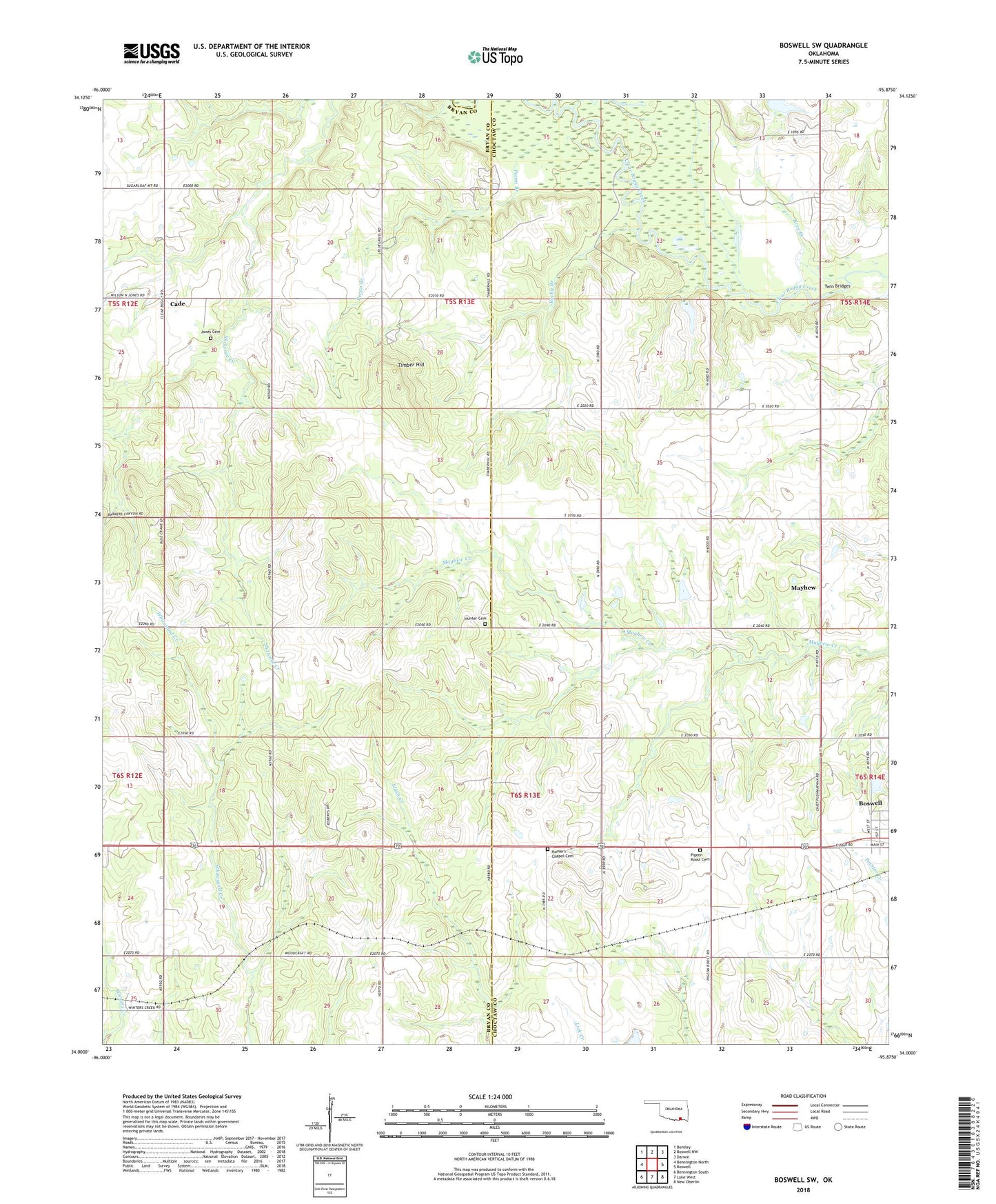
2018 topographic map quadrangle Boswell SW in the state of Oklahoma. Scale: 1:24000. Based on the newly updated USGS 7.5' US Topo map series, this map is in the following counties: Choctaw, Bryan. The map contains contour data, water features, and other items you are used to seeing on USGS maps, but also has updated roads and other features. This is the next generation of topographic maps. Printed on high-quality waterproof paper with UV fade-resistant inks.
Quads adjacent to this one:
West: Bennington North
Northwest: Bentley
North: Boswell NW
Northeast: Darwin
East: Boswell
Southeast: New Oberlin
South: Lake West
Southwest: Bennington South
Contains the following named places: Boswell State Park, Cade, Cold Springs Creek, County Line Church, East Bryan Division, Homers Chapel, Homer's Chapel Cemetery, Hunter Cemetery, Jones Cemetery, Lake Newkirk Dam, Mayhew, Pecan Branch, Pigeon Roost Cemetery, Pigeon Roost Church, Rocky Branch, Ross Branch, Timber Hill, Timber Hill Church, Twin Bridges, Whitesand Church