MyTopo
Boswell Oklahoma US Topo Map
Couldn't load pickup availability
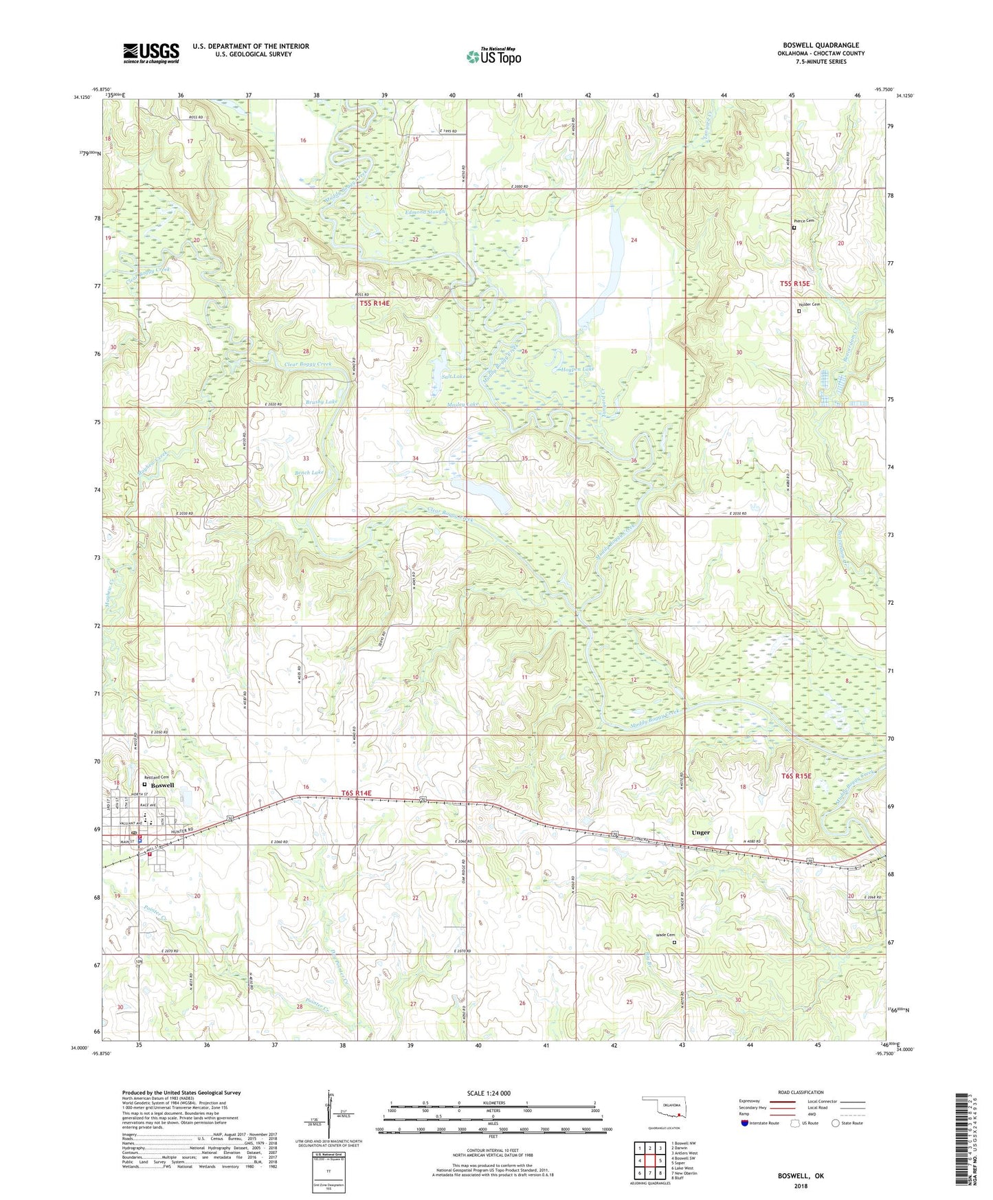
2022 topographic map quadrangle Boswell in the state of Oklahoma. Scale: 1:24000. Based on the newly updated USGS 7.5' US Topo map series, this map is in the following counties: Choctaw. The map contains contour data, water features, and other items you are used to seeing on USGS maps, but also has updated roads and other features. This is the next generation of topographic maps. Printed on high-quality waterproof paper with UV fade-resistant inks.
Quads adjacent to this one:
West: Boswell SW
Northwest: Boswell NW
North: Darwin
Northeast: Antlers West
East: Soper
Southeast: Bluff
South: New Oberlin
Southwest: Lake West
This map covers the same area as the classic USGS quad with code o34095a7.
Contains the following named places: Bench Lake, Boswell, Boswell Elementary School, Boswell High School, Boswell Junior High School, Boswell Police Department, Boswell Post Office, Boswell Volunteer Fire Department Station 1 Headquarters, Boswell Volunteer Fire Department Station 2, Brushy Lake, Clear Boggy Creek, Dry Pointer Creek, Edmond Slough, Grassy Lake, Hogpen Lake, Holder Cemetery, Mayhew Creek, Mosley Lake, Oak Ridge Church, Pierce Cemetery, Restland Cemetery, Saint James Church Number 2, Salt Lake, Tanyard Creek, Town of Boswell, Unger, Wade Cemetery, West Choctaw Division, ZIP Code: 74727