MyTopo
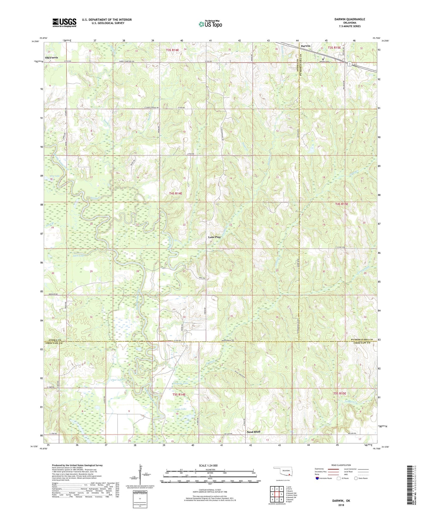
Darwin Oklahoma US Topo Map
Couldn't load pickup availability
2022 topographic map quadrangle Darwin in the state of Oklahoma. Scale: 1:24000. Based on the newly updated USGS 7.5' US Topo map series, this map is in the following counties: Atoka, Choctaw, Pushmataha. The map contains contour data, water features, and other items you are used to seeing on USGS maps, but also has updated roads and other features. This is the next generation of topographic maps. Printed on high-quality waterproof paper with UV fade-resistant inks.
Quads adjacent to this one:
West: Boswell NW
Northwest: Lane
North: Farris
Northeast: Moyers
East: Antlers West
Southeast: Soper
South: Boswell
Southwest: Boswell SW
This map covers the same area as the classic USGS quad with code o34095b7.
Contains the following named places: Allen Lake, Boggy Cutoff, Caney Creek, Center Point School, Clear Lake, Cold Springs Creek, Darwin, Darwin Cemetery, Darwin Church, Dry Lake, Hopena Lake, Howard McLeod Correctional Center, Lamey Slash, Lone Pine, Louie Lake, Pine Hollow, Potubbi Creek, Rard Branch, Sand Bluff, Sand Branch, Sandy Creek, Sugar Creek