MyTopo
New Oberlin Oklahoma US Topo Map
Couldn't load pickup availability
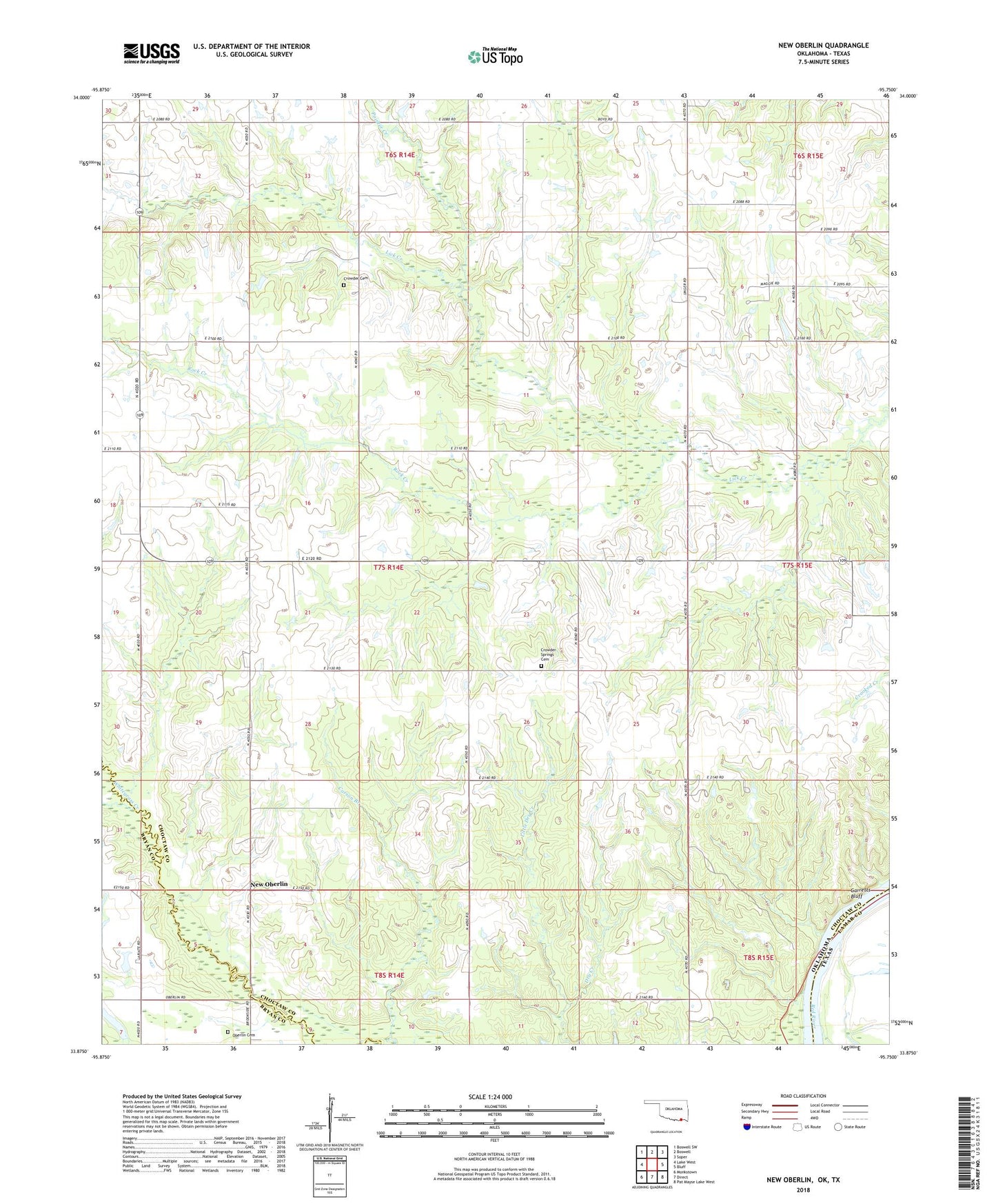
2022 topographic map quadrangle New Oberlin in the state of Oklahoma. Scale: 1:24000. Based on the newly updated USGS 7.5' US Topo map series, this map is in the following counties: Choctaw, Bryan, Lamar. The map contains contour data, water features, and other items you are used to seeing on USGS maps, but also has updated roads and other features. This is the next generation of topographic maps. Printed on high-quality waterproof paper with UV fade-resistant inks.
Quads adjacent to this one:
West: Lake West
Northwest: Boswell SW
North: Boswell
Northeast: Soper
East: Bluff
Southeast: Pat Mayse Lake West
South: Direct
Southwest: Monkstown
Contains the following named places: Bornman School, Carson Grove School, Closed Chapel School, Crowder Cemetery, Crowder Prairie School, Crowder Springs Cemetery, Crowder Springs School, Garretts Bluff, Goaround Airport, Iron Stob Church, Iron Stob School, Little Dry Creek, New Oberlin, Oberlin Cemetery, Pointer Creek, Rock Creek, Township of Hunter, Whitegrass Creek