MyTopo
Kansas Oklahoma US Topo Map
Couldn't load pickup availability
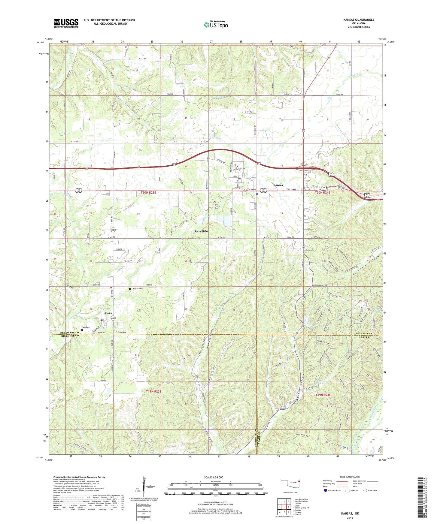
2022 topographic map quadrangle Kansas in the state of Oklahoma. Scale: 1:24000. Based on the newly updated USGS 7.5' US Topo map series, this map is in the following counties: Delaware, Cherokee, Adair. The map contains contour data, water features, and other items you are used to seeing on USGS maps, but also has updated roads and other features. This is the next generation of topographic maps. Printed on high-quality waterproof paper with UV fade-resistant inks.
Quads adjacent to this one:
West: Leach
Northwest: Lake Eucha West
North: Lake Eucha East
Northeast: Colcord
East: Siloam Springs NW
Southeast: Chance
South: Chewey
Southwest: Moodys
This map covers the same area as the classic USGS quad with code o36094b7.
Contains the following named places: Black Fox Springs, Clear Creek Dam, Cookson Hills Christian School, Cookson Hills Christian School Airport, Deer Dam, Deer Lake, First Baptist Church, Flint Ridge Volunteer Fire Department, Galilean Church, Kansas, Kansas Cemetery, Kansas Church, Kansas Elementary School, Kansas High School, Kansas Middle School, Kansas Police Department, Kansas Post Office, Kansas Volunteer Fire Department, Long Prairie Baptist Church, Long Prairie Cemetery, Lost Spring, Mountain View Church, Northeast Technology Center Kansas Campus, Oaks, Oaks - Mission Elementary School, Oaks - Mission High School, Oaks Cemetery, Oaks Community, Oaks Post Office, Oaks Volunteer Fire Department, Russell Cemetery, Town of Kansas, Town of Oaks, Twin Oaks, Twin Oaks Census Designated Place, Walnut Grove Mission, ZIP Codes: 74347, 74359, 74368