MyTopo
Hester Oklahoma US Topo Map
Couldn't load pickup availability
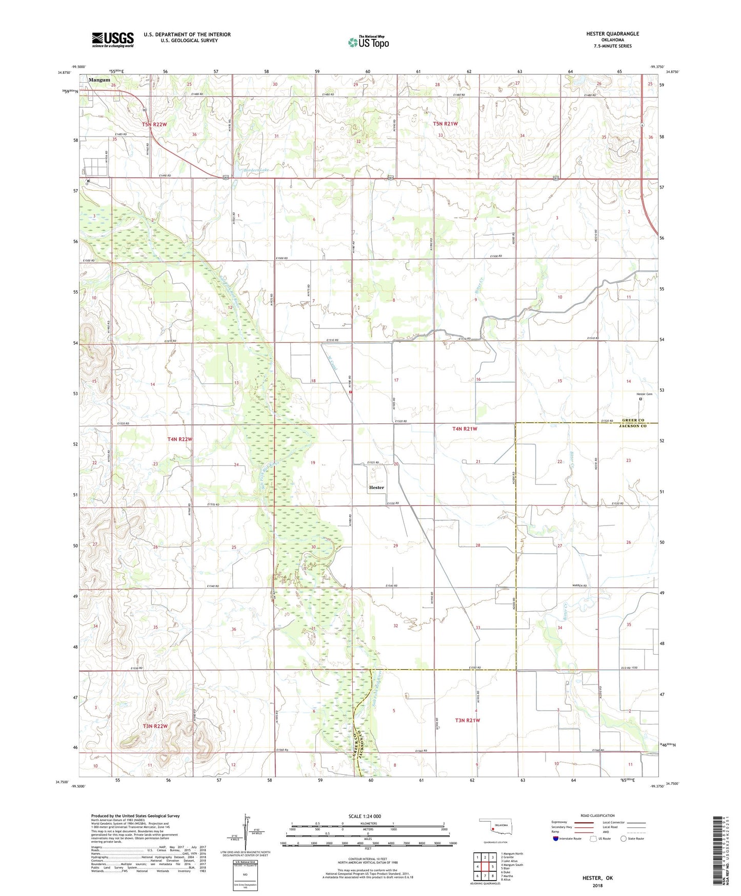
2022 topographic map quadrangle Hester in the state of Oklahoma. Scale: 1:24000. Based on the newly updated USGS 7.5' US Topo map series, this map is in the following counties: Greer, Jackson. The map contains contour data, water features, and other items you are used to seeing on USGS maps, but also has updated roads and other features. This is the next generation of topographic maps. Printed on high-quality waterproof paper with UV fade-resistant inks.
Quads adjacent to this one:
West: Mangum South
Northwest: Mangum North
North: Granite
Northeast: Lake Altus
East: Blair
Southeast: Altus
South: Martha
Southwest: Duke
This map covers the same area as the classic USGS quad with code o34099g4.
Contains the following named places: Borders Lake, Church of Christ, Hester, Hester Cemetery, Hester Rural Volunteer Fire Department, Lloyd Sullivan Dam, Lloyd Sullivan Reservoir, Sandy Land Research Station, Stover Shopping Center, West Canal