MyTopo
Longdale Oklahoma US Topo Map
Couldn't load pickup availability
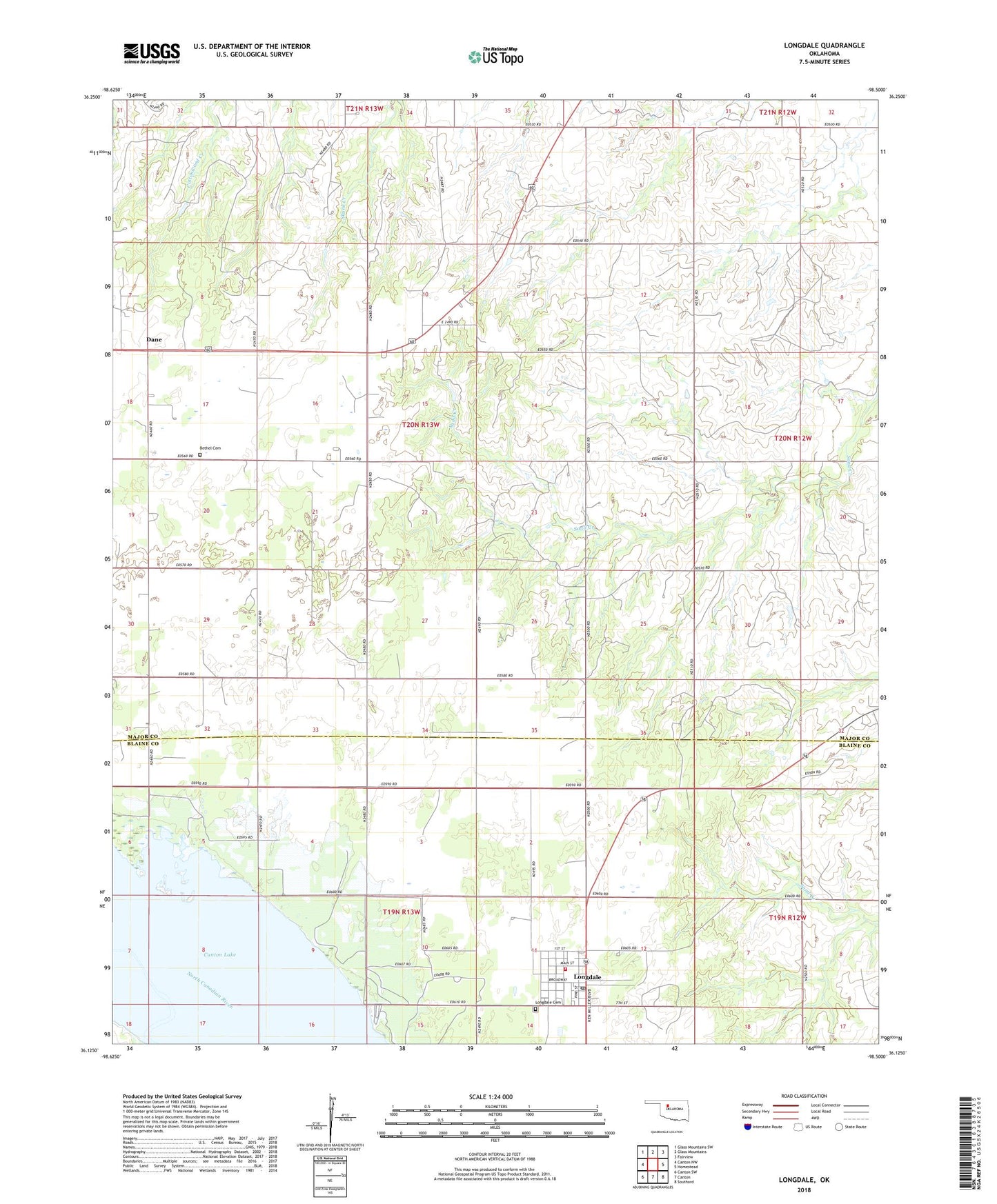
2022 topographic map quadrangle Longdale in the state of Oklahoma. Scale: 1:24000. Based on the newly updated USGS 7.5' US Topo map series, this map is in the following counties: Major, Blaine. The map contains contour data, water features, and other items you are used to seeing on USGS maps, but also has updated roads and other features. This is the next generation of topographic maps. Printed on high-quality waterproof paper with UV fade-resistant inks.
Quads adjacent to this one:
West: Canton NW
Northwest: Glass Mountains SW
North: Glass Mountains
Northeast: Fairview
East: Homestead
Southeast: Southard
South: Canton
Southwest: Canton SW
This map covers the same area as the classic USGS quad with code o36098b5.
Contains the following named places: Bethel Cemetery, Blaine County Jail Longdale, Canton Wildlife Management Area, Cedar Springs, Dane, Fairview Lakeside Country Club, Kusch Lake, Kusch Lake Dam, Longdale, Longdale Cemetery, Longdale Fire Department, Longdale Post Office, Longdale Recreation Area, Town of Longdale, Wahl Lake, Wahl Lake Dam, ZIP Code: 73755