MyTopo
Finley Oklahoma US Topo Map
Couldn't load pickup availability
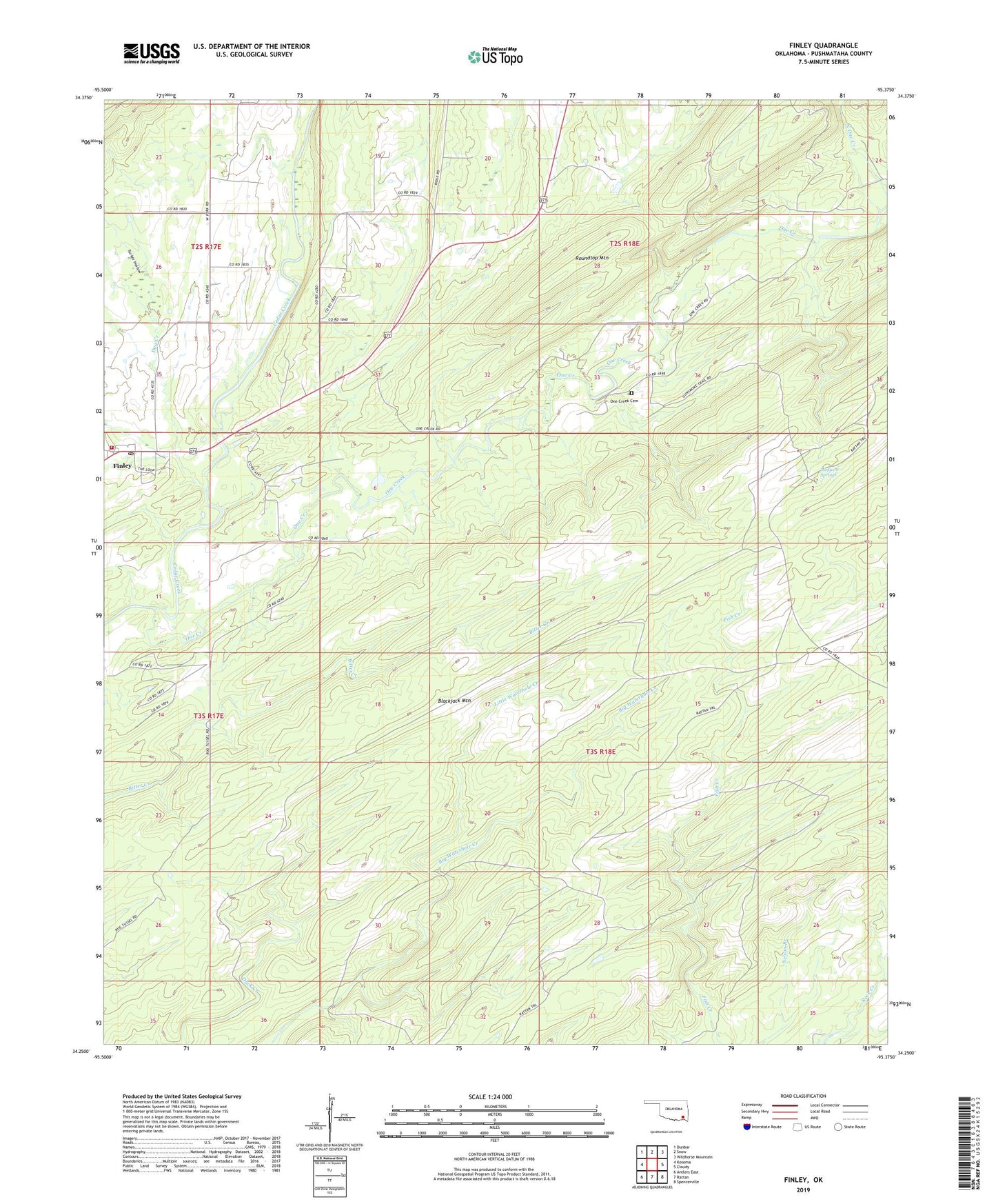
2022 topographic map quadrangle Finley in the state of Oklahoma. Scale: 1:24000. Based on the newly updated USGS 7.5' US Topo map series, this map is in the following counties: Pushmataha. The map contains contour data, water features, and other items you are used to seeing on USGS maps, but also has updated roads and other features. This is the next generation of topographic maps. Printed on high-quality waterproof paper with UV fade-resistant inks.
Quads adjacent to this one:
West: Kosoma
Northwest: Dunbar
North: Snow
Northeast: Wildhorse Mountain
East: Cloudy
Southeast: Spencerville
South: Rattan
Southwest: Antlers East
This map covers the same area as the classic USGS quad with code o34095c4.
Contains the following named places: Dog Creek, Finley, Finley Census Designated Place, Finley Fire Department, Finley Post Office, Gunsmoke Trail, Little Waterhole Creek, Medicine Springs, One Creek, One Creek Cemetery, Rattan Trail, Roundtop Mountain, Tucker Hollow, ZIP Code: 74543