MyTopo
Kosoma Oklahoma US Topo Map
Couldn't load pickup availability
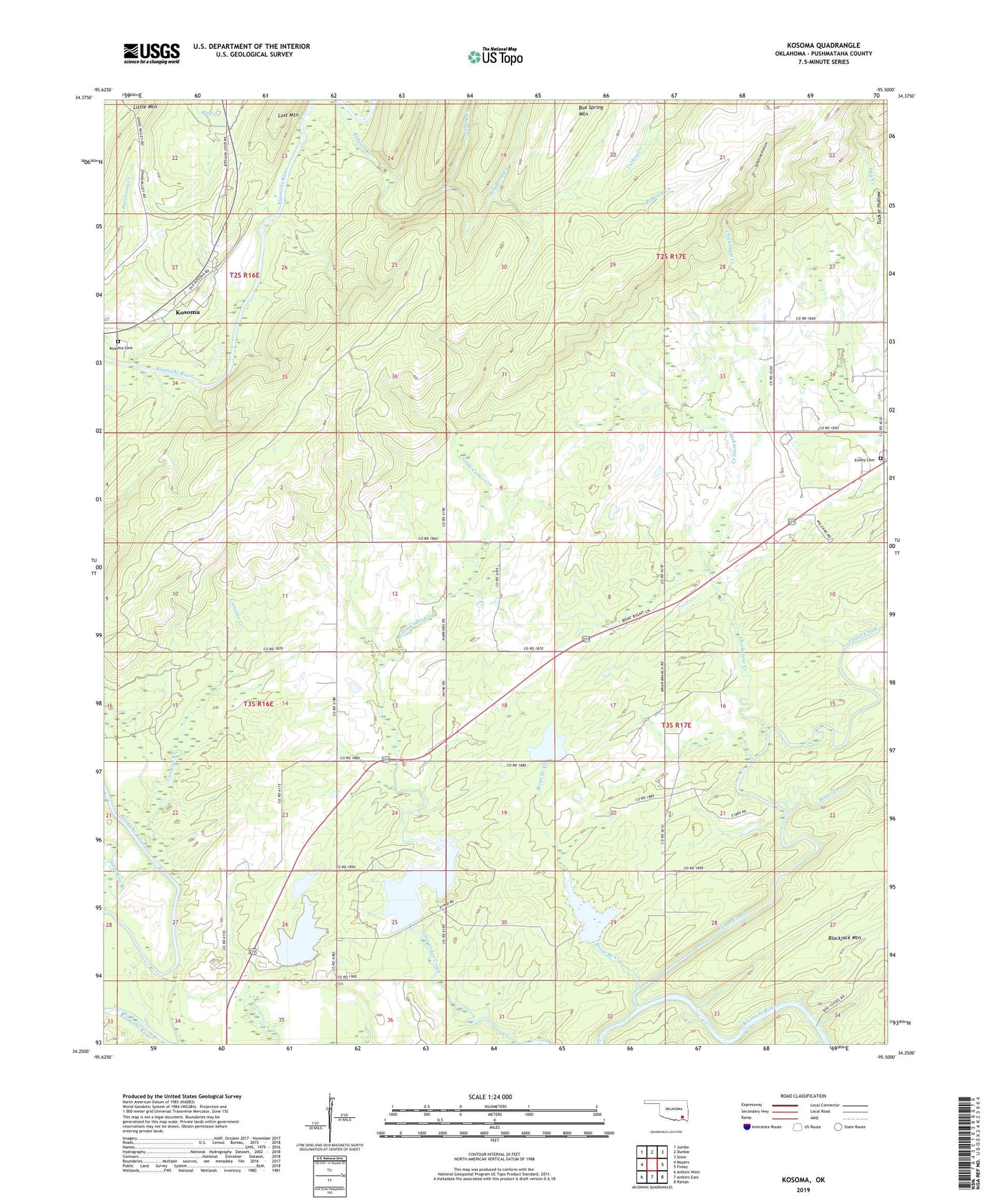
2022 topographic map quadrangle Kosoma in the state of Oklahoma. Scale: 1:24000. Based on the newly updated USGS 7.5' US Topo map series, this map is in the following counties: Pushmataha. The map contains contour data, water features, and other items you are used to seeing on USGS maps, but also has updated roads and other features. This is the next generation of topographic maps. Printed on high-quality waterproof paper with UV fade-resistant inks.
Quads adjacent to this one:
West: Moyers
Northwest: Jumbo
North: Dunbar
Northeast: Snow
East: Finley
Southeast: Rattan
South: Antlers East
Southwest: Antlers West
This map covers the same area as the classic USGS quad with code o34095c5.
Contains the following named places: Bitter Creek, Briar Branch Creek, Caroline Creek, Cedar Creek, Chickasaw Creek, Finley Cemetery, Grassy Creek, Judge Cox Branch, Kosoma, Kosoma Cemetery, Lily Pond Creek, Little Cedar Church, Oknoname 127007 Dam, Oknoname 127007 Reservoir, Oknoname 127008 Dam, Oknoname 127008 Reservoir, Oknoname 127009 Dam, Oknoname 127009 Reservoir, Oknoname 127010 Dam, Oknoname 127010 Reservoir, Old Cedar Church, Robison Creek, Sunshine Hollow