MyTopo
Hackett Arkansas US Topo Map
Couldn't load pickup availability
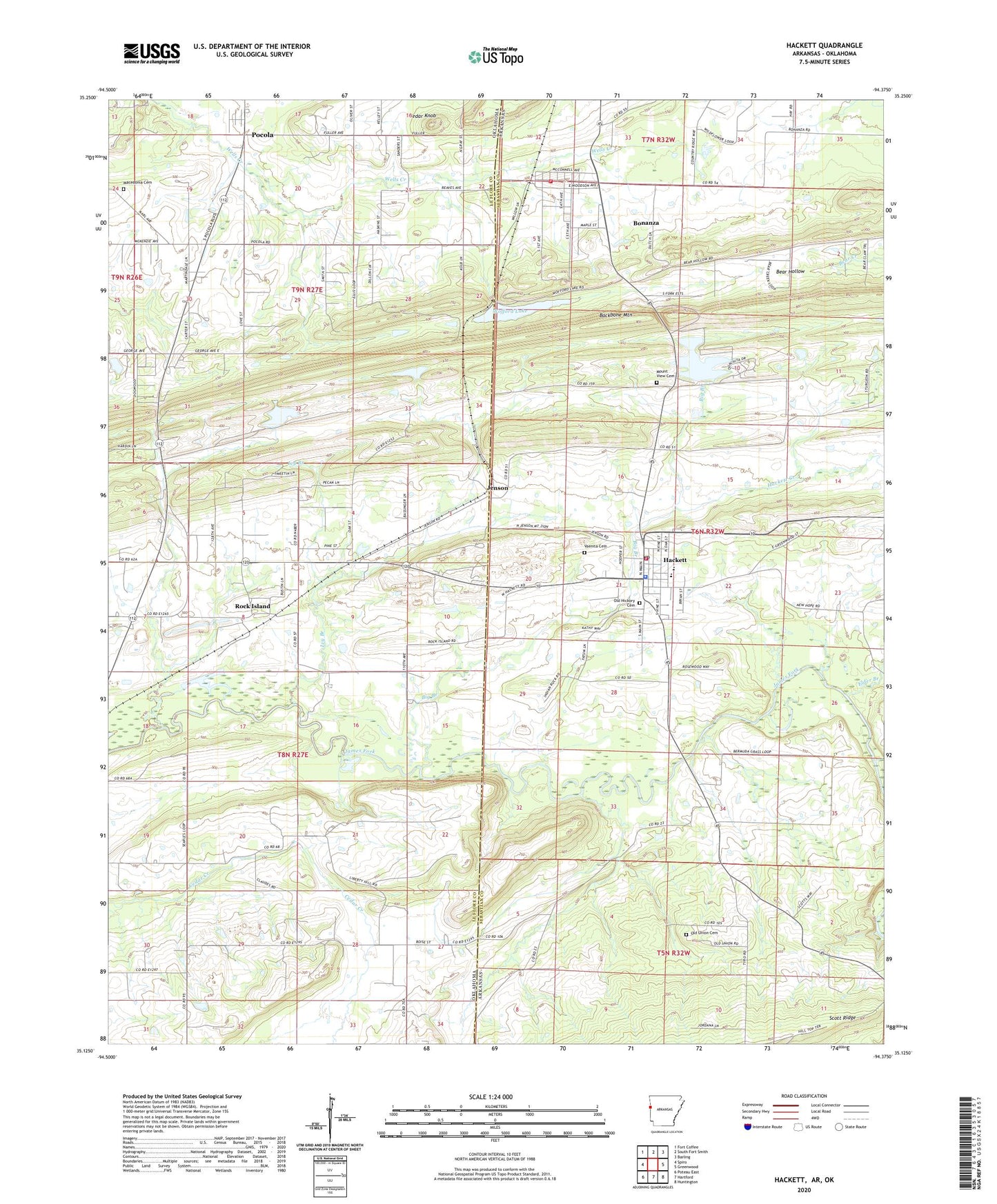
2024 topographic map quadrangle Hackett in the states of Arkansas, Oklahoma. Scale: 1:24000. Based on the newly updated USGS 7.5' US Topo map series, this map is in the following counties: Sebastian, Le Flore. The map contains contour data, water features, and other items you are used to seeing on USGS maps, but also has updated roads and other features. This is the next generation of topographic maps. Printed on high-quality waterproof paper with UV fade-resistant inks.
Quads adjacent to this one:
West: Spiro
Northwest: Fort Coffee
North: South Fort Smith
Northeast: Barling
East: Greenwood
Southeast: Huntington
South: Hartford
Southwest: Poteau East
Contains the following named places: Amity Church, Bear Hollow, Big Branch, Bonanza, Bonanza Police Department, Bonanza Volunteer Fire Department, Cedar Knob, Cedar Knobb, City of Bonanza, City of Hackett, Davy Park, Doubleday, Elder Branch, Emergency Medical Services of Le Flore County Station 4 Pocola, Gray Mountain, Hackett, Hackett City Police Department, Hackett Creek, Hackett Elementary School, Hackett High School, Hackett Post Office, Hackett Volunteer Fire Department, Harden Number 1 Dam, Harden Number 1 Reservoir, Ivy Branch, Jenson, Liberty Hill Church, Macedonia Cemetery, Mountain View Cemetery, Old Hickory Cemetery, Old Union Cemetery, Old Union Church, Pocola, Pocola Division, Rock Island, Sebastian Lake, Sebastian Lake Dam, Town of Pocola, Town of Rock Island, Township of Cole, Township of Pocola, Vinita Cemetery, Wafford Lake Dam, Wofford Lake, ZIP Codes: 72937, 74902