MyTopo
Porcupine Butte Oklahoma US Topo Map
Couldn't load pickup availability
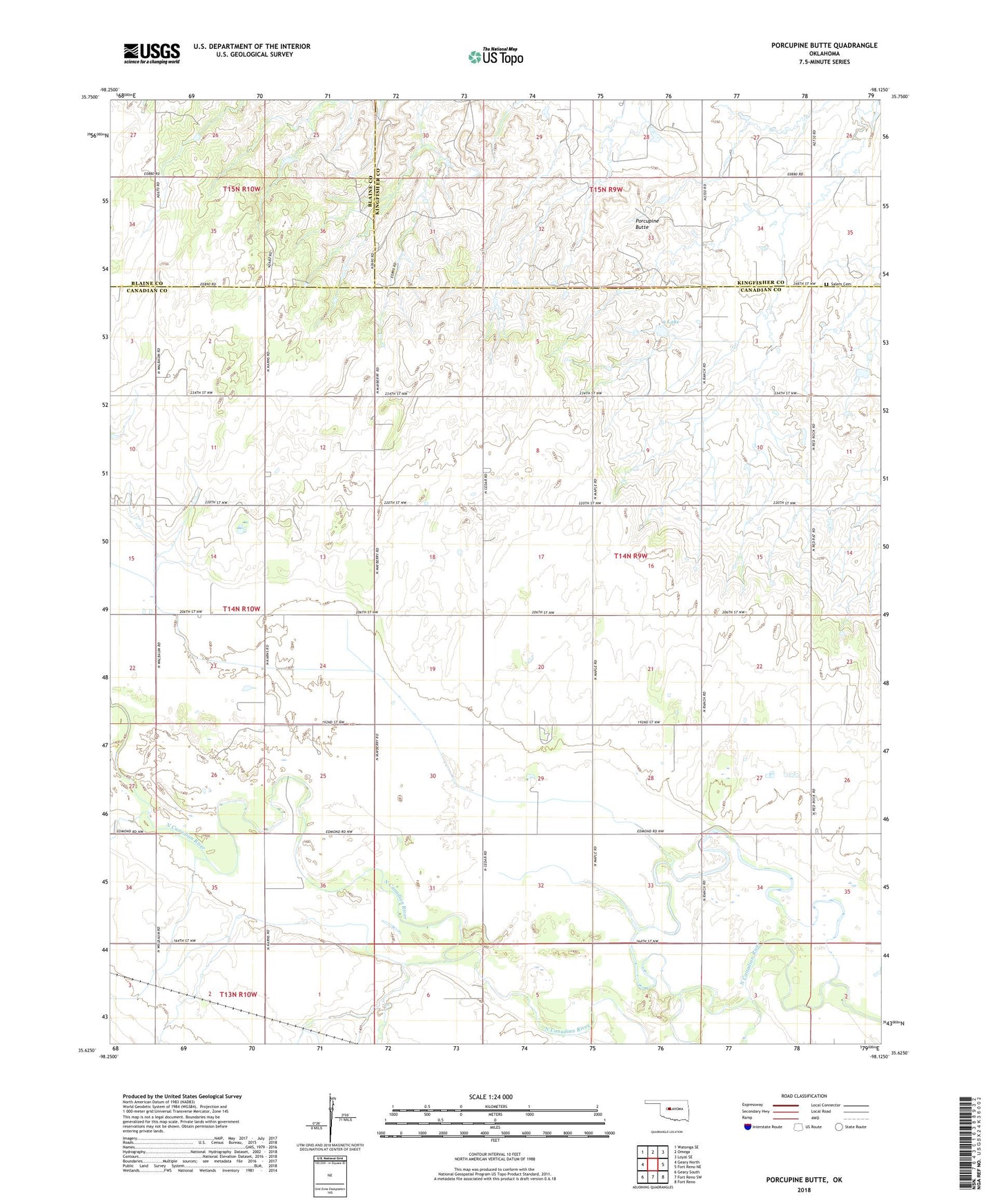
2022 topographic map quadrangle Porcupine Butte in the state of Oklahoma. Scale: 1:24000. Based on the newly updated USGS 7.5' US Topo map series, this map is in the following counties: Canadian, Kingfisher, Blaine. The map contains contour data, water features, and other items you are used to seeing on USGS maps, but also has updated roads and other features. This is the next generation of topographic maps. Printed on high-quality waterproof paper with UV fade-resistant inks.
Quads adjacent to this one:
West: Geary North
Northwest: Watonga SE
North: Omega
Northeast: Loyal SE
East: Fort Reno NE
Southeast: Fort Reno
South: Fort Reno SW
Southwest: Geary South
This map covers the same area as the classic USGS quad with code o35098f2.
Contains the following named places: Coleman Chapel, Grandview Community Center, Oknoname 017009 Dam, Oknoname 9 Lake, Porcupine Butte, Salem Cemetery, Swappingback Mission, Township of Oak