MyTopo
Hartford Arkansas US Topo Map
Couldn't load pickup availability
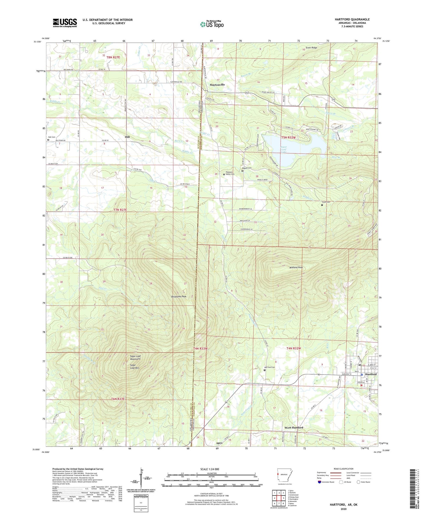
2024 topographic map quadrangle Hartford in the states of Arkansas, Oklahoma. Scale: 1:24000. Based on the newly updated USGS 7.5' US Topo map series, this map is in the following counties: Sebastian, Le Flore. The map contains contour data, water features, and other items you are used to seeing on USGS maps, but also has updated roads and other features. This is the next generation of topographic maps. Printed on high-quality waterproof paper with UV fade-resistant inks.
Quads adjacent to this one:
West: Poteau East
Northwest: Spiro
North: Hackett
Northeast: Greenwood
East: Huntington
Southeast: Cauthron
South: Bates
Southwest: Heavener
Contains the following named places: Begum Cemetery, City of Hartford, Clark Cemetery, Emert Branch, Hall Cemetery, Hartford, Hartford Elementary School, Hartford High School, Hartford Police Department, Hartford Post Office, Hartford Volunteer Fire Department, Haw Branch, Hill, Midland Peak, New Providence Church, Oklahoma Peak, Pleasant Valley Cemetery, Red Yard - Jackson Cemetery, Rock Creek, Scott Ridge, Slaytonville, Sugar Loaf Lake, Sugar Loaf Lake Dam, Sugar Loaf Mountain, Sugar Loaf Mountains, Sugarloaf - Slaytonville Volunteer Fire Department, Township of Hartford, Township of Mississippi, West Hartford, ZIP Code: 72938