MyTopo
Jennings Oklahoma US Topo Map
Couldn't load pickup availability
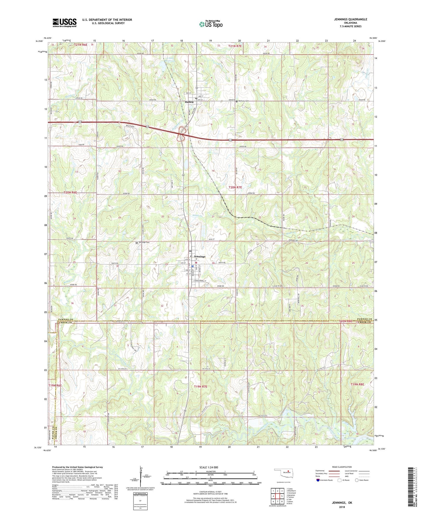
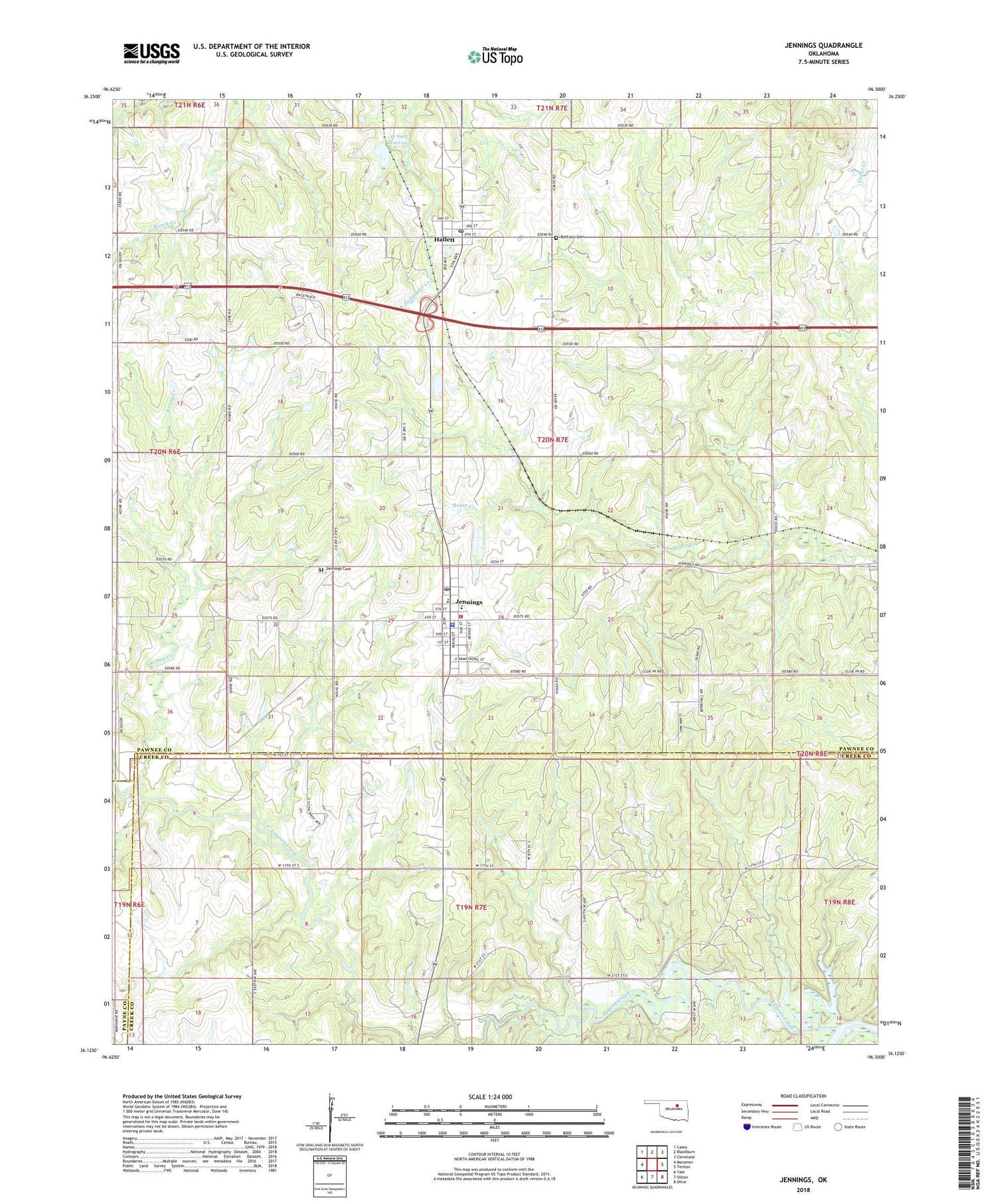
2018 topographic map quadrangle Jennings in the state of Oklahoma. Scale: 1:24000. Based on the newly updated USGS 7.5' US Topo map series, this map is in the following counties: Pawnee, Creek, Payne. The map contains contour data, water features, and other items you are used to seeing on USGS maps, but also has updated roads and other features. This is the next generation of topographic maps. Printed on high-quality waterproof paper with UV fade-resistant inks.
Quads adjacent to this one:
West: Maramec
Northwest: Casey
North: Blackburn
Northeast: Cleveland
East: Terlton
Southeast: Olive
South: Oilton
Southwest: Yale
Contains the following named places: Bethany Cemetery, Cimarron Strip, Hallett, Hallett Post Office, Hallett Siding, Jennings, Jennings Cemetery, Jennings Elementary School, Jennings Police Department, Jennings Post Office, Jennings Rural Fire Department, Kenny Creek, Lagoon Creek, Oknoname 037001 Dam, Oknoname 037001 Reservoir, Oknoname 117005 Dam, Oknoname 117005 Reservoir, Town of Hallett, Town of Jennings, Township of McElroy, Victory Christian Academy, ZIP Codes: 74034, 74038