MyTopo
Farris Oklahoma US Topo Map
Couldn't load pickup availability
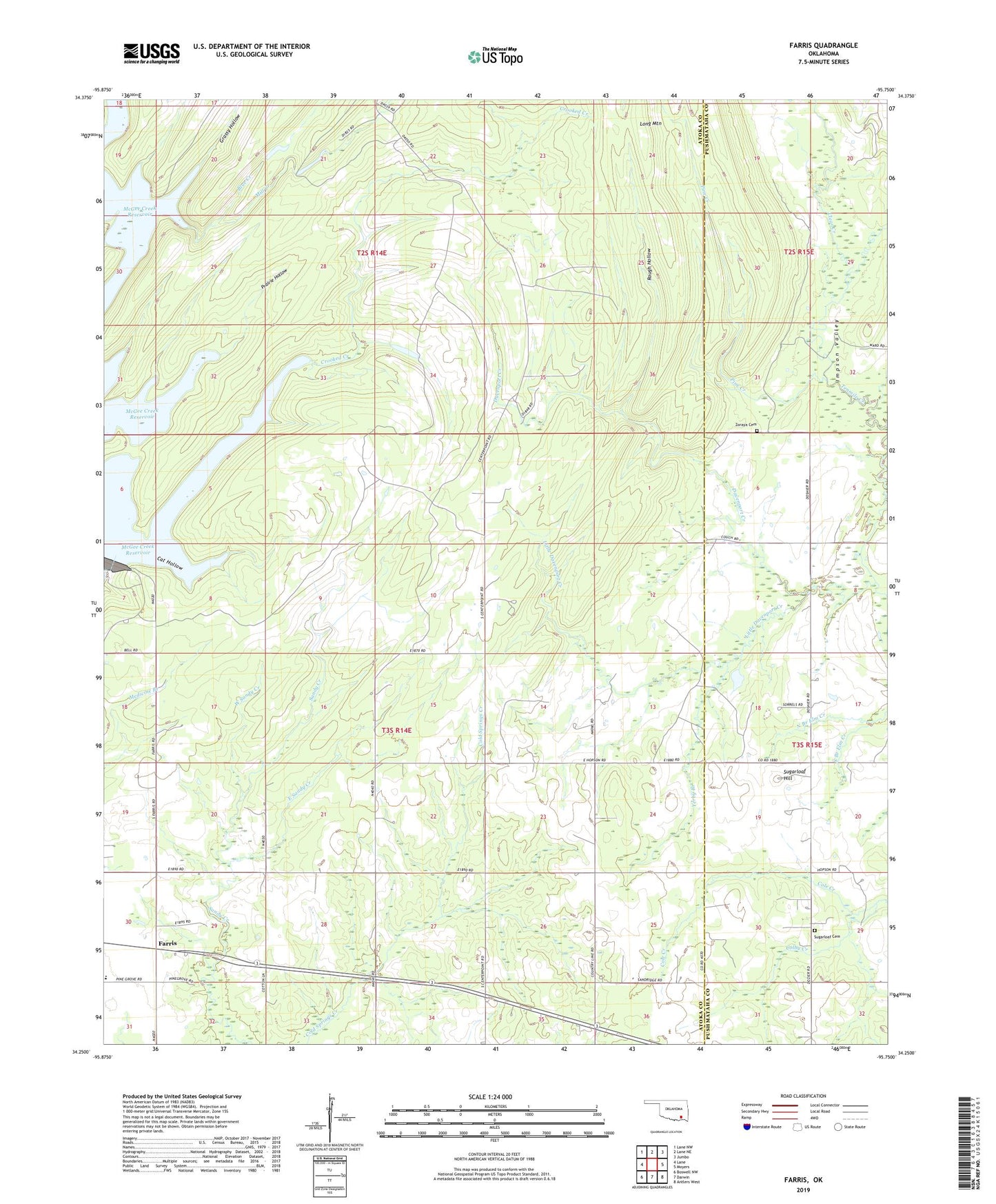
2022 topographic map quadrangle Farris in the state of Oklahoma. Scale: 1:24000. Based on the newly updated USGS 7.5' US Topo map series, this map is in the following counties: Atoka, Pushmataha. The map contains contour data, water features, and other items you are used to seeing on USGS maps, but also has updated roads and other features. This is the next generation of topographic maps. Printed on high-quality waterproof paper with UV fade-resistant inks.
Quads adjacent to this one:
West: Lane
Northwest: Lane NW
North: Lane NE
Northeast: Jumbo
East: Moyers
Southeast: Antlers West
South: Darwin
Southwest: Boswell NW
This map covers the same area as the classic USGS quad with code o34095c7.
Contains the following named places: Blue Creek, Cat Hollow, Center Point, Center Point Church, Clear Creek, Colby Creek, Crooked Creek, Davenport Creek, East Sandy Creek, Farris, Farris Elementary School, Grassy Hollow, Impson Valley, Little Davenport Creek, Long Mountain, Mill Creek, North Branch Elm Creek, Oknoname 127004 Dam, Oknoname 127004 Reservoir, Pine Creek, Pine Springs School, Prairie Hollow, Rough Hollow, Round Lake Church, South Branch Elm Creek, Sugarloaf Cemetery, Sugarloaf Hill, Township of Farris, West Sandy Creek, Yerby Branch, Zoraya Cemetery