MyTopo
Lane NW Oklahoma US Topo Map
Couldn't load pickup availability
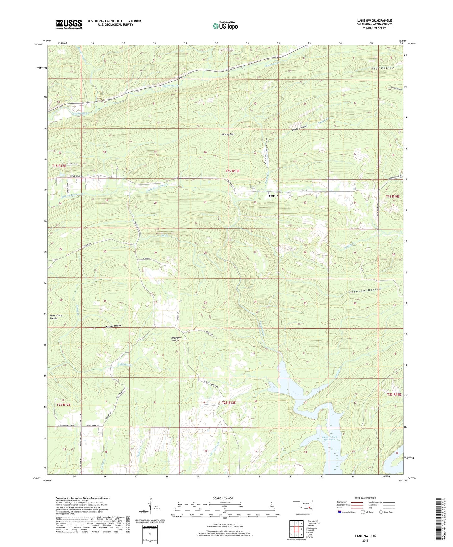
2019 topographic map quadrangle Lane NW in the state of Oklahoma. Scale: 1:24000. Based on the newly updated USGS 7.5' US Topo map series, this map is in the following counties: Atoka. The map contains contour data, water features, and other items you are used to seeing on USGS maps, but also has updated roads and other features. This is the next generation of topographic maps. Printed on high-quality waterproof paper with UV fade-resistant inks.
Quads adjacent to this one:
West: Stringtown
Northwest: Coalgate SE
North: Limestone Gap
Northeast: Redden
East: Lane NE
Southeast: Farris
South: Lane
Southwest: Bruno
Contains the following named places: Armstrong School, Atoka County Dam, Atoka County Lake, Breadtown Creek, Cat Creek, Cedar Hollow, Fugate, Hiawana Creek, Hiawana Prairie, Hickory Flat, Horseshoe Bend, Kennedy Hollow, Miller School, Oknoname 135004 Dam, Oknoname 135004 Reservoir, Panther Creek, Peacock Hollow, Stringtown Public Hunting Area, Texas Hole, Wildcat Hollow, Wildlife Management Area, ZIP Code: 74569