MyTopo
Little Axe Oklahoma US Topo Map
Couldn't load pickup availability
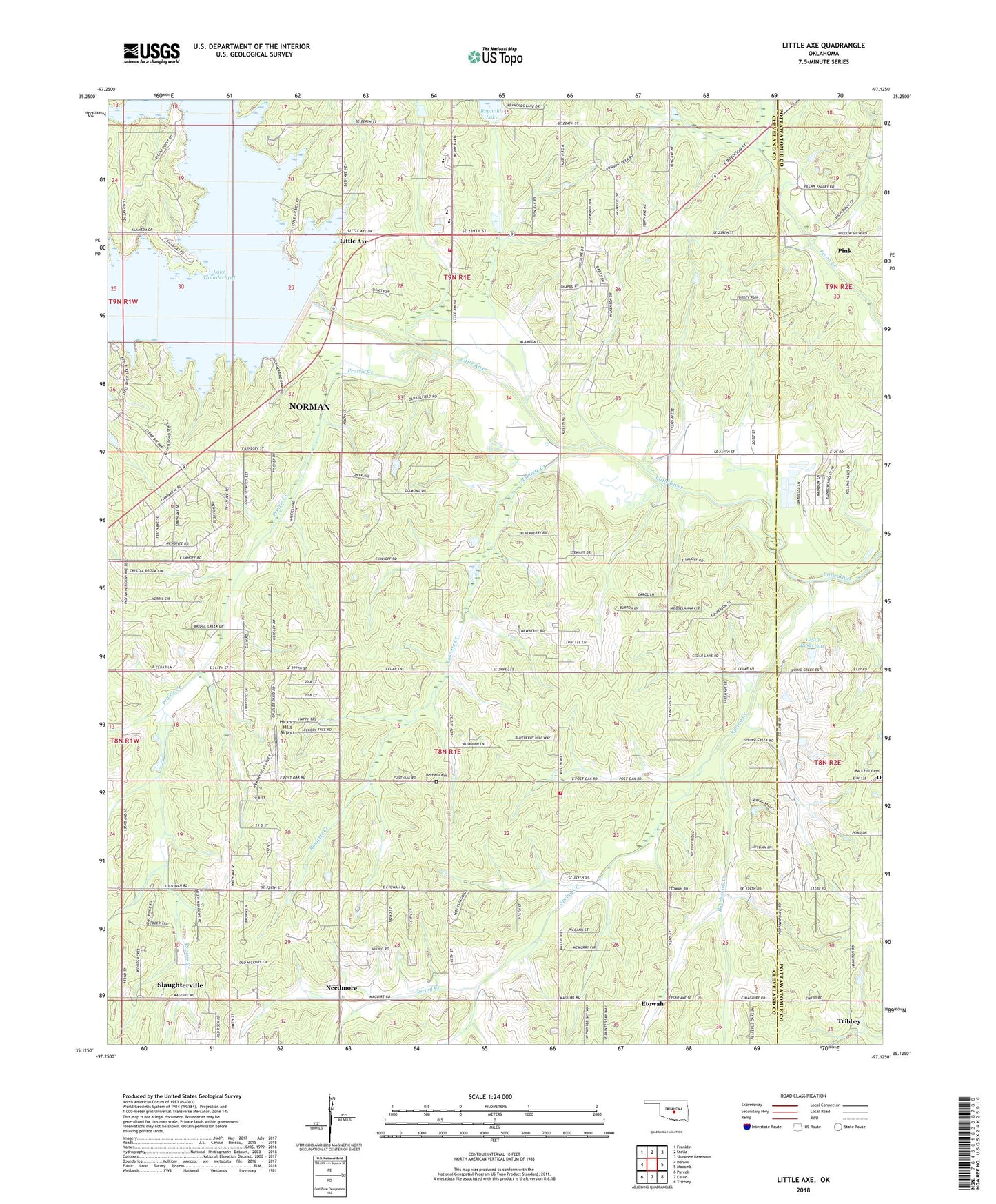
2018 topographic map quadrangle Little Axe in the state of Oklahoma. Scale: 1:24000. Based on the newly updated USGS 7.5' US Topo map series, this map is in the following counties: Cleveland, Pottawatomie. The map contains contour data, water features, and other items you are used to seeing on USGS maps, but also has updated roads and other features. This is the next generation of topographic maps. Printed on high-quality waterproof paper with UV fade-resistant inks.
Quads adjacent to this one:
West: Denver
Northwest: Franklin
North: Stella
Northeast: Shawnee Reservoir
East: Macomb
Southeast: Tribbey
South: Eason
Southwest: Purcell
Contains the following named places: Bennett Church, Bethel Cemetery, Bourbonais Creek, Cedar Country Fire Department Station 1, East Cleveland Division, Etowah, Etowah Church, Hickory Hills Airport, Hog Creek, Lake Thunderbird, Lake Thunderbird Dam, Lakeside Free Will Baptist Church, Little Axe, Little Axe Elementary School, Little Axe High School, Little Axe Middle School, Little Jim Mission, Little River State Park, Mars Hill Cemetery, Needmore, Norman Fire Department Station 5, Oknoname 12513 Dam, Oknoname 12513 Reservoir, Prairie Creek, Reynolds Lake, Reynolds Lake Dam, Roulette Creek, Spring Creek, Town of Etowah, Township of Little River