MyTopo
Luther SE Oklahoma US Topo Map
Couldn't load pickup availability
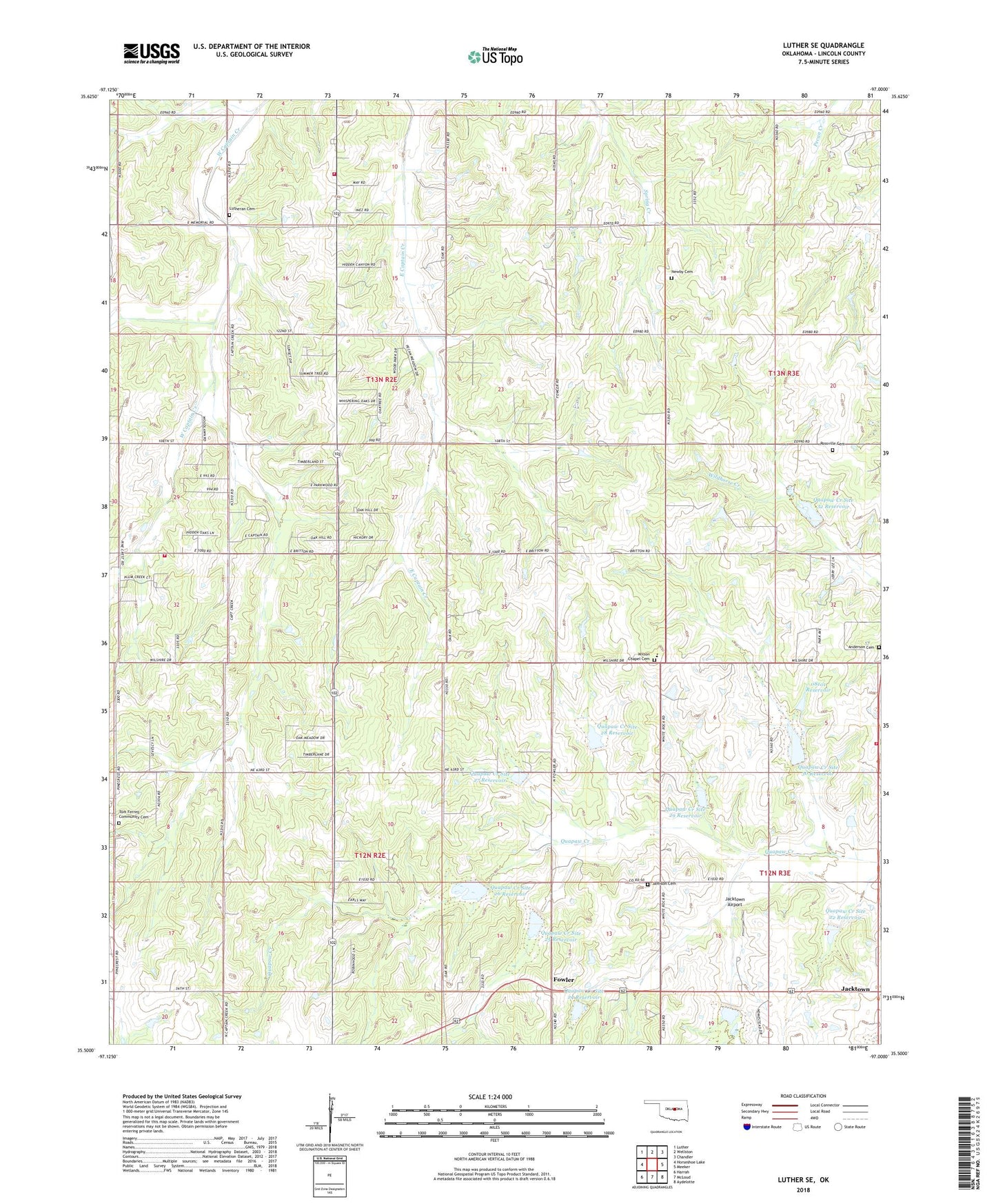
2022 topographic map quadrangle Luther SE in the state of Oklahoma. Scale: 1:24000. Based on the newly updated USGS 7.5' US Topo map series, this map is in the following counties: Lincoln. The map contains contour data, water features, and other items you are used to seeing on USGS maps, but also has updated roads and other features. This is the next generation of topographic maps. Printed on high-quality waterproof paper with UV fade-resistant inks.
Quads adjacent to this one:
West: Horseshoe Lake
Northwest: Luther
North: Wellston
Northeast: Chandler
East: Meeker
Southeast: Aydelotte
South: McLoud
Southwest: Harrah
This map covers the same area as the classic USGS quad with code o35097e1.
Contains the following named places: Anderson Cemetery, Captain Creek Community Center, Fowler, Frost Ranch Airport, Hillside Church, Jacktown, Jacktown Airport, Jacktown Fire Department, Jamison Cemetery, Kickapoo Oklahoma Tribal Statistical Area, Levescy Airport, Mammoth Church, Newby Cemetery, Oknoname 08101 Dam, Oknoname 08101 Reservoir, Quapaw Creek Site 22 Dam, Quapaw Creek Site 22 Reservoir, Quapaw Creek Site 24 Dam, Quapaw Creek Site 24 Reservoir, Quapaw Creek Site 25 Dam, Quapaw Creek Site 25 Reservoir, Quapaw Creek Site 26 Dam, Quapaw Creek Site 26 Reservoir, Quapaw Creek Site 27 Dam, Quapaw Creek Site 27 Reservoir, Quapaw Creek Site 28 Dam, Quapaw Creek Site 28 Reservoir, Quapaw Creek Site 29 Dam, Quapaw Creek Site 29 Reservoir, Quapaw Creek Site 30 Dam, Quapaw Creek Site 30 Reservoir, Quapaw Creek Site 32 Dam, Quapaw Creek Site 32 Reservoir, Rossville Cemetery, Saint Pauls Lutheran Cemetery, Southwest Lincoln County Fire Protection District 1 Station 1, Southwest Lincoln County Fire Protection District 1 Station 2, Tom Ferrell Community Cemetery, Township of Bryan, Township of Kickapoo, White Rock Elementary School, Wilson Chapel Cemetery