MyTopo
Mangum South Oklahoma US Topo Map
Couldn't load pickup availability
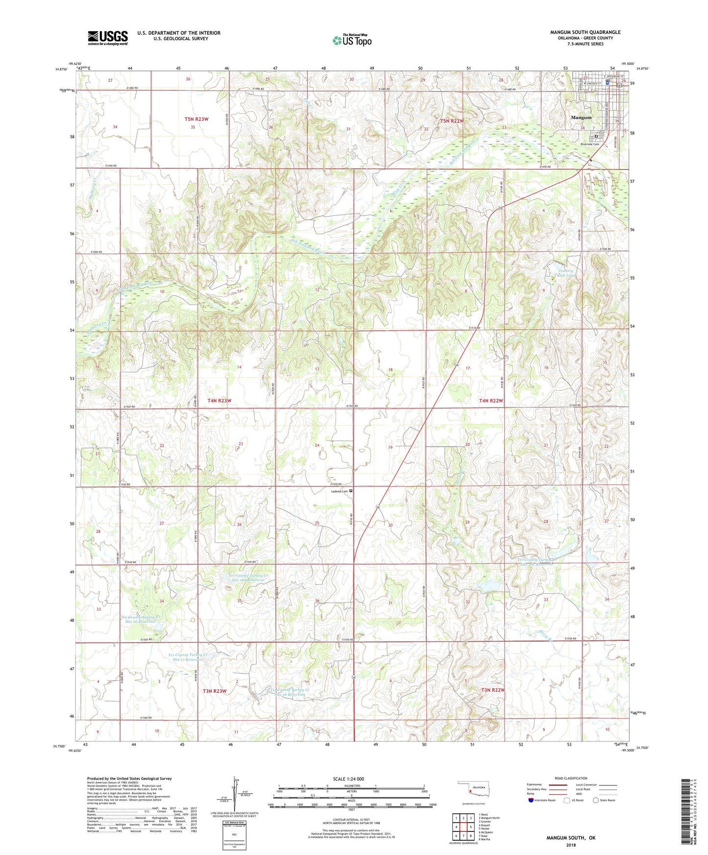
2018 topographic map quadrangle Mangum South in the state of Oklahoma. Scale: 1:24000. Based on the newly updated USGS 7.5' US Topo map series, this map is in the following counties: Greer. The map contains contour data, water features, and other items you are used to seeing on USGS maps, but also has updated roads and other features. This is the next generation of topographic maps. Printed on high-quality waterproof paper with UV fade-resistant inks.
Quads adjacent to this one:
West: Russell
Northwest: Reed
North: Mangum North
Northeast: Granite
East: Hester
Southeast: Martha
South: Duke
Southwest: McQueen
Contains the following named places: Assembly of Jesus Christ Church, Church Triumphant, Country Club Lake, First Assembly of God Church, First United Methodist Church, Fish Creek, Geer County Jail, Greer County Sheriff's Office, Greer County Special Ambulance Service, J L Briscoe Dam, J L Briscoe Reservoir, Ladessa Cemetery, Mangum, Mangum Division, Mangum Police Department, Mangum Post Office, Mulberry Creek, Riverside Cemetery, Township of Tilley, Tri-County Turkey Creek Site 16 Dam, Tri-County Turkey Creek Site 16 Reservoir, Tri-County Turkey Creek Site 16a Dam, Tri-County Turkey Creek Site 16a Reservoir, Tri-County Turkey Creek Site 17 Dam, Tri-County Turkey Creek Site 17 Reservoir, Tri-County Turkey Creek Site 18 Dam, Tri-County Turkey Creek Site 18 Reservoir, Tri-County Turkey Creek Site 28c Dam, Tri-County Turkey Creek Site 28c Reservoir