MyTopo
Granite Oklahoma US Topo Map
Couldn't load pickup availability
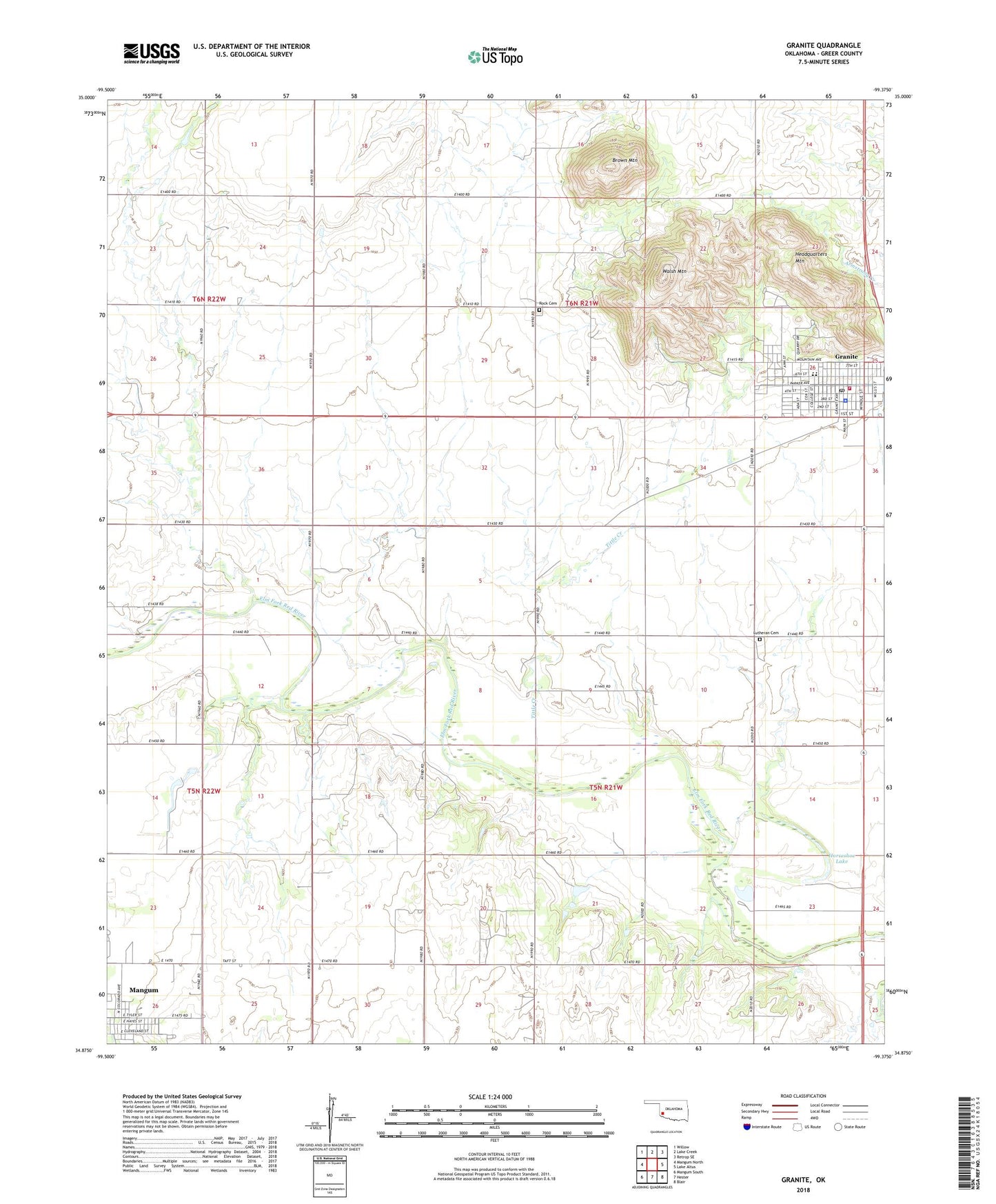
2022 topographic map quadrangle Granite in the state of Oklahoma. Scale: 1:24000. Based on the newly updated USGS 7.5' US Topo map series, this map is in the following counties: Greer. The map contains contour data, water features, and other items you are used to seeing on USGS maps, but also has updated roads and other features. This is the next generation of topographic maps. Printed on high-quality waterproof paper with UV fade-resistant inks.
Quads adjacent to this one:
West: Mangum North
Northwest: Willow
North: Lake Creek
Northeast: Retrop SE
East: Lake Altus
Southeast: Blair
South: Hester
Southwest: Mangum South
This map covers the same area as the classic USGS quad with code o34099h4.
Contains the following named places: Brown Mountain, Camp Kate Portwood, Granite, Granite Division, Granite Elementary School, Granite Fire Department, Granite High School, Granite Police Department, Granite Post Office, Greer County Special Ambulance Granite, Headquarters Mountain, Horseshoe Lake, Joe Harp Field, KTIJ-FM (Elk City), Lutheran Cemetery, Rock Cemetery, Tittle Creek, Township of Granite, Walsh Mountain, ZIP Code: 73547