MyTopo
Meers Oklahoma US Topo Map
Couldn't load pickup availability
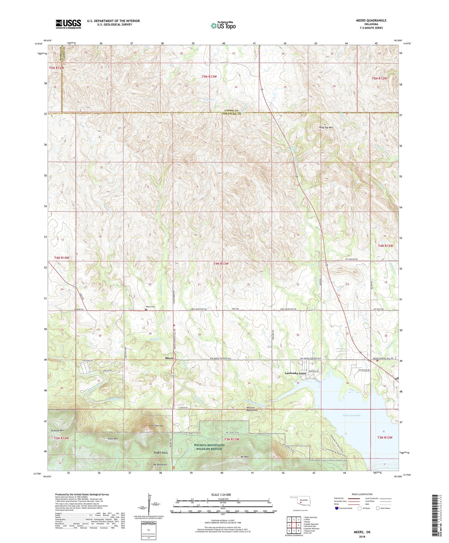
2018 topographic map quadrangle Meers in the state of Oklahoma. Scale: 1:24000. Based on the newly updated USGS 7.5' US Topo map series, this map is in the following counties: Comanche, Caddo, Kiowa. The map contains contour data, water features, and other items you are used to seeing on USGS maps, but also has updated roads and other features. This is the next generation of topographic maps. Printed on high-quality waterproof paper with UV fade-resistant inks.
Quads adjacent to this one:
West: Saddle Mountain
Northwest: Bally Mountain
North: Alden
Northeast: Boone
East: Richards Spur
Southeast: Fort Sill
South: Mount Scott
Southwest: Quanah Mountain
Contains the following named places: Canyon Creek, Cedar Creek, Curtright Springs, Jackson Creek, Jimmy Creek, Kimbell Ranch, Lake Lawtonka, Lawtonka Acres, Lawtonka Acres Census Designated Place, Meers, Meers Cemetery, Meers Volunteer Fire Department, Mount Roosevelt, Mount Scott Kiowa Mission, Mount Scott Tribal Cemetery, Mount Sheridan, Mount Wall, Mountain Scott Tribal Cemetery, Northwest Comanche Division, Paradise Valley Fire Department, Poko Mountain, Ranch Creek, Ring Top Mountain, Robinson Landing, Robison Landing, Tarbone Mountain, Township of McMaster, Yshua Sports Camp