MyTopo
Pittsburg Oklahoma US Topo Map
Couldn't load pickup availability
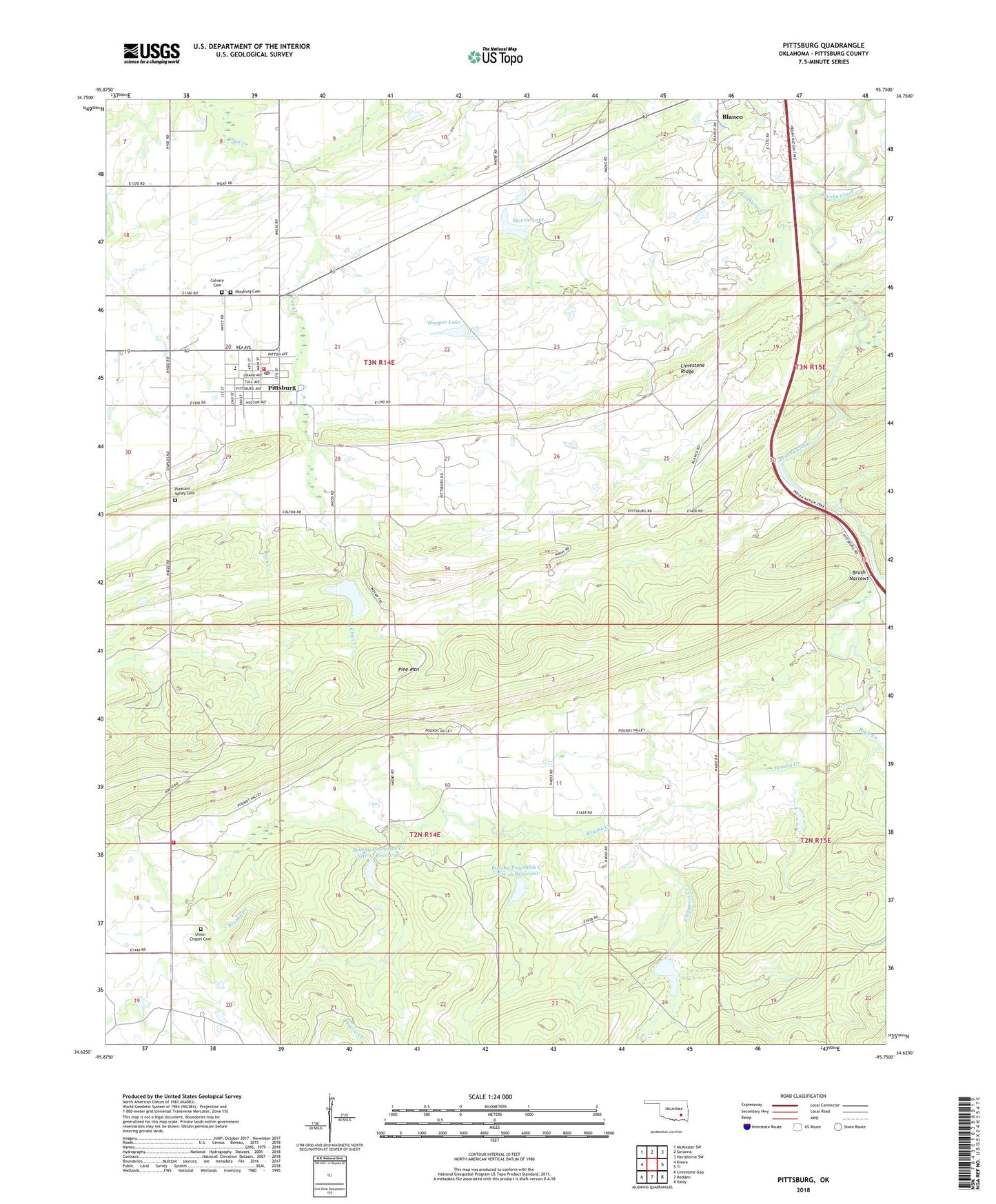
2018 topographic map quadrangle Pittsburg in the state of Oklahoma. Scale: 1:24000. Based on the newly updated USGS 7.5' US Topo map series, this map is in the following counties: Pittsburg. The map contains contour data, water features, and other items you are used to seeing on USGS maps, but also has updated roads and other features. This is the next generation of topographic maps. Printed on high-quality waterproof paper with UV fade-resistant inks.
Quads adjacent to this one:
West: Kiowa
Northwest: McAlester SW
North: Savanna
Northeast: Hartshorne SW
East: Ti
Southeast: Daisy
South: Redden
Southwest: Limestone Gap
Contains the following named places: Bill Hopper Lake Dam, Brush Narrows, Brushy Peaceable Creek Site 16 Dam, Brushy Peaceable Creek Site 17 Dam, Brushy Peaceable Creek Site 17 Reservoir, Burshy Peaceable Creek Site 16 Reservoir, Calvary Cemetery, Chippewa Creek, Elm Creek, Hopper Lake, Limestone Ridge, Modisette Creek, Oknoname 121001 Dam, Oknoname 121001 Reservoir, Pittsburg, Pittsburg Area Volunteer Fire Department, Pittsburg Cemetery, Pittsburg Dam, Pittsburg Elementary School, Pittsburg High School, Pittsburg Lake, Pittsburg Post Office, Pleasant Valley Cemetery, Rock Creek, Storrie Lake, Storrie Lake Dam, Town of Pittsburg, Union Chapel, Union Chapel Cemetery, Union Chapel Fire Department, Wildhorse Creek, ZIP Code: 74560