MyTopo
Potato Peaks Oklahoma US Topo Map
Couldn't load pickup availability
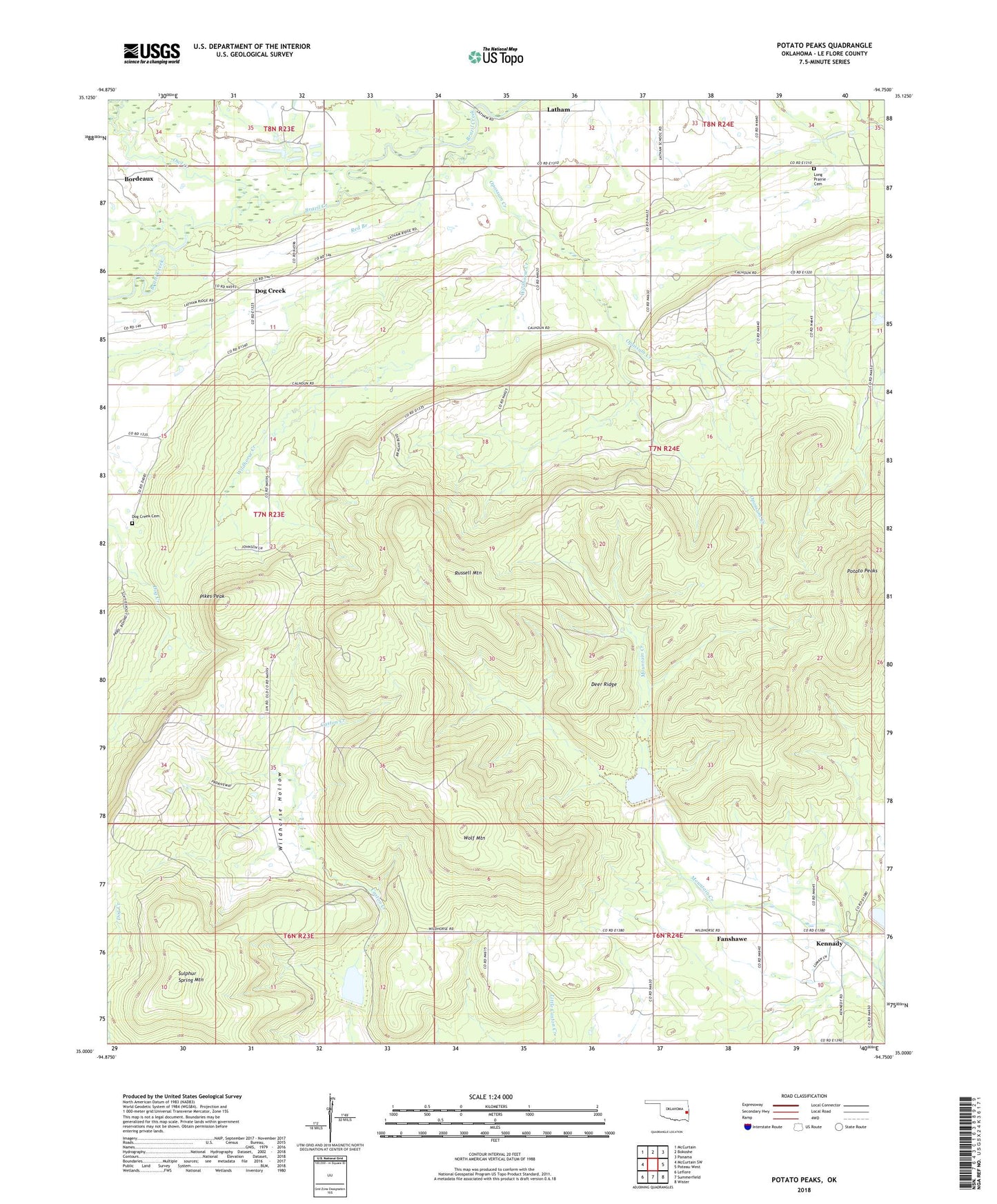
2018 topographic map quadrangle Potato Peaks in the state of Oklahoma. Scale: 1:24000. Based on the newly updated USGS 7.5' US Topo map series, this map is in the following counties: Le Flore. The map contains contour data, water features, and other items you are used to seeing on USGS maps, but also has updated roads and other features. This is the next generation of topographic maps. Printed on high-quality waterproof paper with UV fade-resistant inks.
Quads adjacent to this one:
West: McCurtain SW
Northwest: McCurtain
North: Bokoshe
Northeast: Panama
East: Poteau West
Southeast: Wister
South: Summerfield
Southwest: Leflore
Contains the following named places: Bordeaux, Caston Mountain Creek Site 2 Dam, Caston Mountain Creek Site 2 Reservoir, Caston Mountain Creek Site 5 Dam, Deer Ridge, Dog Creek, Dog Creek Cemetery, Kennady, Latham, Little Mountain Creek, Long Prairie Cemetery, Opossum Creek, Owl Creek, Pikes Peak, Potato Peaks, Red Branch, Russell Mountain, Sulphur Spring Mountain, Township of Kennady, Wildhorse Creek, Wildhorse Hollow, Wolf Creek, Wolf Mountain, ZIP Code: 74956