MyTopo
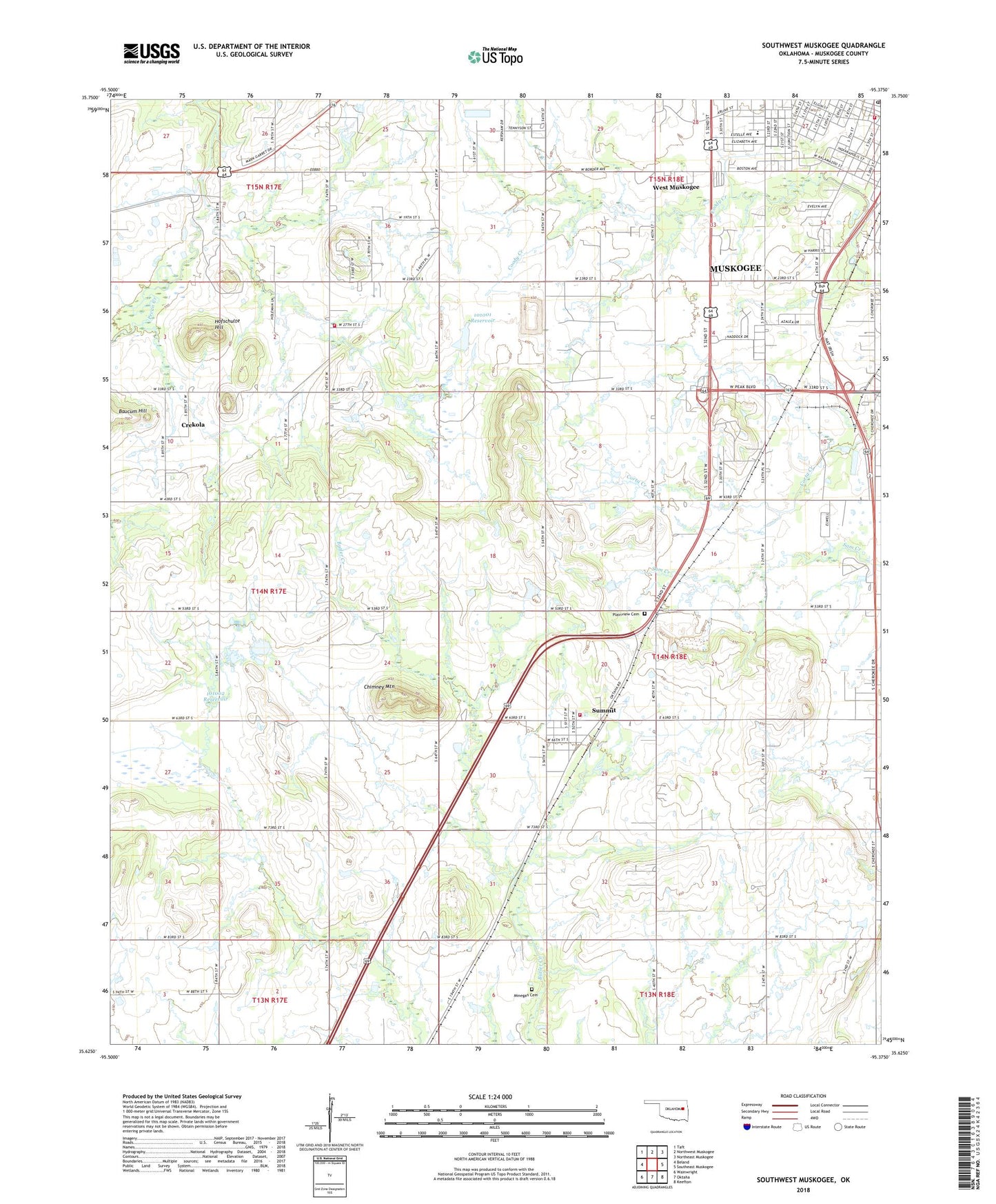
Southwest Muskogee Oklahoma US Topo Map
Couldn't load pickup availability
2018 topographic map quadrangle Southwest Muskogee in the state of Oklahoma. Scale: 1:24000. Based on the newly updated USGS 7.5' US Topo map series, this map is in the following counties: Muskogee. The map contains contour data, water features, and other items you are used to seeing on USGS maps, but also has updated roads and other features. This is the next generation of topographic maps. Printed on high-quality waterproof paper with UV fade-resistant inks.
Quads adjacent to this one:
West: Beland
Northwest: Taft
North: Northwest Muskogee
Northeast: Northeast Muskogee
East: Southeast Muskogee
Southeast: Keefton
South: Oktaha
Southwest: Wainwright
Contains the following named places: Beebe Cemetery Church, Berean Seventh Day Adventist Church, Central Missionary Baptist Church, Cherokee Elementary School, Chimney Mountain, Crekola, Evangel Assembly of God Church, Fairview Church, First Indian Baptist Church, Goodwill Church of God, Gospel Assembly Church, Grace Cathedral Pentecostal Church, Grandview Center, Grandview Shopping Center, Gullick Park, Hatbox Field, Hofschulte Hill, Immanuel Baptist Church, Jefferson School, Meadowbrook Baptist Church, Meadowbrook Country Club, Minegan Cemetery, Mountain View Church, Mountain View Volunteer Fire Department, Muskogee Fire Department, Muskogee Post Office, Muskogee Shopping Center, Oknoname 101001 Dam, Oknoname 101001 Reservoir, Oknoname 101002 Dam, Oknoname 101002 Reservoir, Plainview Cemetery, Rayfield Baptist Church, Rotary Park, Southside Church, Summit, Summit Volunteer Fire Department, Timothy Church, Town of Summit, Township of Ogle, West Muskogee, ZIP Code: 74401