MyTopo
Spencerville Oklahoma US Topo Map
Couldn't load pickup availability
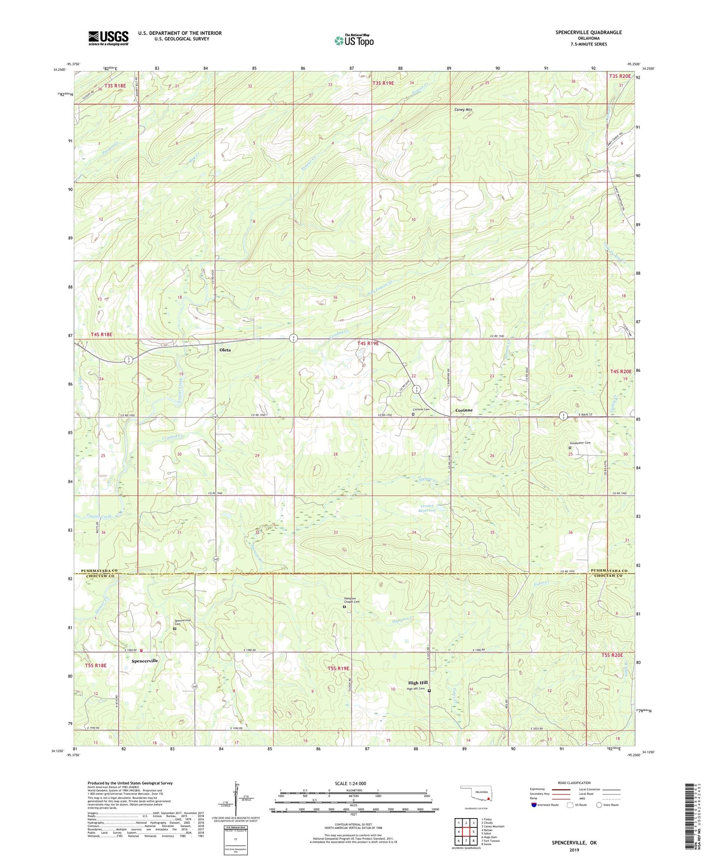
2019 topographic map quadrangle Spencerville in the state of Oklahoma. Scale: 1:24000. Based on the newly updated USGS 7.5' US Topo map series, this map is in the following counties: Pushmataha, Choctaw. The map contains contour data, water features, and other items you are used to seeing on USGS maps, but also has updated roads and other features. This is the next generation of topographic maps. Printed on high-quality waterproof paper with UV fade-resistant inks.
Quads adjacent to this one:
West: Rattan
Northwest: Finley
North: Cloudy
Northeast: Caney Mountain
East: Sobol
Southeast: Swink
South: Fort Towson
Southwest: Hugo Dam
Contains the following named places: Black Jack Indian Cemetery, Blackjack Church, Corinne, Corinne Cemetery, Crooked Creek, Frazier Creek Trail, Goodwater Cemetery, Goodwater Church, Hampton Chapel Cemetery, Hampton Church, Hampton Creek, High Bridge, High Hill, High Hill Cemetery, Oknoname 127003 Dam, Oknoname 127003 Reservoir, Oleta, South Branch Frazier Creek, Spencerville, Spencerville Cemetery, Spencerville Fire Department, Turkey Creek, ZIP Code: 74760