MyTopo
Stigler East Oklahoma US Topo Map
Couldn't load pickup availability
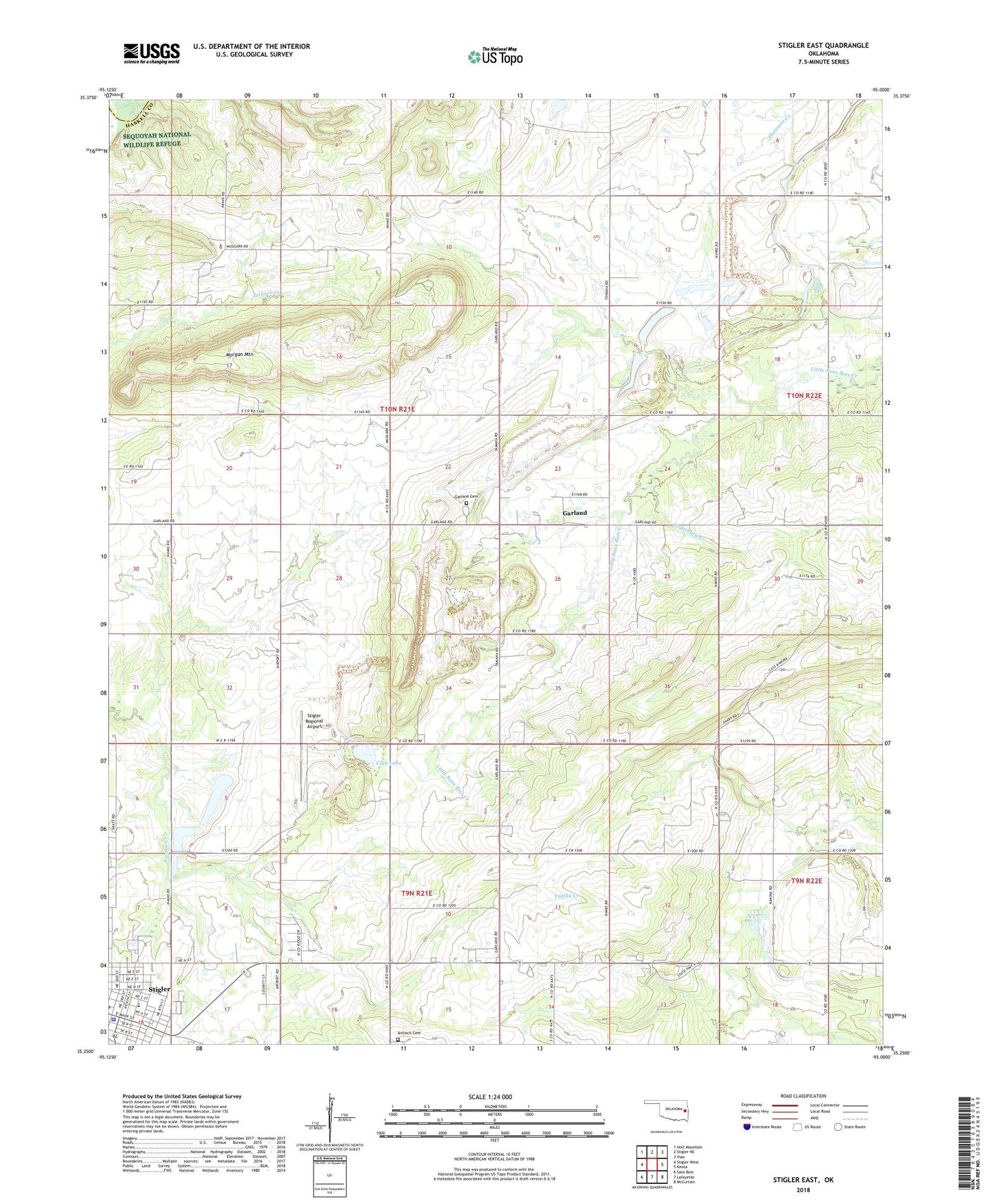
2018 topographic map quadrangle Stigler East in the state of Oklahoma. Scale: 1:24000. Based on the newly updated USGS 7.5' US Topo map series, this map is in the following counties: Haskell, Muskogee. The map contains contour data, water features, and other items you are used to seeing on USGS maps, but also has updated roads and other features. This is the next generation of topographic maps. Printed on high-quality waterproof paper with UV fade-resistant inks.
Quads adjacent to this one:
West: Stigler West
Northwest: Holt Mountain
North: Stigler NE
Northeast: Vian
East: Keota
Southeast: McCurtain
South: Lafayette
Southwest: Sans Bois
Contains the following named places: Antioch Cemetery, Antioch Church, Cedarburg Creek, City of Stigler, Club Lake, Crossroads Church, Cumberland Church, First Christian Church, Garland, Garland Cemetery, Garland Chapel, Garland School, Kanima School, Morgan Mountain, Rucker School, Stigler, Stigler Division, Stigler Elementary School, Stigler Regional Airport, Township of Taloka, United Methodist Church