MyTopo
Unap Mountain Oklahoma US Topo Map
Couldn't load pickup availability
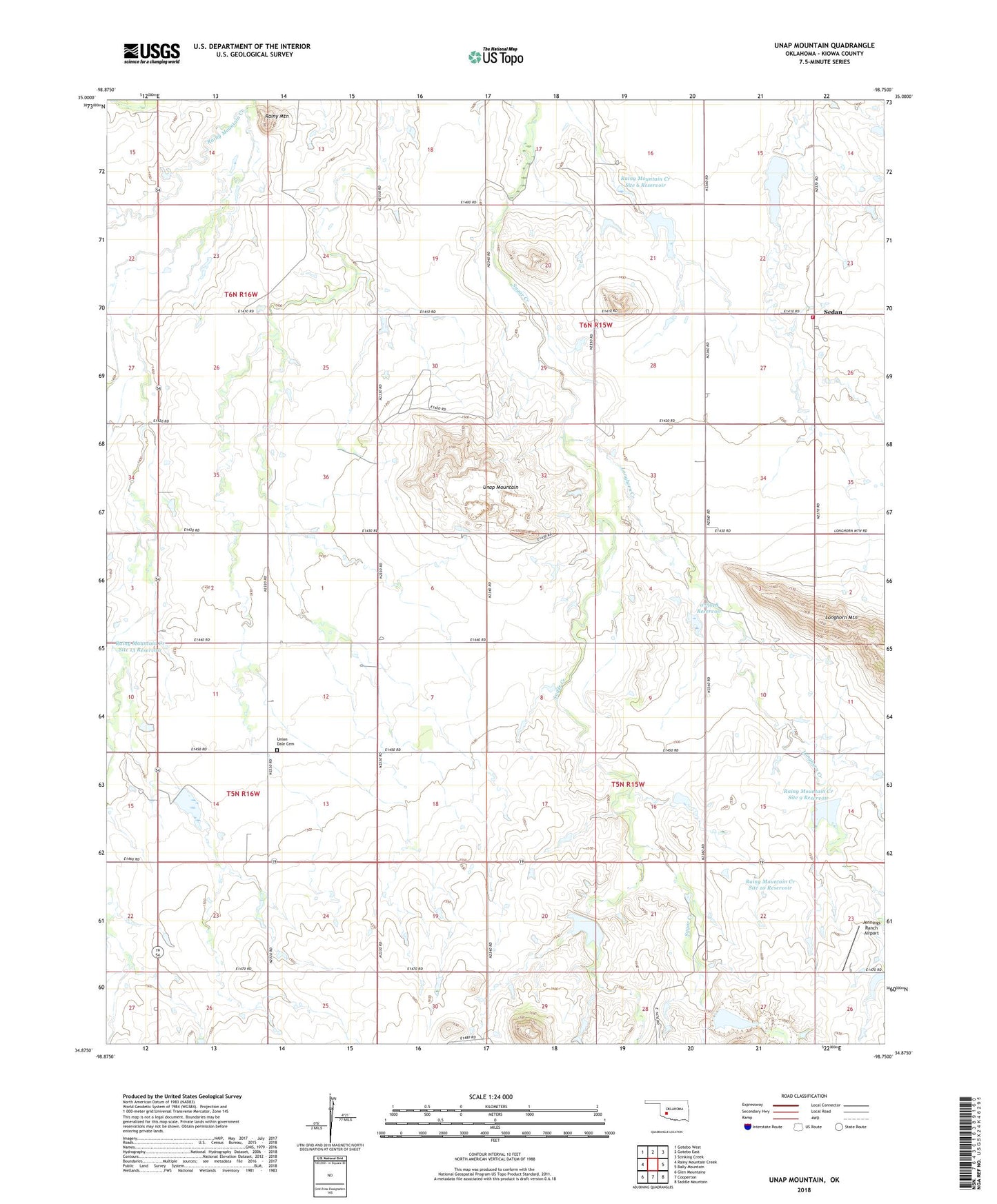
2018 topographic map quadrangle Unap Mountain in the state of Oklahoma. Scale: 1:24000. Based on the newly updated USGS 7.5' US Topo map series, this map is in the following counties: Kiowa. The map contains contour data, water features, and other items you are used to seeing on USGS maps, but also has updated roads and other features. This is the next generation of topographic maps. Printed on high-quality waterproof paper with UV fade-resistant inks.
Quads adjacent to this one:
West: Rainy Mountain Creek
Northwest: Gotebo West
North: Gotebo East
Northeast: Stinking Creek
East: Bally Mountain
Southeast: Saddle Mountain
South: Cooperton
Southwest: Glen Mountains
Contains the following named places: Jennings Ranch Airport, Longhorn Creek, Oknoname 075018 Dam, Oknoname 075018 Reservoir, Rainy Mountain, Rainy Mountain Creek Site 10 Dam, Rainy Mountain Creek Site 10 Reservoir, Rainy Mountain Creek Site 11 Dam, Rainy Mountain Creek Site 11 Reservoir, Rainy Mountain Creek Site 13 Dam, Rainy Mountain Creek Site 13 Reservoir, Rainy Mountain Creek Site 4 Dam, Rainy Mountain Creek Site 4 Reservoir, Rainy Mountain Creek Site 6 Dam, Rainy Mountain Creek Site 6 Reservoir, Rainy Mountain Creek Site 8a Dam, Rainy Mountain Creek Site 8a Reservoir, Rainy Mountain Creek Site 9 Dam, Rainy Mountain Creek Site 9 Reservoir, Rainy Mountain Indian School Reservation, Sedan, Sedan Volunteer Fire Association, Sugar Creek Ranch Airport, Unap Mountain, Union Dale Cemetery