MyTopo
Mission Oregon US Topo Map
Couldn't load pickup availability
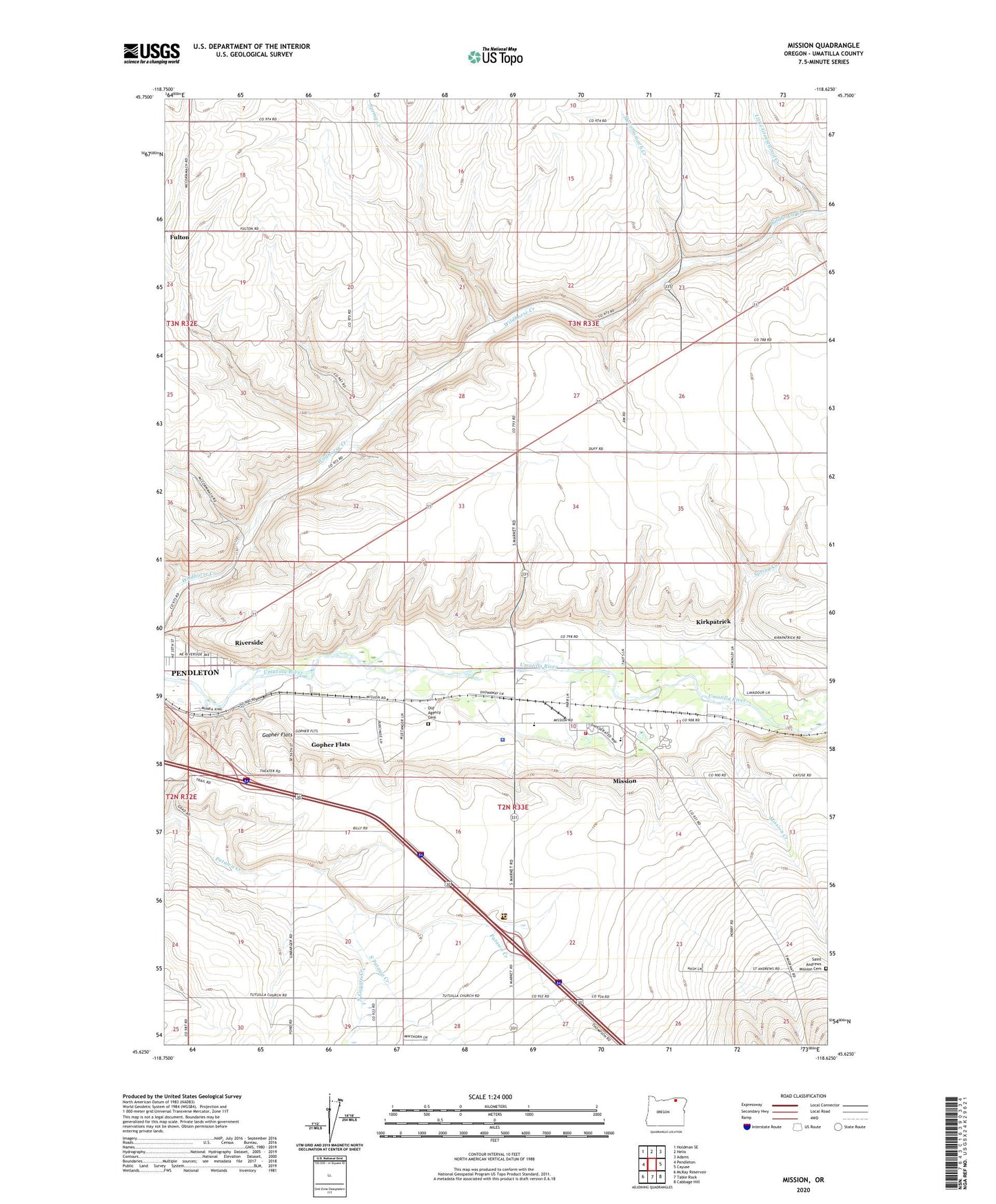
2024 topographic map quadrangle Mission in the state of Oregon. Scale: 1:24000. Based on the newly updated USGS 7.5' US Topo map series, this map is in the following counties: Umatilla. The map contains contour data, water features, and other items you are used to seeing on USGS maps, but also has updated roads and other features. This is the next generation of topographic maps. Printed on high-quality waterproof paper with UV fade-resistant inks.
Quads adjacent to this one:
West: Pendleton
Northwest: Holdman SE
North: Helix
Northeast: Adams
East: Cayuse
Southeast: Cabbage Hill
South: Table Rock
Southwest: McKay Reservoir
This map covers the same area as the classic USGS quad with code o45118f6.
Contains the following named places: Agency Indian Cemetery, Fulton, Gopher Flats, Gopher Flats Census Designated Place, Havana, Indian Agency Headquarters, Indian Ceremonial Ground, Kirkpatrick, Kirkpatrick Census Designated Place, KUMA - AM, Little Greasewood Creek, McCormmach, McCormmach Creek, Mission, Mission Census Designated Place, Mission Creek, Munra, Nixyaawii Community School, North Coyote Creek, Old Agency Cemetery, Oregon State University Agricultural Experiment Station, Riverside, Riverside Census Designated Place, Riverside School, Rothrock Landing Strip, Roundup Substation, Saint Andrews Mission Cemetery, Saxe, South Patawa Creek, Spring Creek, Tamastslikt Cultural Institute, Tutuilla Mission, Tutuilla Presbyterian Indian Mission Cemetery, Umatilla Indian Police Department, Umatilla National Forest Law Enforcement and Investigations, Umatilla Post Office, Umatilla Tribal Fire Department, Woodpecker Landing Strip