MyTopo
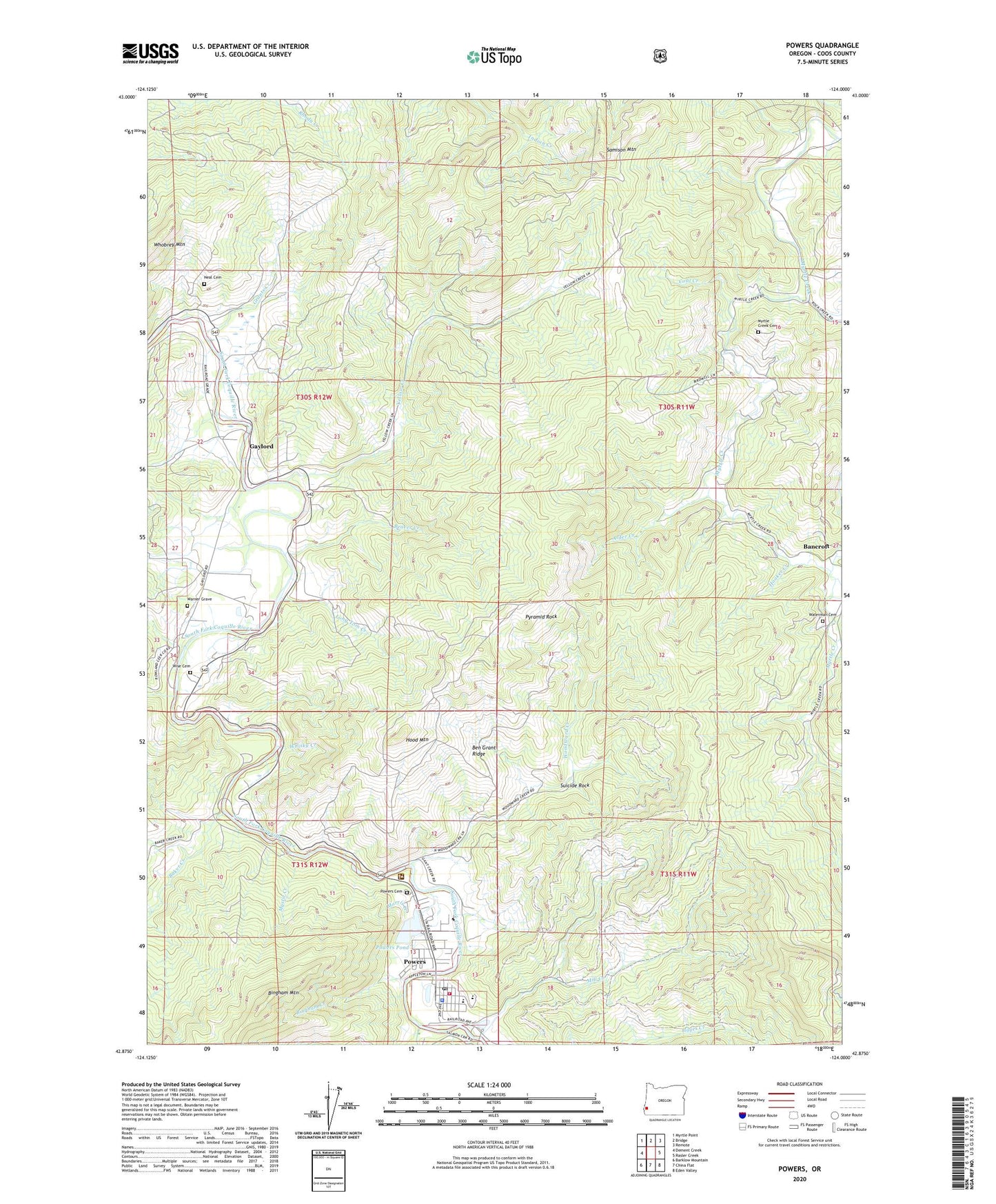
Powers Oregon US Topo Map
Couldn't load pickup availability
Also explore the Powers Forest Service Topo of this same quad for updated USFS data
2024 topographic map quadrangle Powers in the state of Oregon. Scale: 1:24000. Based on the newly updated USGS 7.5' US Topo map series, this map is in the following counties: Coos. The map contains contour data, water features, and other items you are used to seeing on USGS maps, but also has updated roads and other features. This is the next generation of topographic maps. Printed on high-quality waterproof paper with UV fade-resistant inks.
Quads adjacent to this one:
West: Dement Creek
Northwest: Myrtle Point
North: Bridge
Northeast: Remote
East: Rasler Creek
Southeast: Eden Valley
South: China Flat
Southwest: Barklow Mountain
This map covers the same area as the classic USGS quad with code o42124h1.
Contains the following named places: Baker Creek, Baker Creek Boat Ramp, Bancroft, Bancroft Post Office, Beaver Creek, Beaver Creek Boat Ramp, Ben Grant Ridge, Bicentennial Park, Bingham Creek, Bingham Mountain, Byerle, Carman, China Creek, City of Powers, Coal Creek, Colby, Cole Creek, Coos Bay Timber Company Dam, Coquille Myrtle Grove State Park, Coquille Myrtle Grove State Park Boat Ramp, Etelka, Etelka Post Office, Etelka School, Fensler, Fort Rowland, Gaylord, Gaylord Post Office, Gaylord Siding, Grants Creek, Hazel M Lewis Memorial Library, Hood Mountain, Hooker Creek, King Street Park, Long Tom Creek, Mill Creek, Morris Creek, Myrtle Creek Cemetery, Myrtlewood Campground, Mystic Creek, Neal Cemetery, Powers, Powers Cemetery, Powers City Hall, Powers County Park, Powers Elementary School, Powers High School, Powers Municipal Court, Powers Police Department, Powers Pond, Powers Post Office, Powers Public Works, Powers Ranger Station, Powers Sewage Treatment Plant, Powers Volunteer Fire and Ambulance, Powers Water Treatment Plant, Pyramid Rock, Regal, Rock Creek, Rowland Creek, Rowland Prairie, Salmon Creek, Samison Mountain, Snow Creek, Suicide Rock, Sunshine, Taft Prairie, Warner Grave, Waterman Cemetery, Whisky Creek, Whobrey Mountain, Wilson Prairie, Wise Cemetery, Woodward Creek, Yellow Creek