MyTopo
Tumalo Oregon US Topo Map
Couldn't load pickup availability
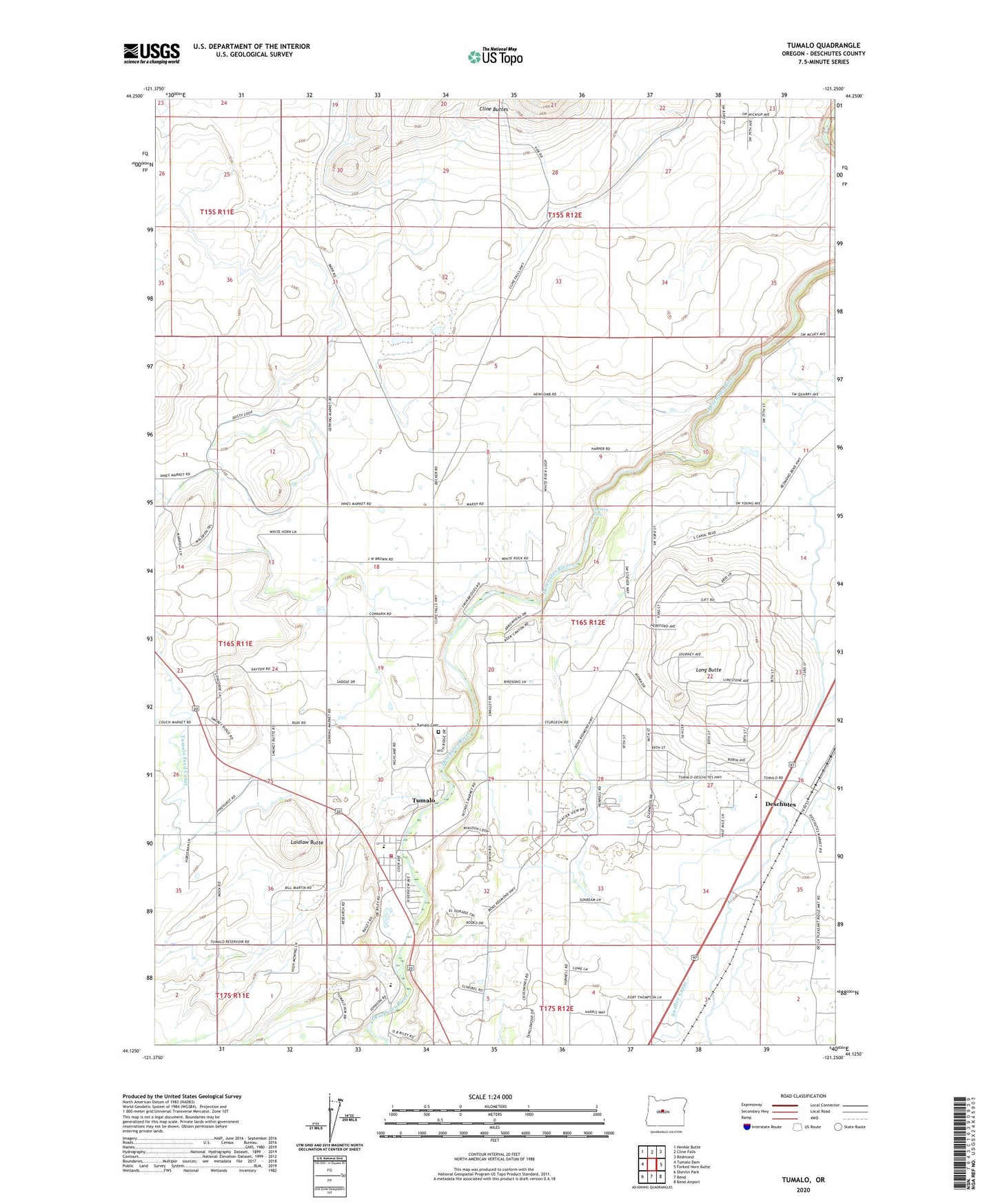
2024 topographic map quadrangle Tumalo in the state of Oregon. Scale: 1:24000. Based on the newly updated USGS 7.5' US Topo map series, this map is in the following counties: Deschutes. The map contains contour data, water features, and other items you are used to seeing on USGS maps, but also has updated roads and other features. This is the next generation of topographic maps. Printed on high-quality waterproof paper with UV fade-resistant inks.
Quads adjacent to this one:
West: Tumalo Dam
Northwest: Henkle Butte
North: Cline Falls
Northeast: Redmond
East: Forked Horn Butte
Southeast: Bend Airport
South: Bend
Southwest: Shevlin Park
This map covers the same area as the classic USGS quad with code o44121b3.
Contains the following named places: Awbrey Falls, City of Bend Fire Department Station 302 Tumalo Fire Station, Deschutes, Deschutes Junction, Deschutes Post Office, Laidlaw Butte, Long Butte, Peterson Rock Garden and Museum, Tumalo, Tumalo Cemetery, Tumalo Census Designated Place, Tumalo Elementary School, Tumalo Post Office, Tumalo State Park