MyTopo
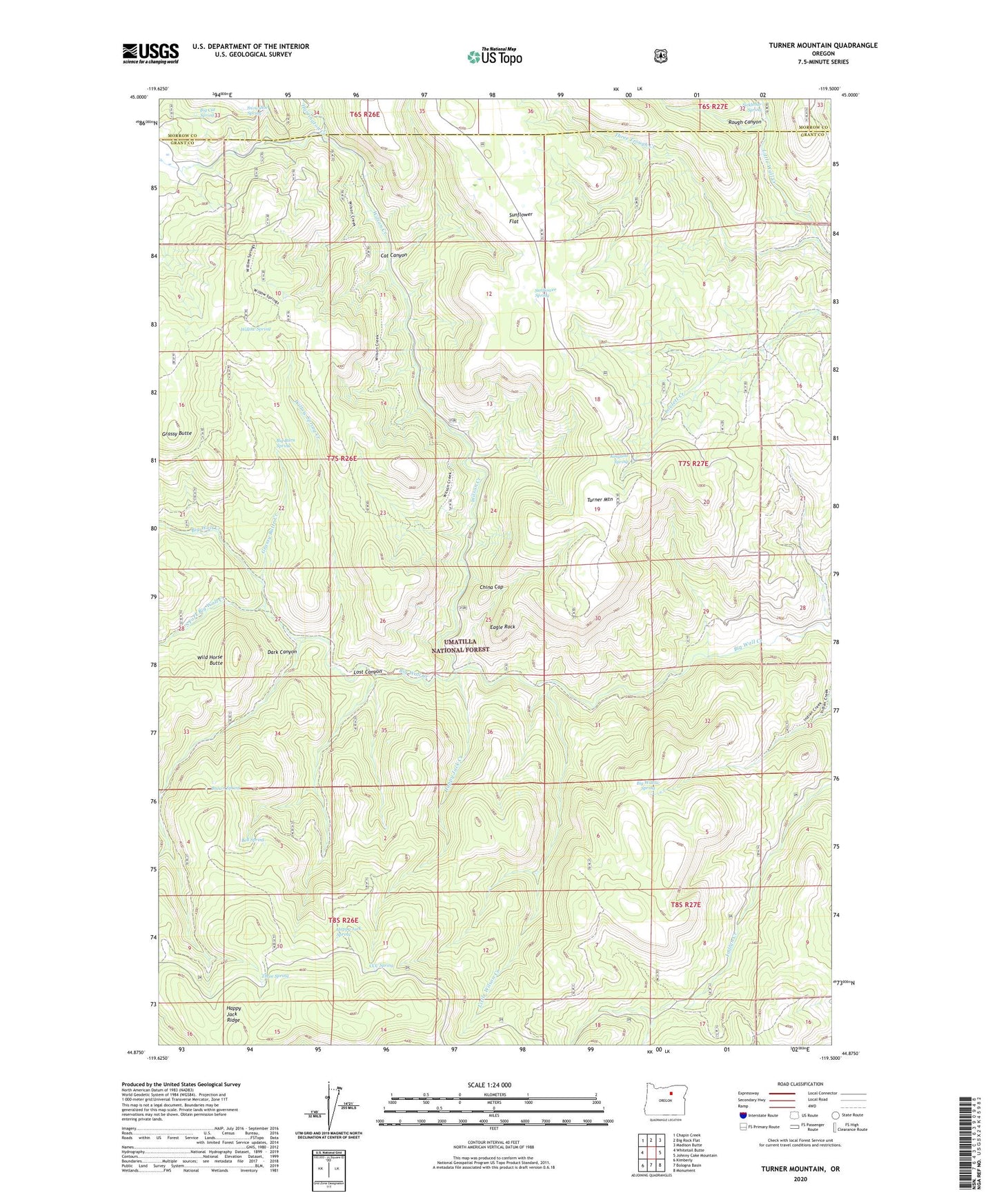
Turner Mountain Oregon US Topo Map
Couldn't load pickup availability
Also explore the Turner Mountain Forest Service Topo of this same quad for updated USFS data
2023 topographic map quadrangle Turner Mountain in the state of Oregon. Scale: 1:24000. Based on the newly updated USGS 7.5' US Topo map series, this map is in the following counties: Grant, Morrow. The map contains contour data, water features, and other items you are used to seeing on USGS maps, but also has updated roads and other features. This is the next generation of topographic maps. Printed on high-quality waterproof paper with UV fade-resistant inks.
Quads adjacent to this one:
West: Whitetail Butte
Northwest: Chapin Creek
North: Big Rock Flat
Northeast: Madison Butte
East: Johnny Cake Mountain
Southeast: Monument
South: Bologna Basin
Southwest: Kimberly
This map covers the same area as the classic USGS quad with code o44119h5.
Contains the following named places: Bell Spring, Big Burn Spring, Big Cat Spring, Big Willow Spring, Big Willow Spring Creek, Blue Spruce Camp, Brown Spring, Cat Canyon, CCC Spring, China Cap, Dark Canyon, Eagle Rock, Grassy Butte, Grassy Butte Creek, Happy Jack Creek, Happy Jack Ridge, Happy Jack Spring, Harrington Creek, Kingbolt Spring, Little Wilson Creek, Lost Canyon, Lovlett Corral, Rough Canyon, Snowshoe Spring, South Fork Big Wall Creek, Sunflower Spring, Three Spring, Three Trough Creek, Turner Mountain, Wild Horse Butte, Willow Spring, Willow Spring Creek, Wilson Creek