MyTopo
Blair Lake Oregon US Topo Map
Couldn't load pickup availability
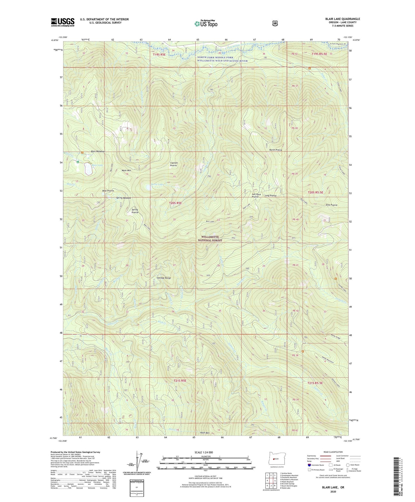
2020 topographic map quadrangle Blair Lake in the state of Oregon. Scale: 1:24000. Based on the newly updated USGS 7.5' US Topo map series, this map is in the following counties: Lane. The map contains contour data, water features, and other items you are used to seeing on USGS maps, but also has updated roads and other features. This is the next generation of topographic maps. Printed on high-quality waterproof paper with UV fade-resistant inks.
Quads adjacent to this one:
West: Huckleberry Mountain
Northwest: Sardine Butte
North: Grasshopper Mountain
Northeast: Chucksney Mountain
East: Waldo Mountain
Southeast: Waldo Lake
South: Mount David Douglas
Southwest: McCredie Springs
Contains the following named places: Alice Creek, Beal Prairie, Blair Lake, Blair Lake Recreation Site, Blair Lake Trail, Blair Meadows, Boomer Creek, Brock Creek, Captain Creek, Captain Prairie, Cayuse Creek, Claire Prairie, Curley Creek, Delate Creek, Devils Lake, Etta Prairie, Fisher Creek, Fisher Prairie, Furnish Creek, Glade Creek, Griffing Prairie, Koch Creek, Long Prairie, Mule Creek, Mule Mountain, Mule Mountain Lookout, North Prairie, Pitch Creek, Pocher Creek, Ranger Creek, Salmon Creek Trail, Salt Rock Prairie, Spring Meadow, Spring Prairie, Triangle Creek, Winnie Prairie