MyTopo
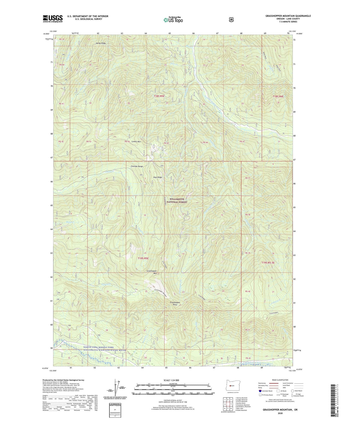
Grasshopper Mountain Oregon US Topo Map
Couldn't load pickup availability
Also explore the Grasshopper Mountain Forest Service Topo of this same quad for updated USFS data
2024 topographic map quadrangle Grasshopper Mountain in the state of Oregon. Scale: 1:24000. Based on the newly updated USGS 7.5' US Topo map series, this map is in the following counties: Lane. The map contains contour data, water features, and other items you are used to seeing on USGS maps, but also has updated roads and other features. This is the next generation of topographic maps. Printed on high-quality waterproof paper with UV fade-resistant inks.
Quads adjacent to this one:
West: Sardine Butte
Northwest: Harvey Mountain
North: Cougar Reservoir
Northeast: French Mountain
East: Chucksney Mountain
Southeast: Waldo Mountain
South: Blair Lake
Southwest: Huckleberry Mountain
This map covers the same area as the classic USGS quad with code o43122h2.
Contains the following named places: Augusta Creek, Blue Creek, Dutch Oven Forest Camp, Grasshopper Creek, Grasshopper Mountain, Grasshopper Point, Grasshopper Trail, Hardy Ridge, Hiyu Ridge, Hiyu Trail, Homestead Recreation Site, Loon Creek, Lowell Mountain, Rebel Rock Trail, Starr Creek, Station Creek, Tuckta Trail