MyTopo
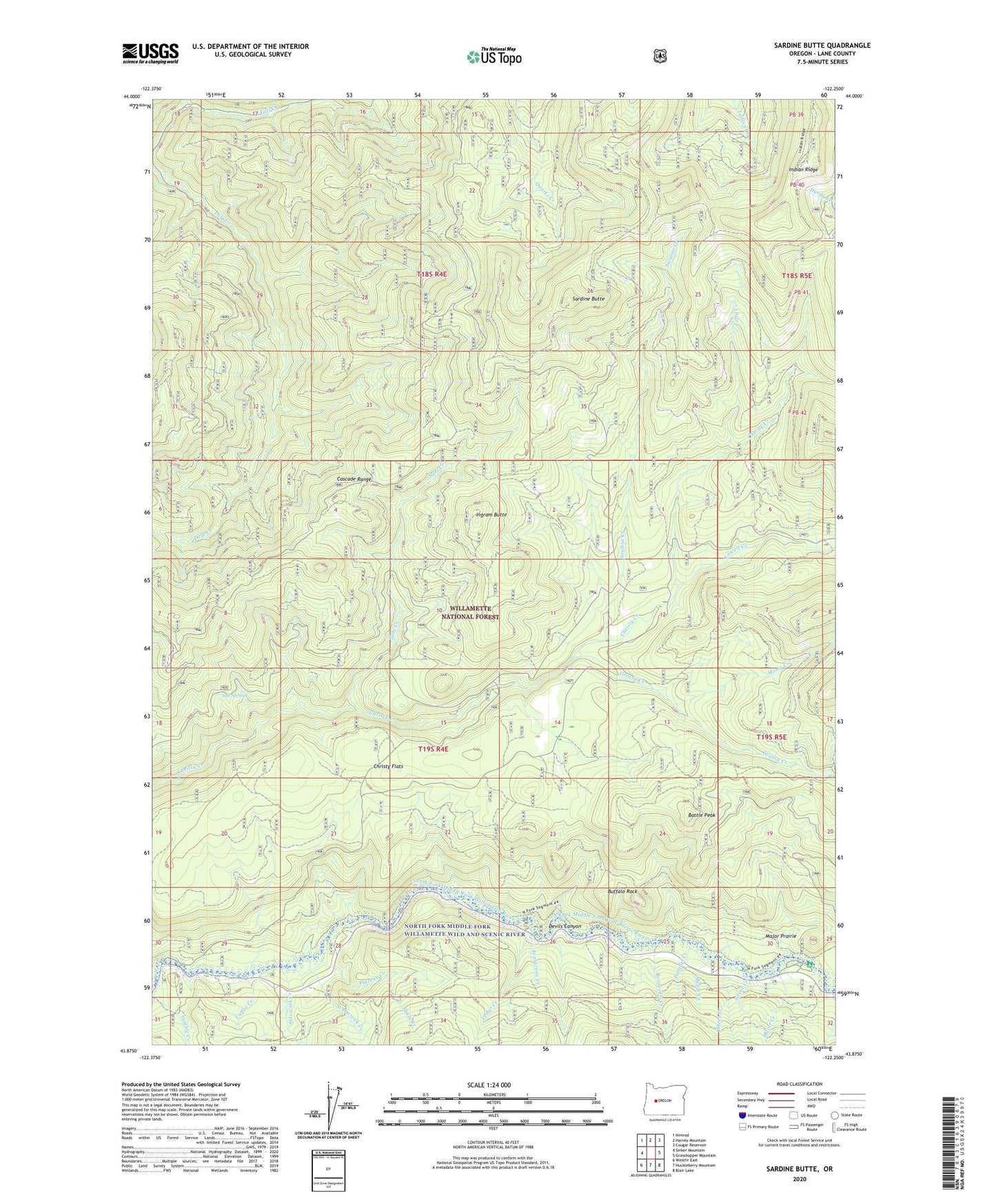
Sardine Butte Oregon US Topo Map
Couldn't load pickup availability
Also explore the Sardine Butte Forest Service Topo of this same quad for updated USFS data
2023 topographic map quadrangle Sardine Butte in the state of Oregon. Scale: 1:24000. Based on the newly updated USGS 7.5' US Topo map series, this map is in the following counties: Lane. The map contains contour data, water features, and other items you are used to seeing on USGS maps, but also has updated roads and other features. This is the next generation of topographic maps. Printed on high-quality waterproof paper with UV fade-resistant inks.
Quads adjacent to this one:
West: Sinker Mountain
Northwest: Nimrod
North: Harvey Mountain
Northeast: Cougar Reservoir
East: Grasshopper Mountain
Southeast: Blair Lake
South: Huckleberry Mountain
Southwest: Westfir East
This map covers the same area as the classic USGS quad with code o43122h3.
Contains the following named places: Battle Peak, Buffalo Rock, Buzzard Creek, Camp 5, Cedar Creek, Christy Flats, Coffee Creek, Devils Canyon, Evergreen Creek, Grassy Creek, Ingram Butte, Kiahanie Recreation Site, Lefty Creek, Lowell Creek, Major Creek, Major Prairie, Maple Creek, Mill Creek, Mossy Creek, Nehi Creek, North Fork Middle Fork Willamette Wild and Scenic River, Parallel Creek, Parker Creek, Plateau Creek, Platt Creek, Roosevelt Creek, Salt Springs, Sardine Butte, Sardine Creek, Shale Creek, Sidewalk Creek, Silver Creek, Steer Creek, Whiterock Creek