MyTopo
Bly Oregon US Topo Map
Couldn't load pickup availability
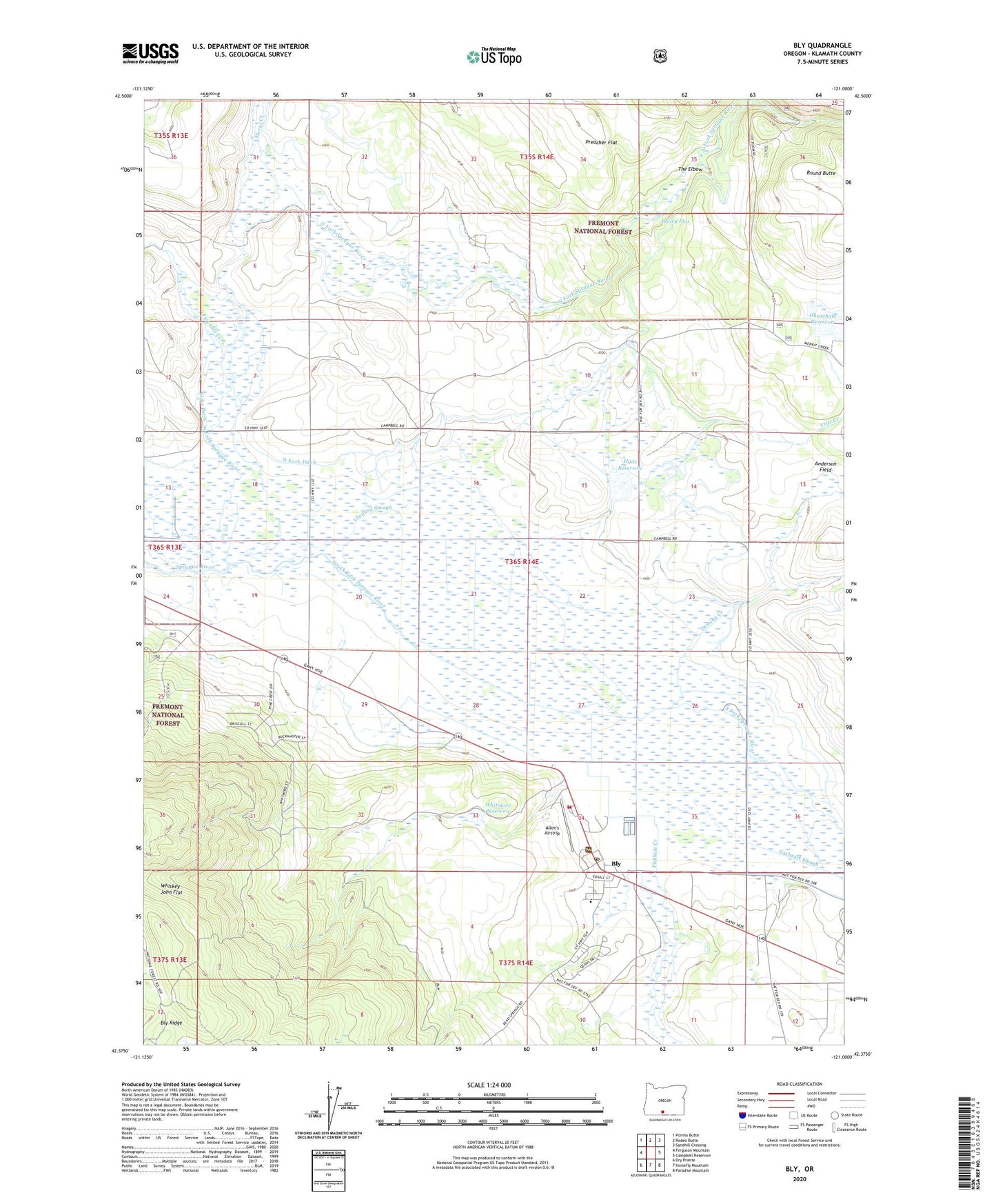
2020 topographic map quadrangle Bly in the state of Oregon. Scale: 1:24000. Based on the newly updated USGS 7.5' US Topo map series, this map is in the following counties: Klamath. The map contains contour data, water features, and other items you are used to seeing on USGS maps, but also has updated roads and other features. This is the next generation of topographic maps. Printed on high-quality waterproof paper with UV fade-resistant inks.
Quads adjacent to this one:
West: Ferguson Mountain
Northwest: Ponina Butte
North: Rodeo Butte
Northeast: Sandhill Crossing
East: Campbell Reservoir
Southeast: Paradise Mountain
South: Horsefly Mountain
Southwest: Dry Prairie
Contains the following named places: Allen's Airstrip, Bailey Flat, BK Ranch, Bly, Bly Branch Library, Bly Census Designated Place, Bly Post Office, Bly Ranger Station, Bly Rural Fire Protection District, Bly Sanitary District Treatment Lagoons, Bly Siding, Bly Trailhead, Campbell Ranch, Deming Creek, Elder Ditch, Fishhole Creek, Fishhole Substation, Fivemile Creek, Fritz Creek, Fritz Creek Dam, Garner Post Office, Gearhart School, Hyde Airstrip, Hyde Reservoir, Ivory Pine Mill, Lee Adkins Place, Leonard Slough, Meryl Creek, North Fork, North Fork Ditch, North Fork Ranch, North Fork Sprague River, Northfork, Obenchain Dam, Obenchain Ranch, Obenchain Reservoir, Round Butte, South Fork Sprague River, The Elbow, Watts, Whiskey John Flat, Whitmore Reservoir, ZIP Code: 97622