MyTopo
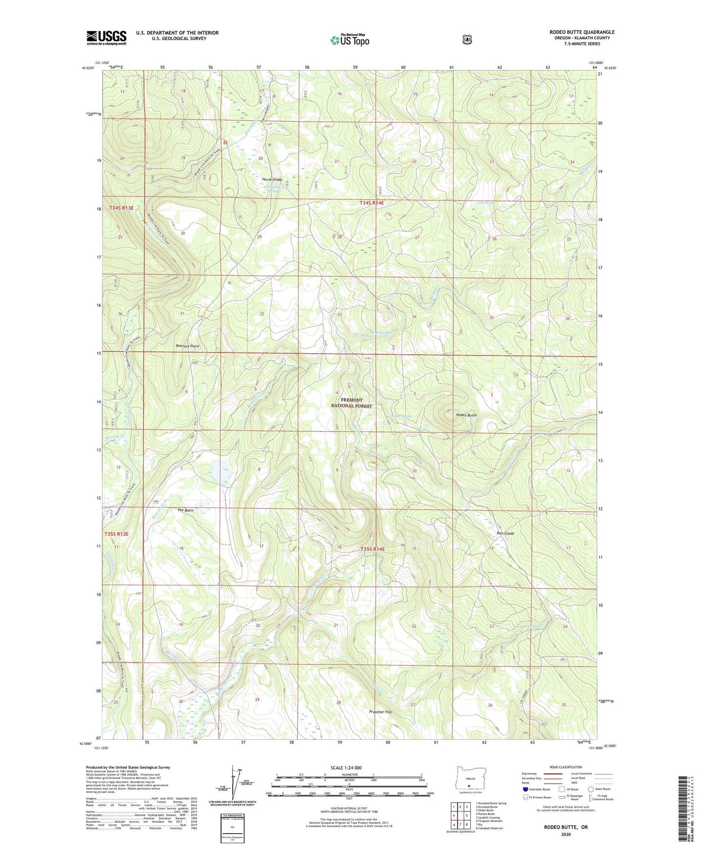
Rodeo Butte Oregon US Topo Map
Couldn't load pickup availability
Also explore the Rodeo Butte Forest Service Topo of this same quad for updated USFS data
2023 topographic map quadrangle Rodeo Butte in the state of Oregon. Scale: 1:24000. Based on the newly updated USGS 7.5' US Topo map series, this map is in the following counties: Klamath. The map contains contour data, water features, and other items you are used to seeing on USGS maps, but also has updated roads and other features. This is the next generation of topographic maps. Printed on high-quality waterproof paper with UV fade-resistant inks.
Quads adjacent to this one:
West: Ponina Butte
Northwest: Riverbed Butte Spring
North: Riverbed Butte
Northeast: Shake Butte
East: Sandhill Crossing
Southeast: Campbell Reservoir
South: Bly
Southwest: Ferguson Mountain
This map covers the same area as the classic USGS quad with code o42121e1.
Contains the following named places: Anderson Cabin, Cain Creek, Camp Six, Camp Six Guard Station, Cold Spring, Foster Field, Griffin Ranch, Horse Glade, Horseglade Spring, Long Creek, McCartie Ranch, Meryl Springs, Obenchain Ranch, O'Connors Puddle Dam, O'Connors Puddle Reservoir, Preacher Flat, Rail Glade, Reservoir Creek, Rimrock Point, Rodeo Butte, Rodeo Spring, Swamp Creek, The Basin