MyTopo
Campbell Lake Oregon US Topo Map
Couldn't load pickup availability
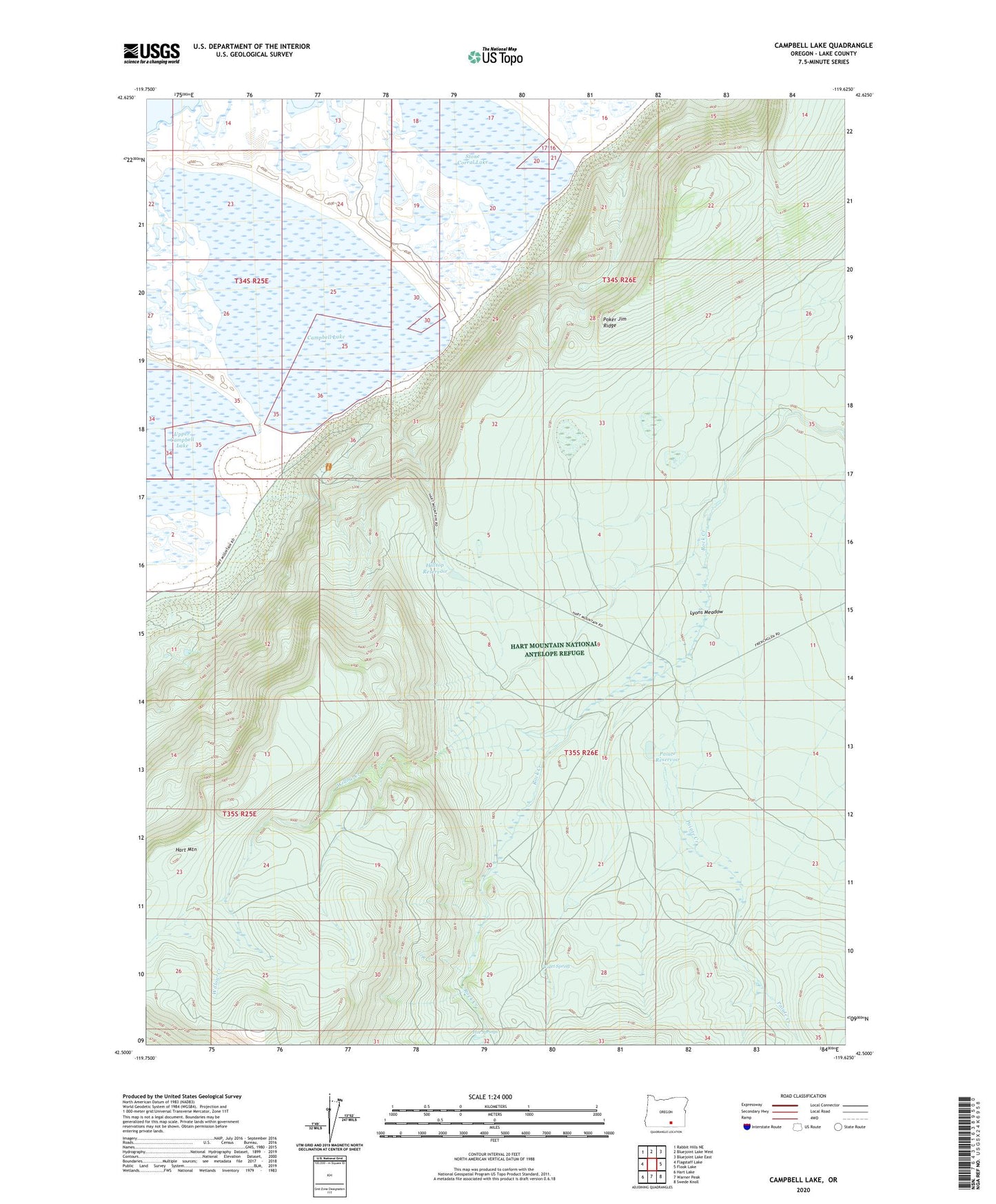
2023 topographic map quadrangle Campbell Lake in the state of Oregon. Scale: 1:24000. Based on the newly updated USGS 7.5' US Topo map series, this map is in the following counties: Lake. The map contains contour data, water features, and other items you are used to seeing on USGS maps, but also has updated roads and other features. This is the next generation of topographic maps. Printed on high-quality waterproof paper with UV fade-resistant inks.
Quads adjacent to this one:
West: Flagstaff Lake
Northwest: Rabbit Hills NE
North: Bluejoint Lake West
Northeast: Bluejoint Lake East
East: Flook Lake
Southeast: Swede Knoll
South: Warner Peak
Southwest: Hart Lake
This map covers the same area as the classic USGS quad with code o42119e6.
Contains the following named places: Bond Creek, Campbell Lake, Delaine Post Office, Hilltop Reservoir, Hot Springs, Lyons Meadow, Paiute Creek, Paiute Reservoir, Petroglyph Lake, Stone Corral, Stone Corral Lake, Upper Campbell Lake, Valet Spring, Willow Creek