MyTopo
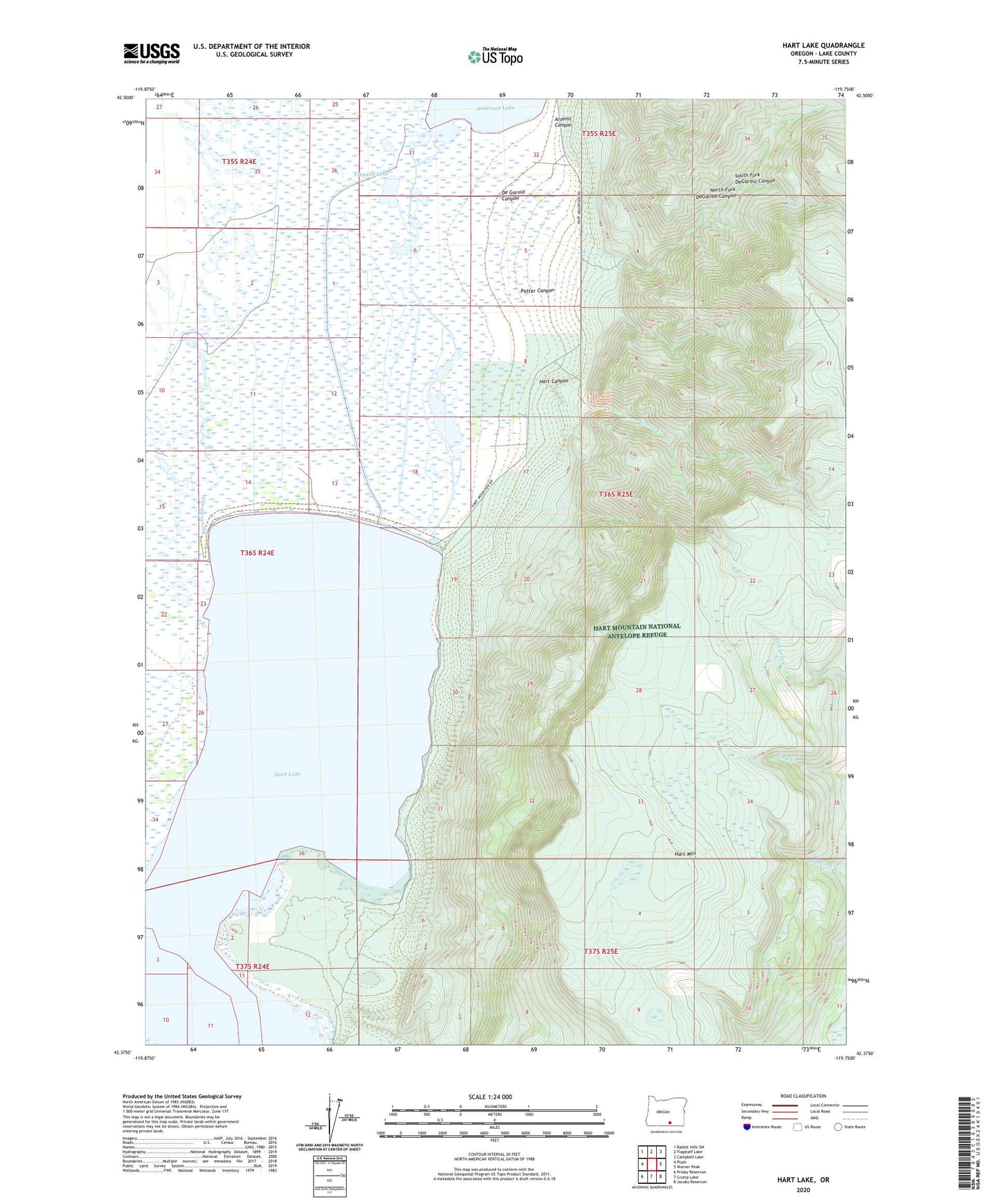
Hart Lake Oregon US Topo Map
Couldn't load pickup availability
2024 topographic map quadrangle Hart Lake in the state of Oregon. Scale: 1:24000. Based on the newly updated USGS 7.5' US Topo map series, this map is in the following counties: Lake. The map contains contour data, water features, and other items you are used to seeing on USGS maps, but also has updated roads and other features. This is the next generation of topographic maps. Printed on high-quality waterproof paper with UV fade-resistant inks.
Quads adjacent to this one:
West: Plush
Northwest: Rabbit Hills SW
North: Flagstaff Lake
Northeast: Campbell Lake
East: Warner Peak
Southeast: Jacobs Reservoir
South: Crump Lake
Southwest: Priday Reservoir
This map covers the same area as the classic USGS quad with code o42119d7.
Contains the following named places: Arsenic Canyon, D Fitzgerald Ranch, De Garmo Canyon, Givens Slough, Hart Canyon, Hart Lake, Hart Lake Dam, Hart Mountain, Honey Creek, Kiely Ranch, Laird Ranch, McKee Ranch, North Fork DeGarmo Canyon, Norton Creek, Potter Canyon, South Fork DeGarmo Canyon, Vinyard Lake, Warner Lakes