MyTopo
Cascadia Oregon US Topo Map
Couldn't load pickup availability
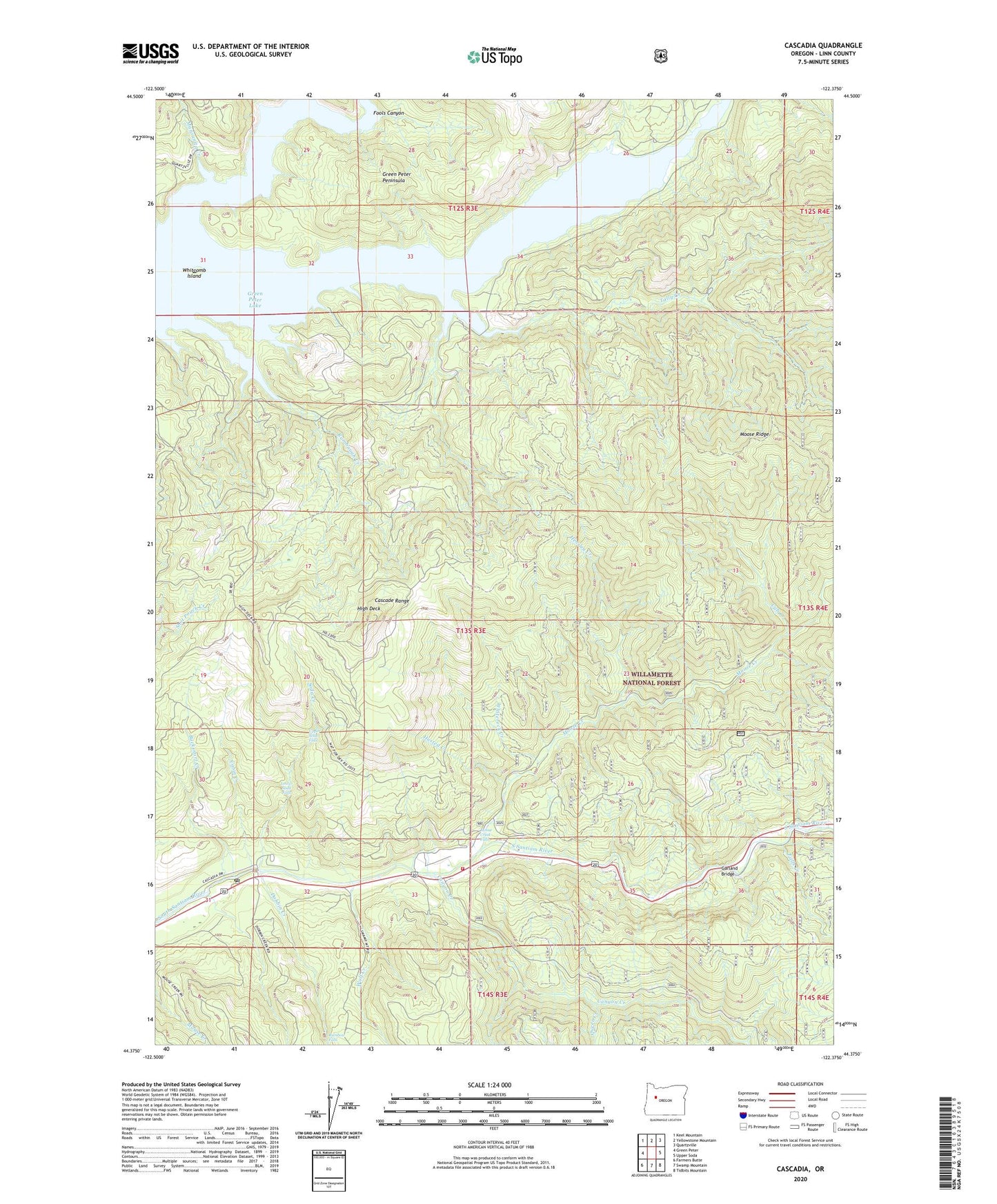
2020 topographic map quadrangle Cascadia in the state of Oregon. Scale: 1:24000. Based on the newly updated USGS 7.5' US Topo map series, this map is in the following counties: Linn. The map contains contour data, water features, and other items you are used to seeing on USGS maps, but also has updated roads and other features. This is the next generation of topographic maps. Printed on high-quality waterproof paper with UV fade-resistant inks.
Quads adjacent to this one:
West: Green Peter
Northwest: Keel Mountain
North: Yellowstone Mountain
Northeast: Quartzville
East: Upper Soda
Southeast: Tidbits Mountain
South: Swamp Mountain
Southwest: Farmers Butte
Contains the following named places: Bucksnort Creek, Cabin Creek, Canyon Creek, Cascadia, Cascadia Post Office, Cascadia School, Cascadia State Park, Cub Creek, Dobbin Creek, Falls Creek, Fools Canyon, Garland Bridge, Green Peter Lake, Green Peter Peninsula, Hensley Creek, High Deck, Husted Creek, Kronenberg Post Office, Lower Soda Falls, Lowersoda Post Office, Lynchwood City Park, Manzanita Creek, Moose Creek, Moose Creek Falls, Queen Creek, Rainbow Falls, Roberts, Soda Creek, Soda Stone Post Office, Strait Creek, Sweet Home Fire and Ambulance District Station 24, Tally Creek, Upper Soda Falls, Whitcomb Island, Whitcomb Island Cemetery, Whitcomb Post Office, Whiterock Creek, Wolf Creek, ZIP Code: 97329